Mazama, Washington
Looking for the best chillin in Mazama? We've got you covered with the top trails, trips, hiking, backpacking, camping and more around Mazama. The detailed guides, photos, and reviews are all submitted by the Outbound community.
Top Chillin Spots in and near Mazama
-
Winthrop, Washington
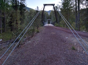
Hike to the Tawlks Foster Suspension Bridge
2 mi / 70 ft gainThe pin above is a small gravel parking lot which is clearly marked as "Trail Head" from the road. Once you park you are within eye shot of an information station and the trail is marked as "Suspension Bridge Access." Walk past this sign and continue on the well-groomed trail eastward for just sh...Read more -
Okanogan County, Washington
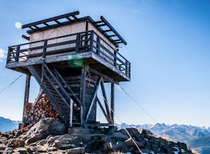
Hike to the Goat Peak Lookout
3.55 mi / 1400 ft gainWith fall coming quickly, that means larch fever. Views of the North Cascades, Methow Valley, and fall colors all at 7000 feet, doing the short hike of just over 2 miles up to the Goat Peak Lookout will not disappoint.The hike begins in a beautiful forest you'd expect too see at 5500 feet. The al...Read more -
Winthrop, Washington
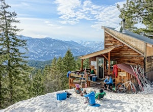
Cross-Country Ski the Rendezvous Huts
During the winter months, there are few places in the country that are as isolated, picturesque and active as the Methow Valley, home to the western themed town of Winthrop and the tiny little town of Mazama.With over 200 kilometers of well-groomed cross country ski trails throughout the valley, ...Read more -
Winthrop, Washington
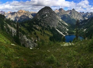
Heather-Maple Pass Loop
5.07.5 mi / 2185 ft gainNote to any hikers taking on this trail, this is a non-repeating trail meaning it goes in a big loop. The trailhead has 2 trail points of entrance. To the right (the pathway that is not paved) is the counter-clockwise route, a little less steep and more scenic at the start. To the left, the trail...Read more -
Rockport, Washington
Kayak Ross Lake to Cougar Island and Rainbow Point
5.0Start from the Ross Lake Trailhead off Highway 20. Hike down with your vessel 1.5 miles to the hull road. From there you can launch your vessel. Ross Lake is very large with many destinations to paddle to. I went to Cougar Island and Rainbow Point then paddled up to multiple spectacular wate...Read more -
Rockport, Washington
Hike to Ross Dam
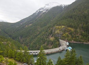
5.02 miThis is a short hike at just under 2 miles round-trip, with little elevation change. The trail begins at a parking area, alongside Washington Route 20. The hike takes you through the forest to an overlook of both Ross Dam and Ross Lake, before making the final descent down to the dam. The trail i...Read more -
Skagit County, Washington
Pelton Basin Camp
8.82 mi / 2543 ft gainStarting at 3,640 feet elevation, the Cascade Pass Trailhead begins adjacent to the Johannesburg Camp and proceeds east along a relentless series of switchbacks. Though the trail is consumed by a thick Washington evergreen forest, the switchbacks frequently open to sweeping vistas of the far-reac...Read more -
Rockport, Washington
Backpack to High Camp on Ruby Mountain
17 mi / 6300 ft gainRuby Mountain is one of the North Cascades more prominent peaks, sitting high above Diablo and Ross Lakes. This trip is one for more experienced hikers with a very aggressive incline from start to finish. If that does not scare you then definitely add this amazing hike to your list. While it can ...Read more -
Rockport, Washington
Camping in the North Cascades at Diablo Lake
4.0Diablo lake is the perfect place to camp if you're looking for solitude and natural beauty. It's northeast from Seattle in the North Cascades. Colonial Creek Campground has large camp sites right on the lake. It is first come first serve, however check out is at noon so arrive around 11:30 to sna...Read more -
Rockport, Washington
Canoe Diablo Lake
Pack up your canoe with supplies for the day and launch from Colonial Creek Campground Area to begin your journey. As you approach the bridge to cross the lake, pull off to the parking area, there is signage for the boat launch area where you can easily carry your equipment down to the water's ed...Read more -
Rockport, Washington
Photograph Ketchum Falls
0.2 mi / 1388 ft gain...After spending my 3 days exploring and capturing the partial lunar eclipse at North Cascades National Park in Washington, I was eager to find another adventure that I haven't done yet or others didn't know much about. As I was driving East leaving Gorge Creek Falls, .9 miles on my left I spott...Read more -
Marblemount, Washington
Photograph Ladder Creek Falls
While not a hike in of itself, this walk to Ladder Creek Falls is still very enjoyable as you bound over a large suspension bridge, wander past smaller falls and overgrown garden steps, and get an up close and personal look at the oldest operating building in Skagit County, the powerhouse. Drive ...Read more -
Chelan, Washington
Chelan Lakeshore Trail
5.018.13 mi / 4478 ft gainMake Note: This adventure requires out-and-back travel via the 'Lady of the Lake' ferry from Chelan, Washington or Field's Point Landing on Lake Chelan. Schedules, fares, and reservations can be made at: http://ladyofthelake.com/ The route described herein utilizes the Lake Chelan Lakeshore Trai...Read more -
Chelan, Washington
Mountain Bike Echo Ridge
Designed for cross country skiing, this trail system brings together the perfect amount of ups and downs for summer mountain biking. Generally flowy with a handful of steeper pitches, the area can be ridden in any number of loops or connections.Looking for an epic ride? Bike to the trailhead from...Read more -
Oroville, Washington
Hike the Similkameen Trail
2.09.7 mi / 35 ft gainThe Similkameen Trail is a short section of the Pacific Northwest National Scenic Trail(PNT) as it heads west from the the town of Oroville, WA following an old railroad grade in the heart of the Okanagan.From the trailhead in town you'll head west for 1.5 miles before coming to an alternate trai...Read more

