Mazama, Washington
Looking for the best backpacking in Mazama? We've got you covered with the top trails, trips, hiking, backpacking, camping and more around Mazama. The detailed guides, photos, and reviews are all submitted by the Outbound community.
Top Backpacking Spots in and near Mazama
-
Rockport, Washington
Backpack to Fourth of July Pass from Thunder Creek
11.2 mi / 2400 ft gainStarting at the Colonial Creek Campgrounds, the trail starts out fairly flat taking you along Thunder Creek for about two miles to the Fourth of July Pass trail head. Once you reach here, the trail begins to climb.Beginning with switch backs, the path straightens out for a while before coming to ...Read more -
Rockport, Washington
Camping in the North Cascades at Diablo Lake
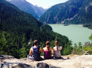
4.0Diablo lake is the perfect place to camp if you're looking for solitude and natural beauty. It's northeast from Seattle in the North Cascades. Colonial Creek Campground has large camp sites right on the lake. It is first come first serve, however check out is at noon so arrive around 11:30 to sna...Read more -
Marblemount, Washington
Climb Eldorado Peak via the East Ridge
8 mi / 6800 ft gainStanding on the knife edge summit, the terrain around you plummets steeply into glacier-filled basins that trickle into turquoise alpine lakes. Serrated snowy peaks give way to forest covered valleys below that craft a rugged landscape. Eldorado Peak delivers you atop this wild and mountainous wo...Read more -
Rockport, Washington
Sourdough Mountain Trail
5.09.34 mi / 5046 ft gainGoing east from Newhalem on highway 20, turn off towards the small town of Diablo. There are signs from there on where to park. This hike is very difficult. It is very steep and gains elevation very quickly and right from the start. Once you get above tree line though you are greeted with great ...Read more -
Manning Park, British Columbia
Hike to Mt. Frosty, EC Manning Provincial Park
14.2 mi / 5433.1 ft gainThe larch meadows on the approach to Mt. Frosty are known for 2 things: 1. Wild flowers during the summer and 2. Larches during the autumn.The trail climbs up the south end of Lightning Lake; it is well groomed and graded all the way up. The steepest section is the climb out of Lightning Lakes – ...Read more -
Marblemount, Washington
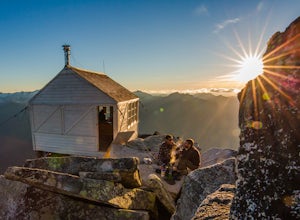
Hidden Lake Lookout
4.97.39 mi / 3415 ft gainBe careful when heading up this 4.5 mile trail since there can be snow coverage into the summer. When you start the trail, you'll get a little tree coverage as you start climbing up. Unfortunately, the shade starts to dissipate after about a mile, where you'll cross over Sibley Creek and enter th...Read more -
Manning Park, British Columbia
Backpack the Heather Trail, BC
24.9 mi / 1138.5 ft gainThis hike begins in the middle of Manning Park, with a drive up to the trail-head. This means you get all the benefits of alpine views and fields of wildflowers in the summer months, without hiking the elevation gain. Manning Park is on the Crowsnest Highway (BC-3). Across the highway from the ...Read more -
Marblemount, Washington
Terror Basin and West McMillan Spire
16.98 mi / 8868 ft gainThe Picket Range is a remote and rugged subrange of Washington's North Cascades. It draws very few visitors per year, and the odds of seeing another human on your adventure are very low. West McMillan Spire is an 8,000' peak located in the Southern Pickets. It is a Class 3 climb involving bot...Read more -
Leavenworth, Washington
Spider Meadow Trail
14.13 mi / 2923 ft gainSpider Meadow Trail is an out-and-back trail where you may see local wildlife located near Stehekin, Washington.Read more -
Leavenworth, Washington
Spider Gap to Buck Creek Pass
5.034.4 mi / 8317 ft gainBackpacking the Spider Gap to Buck Creek Pass Loop in the Glacier Peak Wilderness is no easy task, but yields some of the most spectacular views found in Washington. Plan for at least four days in order to stay fresh and to allow for extra time to soak in the Cascadian beauty that assaults your ...Read more -
Leavenworth, Washington
Backpack to Ice Lakes Basin
20 mi / 7600 ft gainBegin your adventure at the Phelps Creek Trailhead, roughly a 4 hour drive from Seattle. Make sure your car has good clearance and traction because the last section of the forest service road gets a little rough. Only a few minutes after starting down the trail, you will reach a split that head...Read more -
Marblemount, Washington
Lookout Mountain Trail
5.09.06 mi / 4610 ft gainBeginning about 7 miles down the Cascade River Road from Marblemount, the Lookout Mountain Lookout trailhead is on the north side of the road with parking for about 4-5 cars. With about 4500' elevation gain in 4.7 miles, this hike is definitely a thigh burner. The trail begins with a steep climb...Read more -
Leavenworth, Washington
Scramble Fortress Mountain
5.022 mi / 6000 ft gainThe Approach Starting at the Trinity trailhead you'll hike the Buck Creek Trail towards Buck Creek Pass. The trail is fairly obvious once the snows have melted but if you are going early season (June-early July) you will definitely want to bring a GPS. The trail works it's way up the valley alon...Read more -
Marblemount, Washington
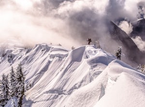
Winter ascent of Trappers Peak
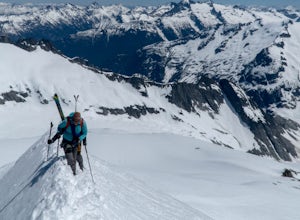
9.78 mi / 3448 ft gainNorth Cascade National Park is home to some of the most rugged and remote mountains in the lower 48 states. Because of this, the area is rarely seen up close and personal in the winter, but there are a few spots where you can see these wild mountains that will defy all imagination. In terms of lo...Read more -
Marblemount, Washington
Thornton Lakes & Trappers Peak
3.710.57 mi / 3885 ft gainTo get to your campground or to Trappers Peak, hike roughly five miles along the trail to ridge, where the trail divides. If you head left you'll go down into lake basis where you can drop your gear. Come back to the divide and head right, which will lead you up to trappers peak. Something to ke...Read more -
Chelan, Washington
Chelan Lakeshore Trail
5.018.13 mi / 4478 ft gainMake Note: This adventure requires out-and-back travel via the 'Lady of the Lake' ferry from Chelan, Washington or Field's Point Landing on Lake Chelan. Schedules, fares, and reservations can be made at: http://ladyofthelake.com/ The route described herein utilizes the Lake Chelan Lakeshore Trai...Read more

