Lopez Island, Washington
Top Spots in and near Lopez Island
-
Victoria, British Columbia
Hike to Jocelyn Hill
4.05.75 mi / 1499 ft gainGowlland Tod is a beautiful park, running along the Finlayson Arm fjord. Jocelyn hill is in the middle of the park, and can be accessed from the Caleb Pike access at the South end (along the Ridge trail) or from the McKenzie Bight access at the North end (along the Timberman trail). With planning...Read more -
Bellingham, Washington
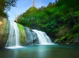
Pixie Falls
2.00.45 mi / 125 ft gainPixie Falls can be accessed during any season; however it’s most enjoyable during the spring and summer months. This waterfall and swimming hole combo is the perfect way to escape the heat and the crowds. On any given day, there will typically be less than 10 people who access the falls. Pixie is...Read more -
Bellingham, Washington
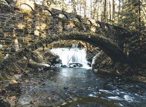
Whatcom Falls
0.13 mi / 20 ft gainWhatcom Falls is easily accessible within Whatcom Falls Park. It is less than a 2 minute walk from the parking lot to the bridge overlooking Whatcom Falls. This is a nice place to checkout with good company if you don't have a lot of time to enjoy the fresh air.Read more -
Blaine, Washington
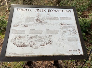
Terrell Marsh Trail
3.00.63 mi / 82 ft gainTerrell Marsh Trail is a loop trail that takes you past scenic surroundings located near Blaine, Washington.Read more -
Mayne Island, British Columbia
Kayak Bennett Bay
4.0The tiny island of Mayne is located in the chain of Gulf Islands just off the coast of Vancouver Island. For a small Island that can be biked across in a couple of hours, it offers some amazing views and photo opportunities. Mayne Island is just a stop away from Victoria and is located right abov...Read more -
Langford, British Columbia
Hiking Mt. Finlayson
4.0Mount Finlayson in Goldstream Provincial Park is 19 km north of Victoria on Hwy 1. The trail takes you up to a scenic lookout of Victoria. For the majority, this trail is quite easy, however, it gets slightly more challenging toward the end when the terrain gets steeper.Park at Goldstream Provinc...Read more -
Langford, British Columbia
Hiking the Goldmine Trail
4.52.2 mi / 295.3 ft gainGoldstream Provincial Park is just a short drive from Victoria. Within 20 minutes of leaving the city center, you can be immersed in an old growth temperate rain forest.From Victoria, take the Trans-Canada highway to the start of the Malahat. The Goldstream day use area is well marked. Stop here ...Read more -
Salt Spring Island, British Columbia
Hike Up Reginald Hill
1.2 mi / 771 ft gainFrom the Fulford ferry terminal, turn left onto Morningside Drive and follow the road to the end, where you’ll find a small area to park your car. From here, head up towards the subdivision and keep an eye out for the trail marker on your left, located 100m past the gate into Reginald Hills Estat...Read more -
Port Angeles, Washington
Run Ediz Hook "The Spit"
4.73 mi / 0 ft gainEdiz Hook or as locals call it, "the Spit" is a 3 mile long sand spit that extends out from Port Angeles along the Juan De Fuca. The views of the surrounding mountains and Vancouver Island, the marine life, beaches, and picnic areas make this a prime spot for a memorable run. We parked at the lo...Read more -
Salt Spring Island, British Columbia
Hike Mount Maxwell
From Ganges head south on Fulford-ganes road toward Fulfrod harbour. Turn right on Dukes road then a right on Seymour Heights. Seymour Heights turns into a dirt road, with a number of pot holes but nothing a non 4x4 car can't handle. At the trail head there is a small turn around and not a ton of...Read more -
Sooke, British Columbia
Hike East Sooke Park
Sitting very close to the southernmost point of Vancouver Island, facing west towards the mouth of the Strait of Juan de Fuca and the open Pacific Ocean, East Sooke Park is a unique and magical place for a hike or trail run. Your first visit will spark the desire to keep returning, to keep explor...Read more -
Sooke, British Columbia
Hike Mount Manuel Quimper
The Sooke Hills is a geographic region of low hills with elevations between 350m (Mt. Wells) to a high of 682m (Mt. Empress), located in the area bounded on three sides by Highway 1 to the east, Highway 14 to the south and the Sooke River to the west. Though heavily logged 100+ years ago, in the ...Read more -
Port Angeles, Washington
Peabody Creek Trail
5.05.1 mi / 948 ft gainPeabody Creek Trail is an out-and-back trail that takes you by a river located near Port Angeles, Washington.Read more -
Delta, British Columbia
Take a Sunset Ride on the Tsawwassen-Swartz Bay Ferry
4.0You can walk on or take your car on the ferry. Either way gets you to the same views. Make sure you sit on the right side of the boat (and it sometimes turns around once leaving the dock). Set up on the upper deck, and prepare yourself for an unbelievable show. Make sure you check out the onboard...Read more -
Surrey, British Columbia
Walk the 1001 Steps Trail
2.00.3 miOne of Surrey's hidden gems, head down to this short trail down a set of stairs that will take you to an uninhabited beach.The zig zagged steps take you down to the Birlington Rail Lines and you can walk along a trail to an opening under the tracks. Head to the beach from here where you will like...Read more -
Salt Spring Island, British Columbia
Kayak Ganges Harbour
5.0Salt spring island has plenty of amazing put in points for an afternoon of sea kayaking, but the ganges harbour is sheltered and easily accessible.For the put in points you have two options: The salt spring marina or churchill beach. Churchill beach would be the easier of the two with the added b...Read more

