Leavenworth, Washington
This bavarian-style town east of Seattle is a fantastic basecamp for mountain adventures.
Top Spots in and near Leavenworth
-
Skykomish, Washington
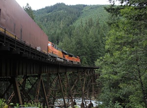
Photograph the Foss River Trestle
5.0Traveling east from Seattle on Highway 2, take a right hand turn onto Foss River Road (Road 68) just after the township of Skykomish. The pavement ends in 1.1 miles, beyond that be cautious of potholes. Continue along this road for a further 1.3 miles, at which point you will pass under a railroa...Read more -
Ronald, Washington
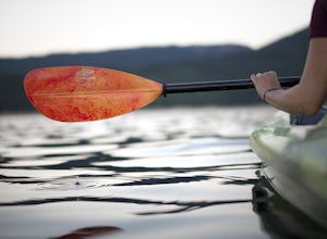
Kayak at Cle Elum Lake
We launched our kayaks from Speelyi Beach right into Cle Elum Lake. Surrounded with views of the beautiful Cascades and the Cle Elum Dam on the northwest side, exploring is endless. Parking: There is a small parking lot at the top of Speelyi Beach or you can drive right onto the beach to launch ...Read more -
Snohomish County, Washington
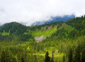
Hike Johnson Ridge to Scorpion Mountain
9 mi / 2650 ft gainFrom Skykomish, WA drive east on SR 2 roughly 1 mile and turn left on the Beckler River Road, FS RD 65. Drive north on this road approximately 7 miles taking a sharp right at the pavement's end just before crossing the Rapid River. You are now on FS RD 6520. Continue on this road bearing left a...Read more -
Snoqualmie Pass, Washington
Hike to Rachel Lake
4.88 mi / 1600 ft gainThis hike is 8 miles roundtrip, with 1600 feet of elevation gain. Once you're on the trail, it starts heading uphill to help get your heart rate up on the hike. As you enter the Alpine Lakes Wilderness, the trail starts to level out. You'll cross a few streams and hike through a fair amount of ve...Read more -
Snoqualmie Pass, Washington
Day Hike to Lila Lakes and Alta Pass
4.312 mi / 3000 ft gainGetting There From Seattle, drive Interstate 90 to Exit 62, Signed Kachess Lake/Stampede Pass. Turn left and head north over the interstate; you'll reach Kachess Lake Campground in five miles. Turn left where the pavements ends and drive four miles on Box Canyon Road (FS Road #4930) to the Rachel...Read more -
Snoqualmie Pass, Washington
Take a Hike Up To Rampart Lakes
5.011 mi / 2200 ft gainGetting There: From I-90 East, take exit 62. Take a left, heading over the highway. After 5.2 miles, the road veers left, passing Lake Kachess Campground. Go another 0.3 miles on the gravel road and take a right at a sign for Rachel Lake/Trail 1313. At this point, the road gets a little rough, bu...Read more -
Snoqualmie Pass, Washington
Hike Alta Mountain
4.012 mi / 3300 ft gainStart off at Trail #1313 to Rachel Lake. The first 2.5 miles is a flat, slow uphill hike till you get to a river crossing. From there, the next 1.3 miles will be a 1,000 foot elevation gain to Rachel Lake. Once you arrive, this is a good spot to rest, eat some snacks, and replenish your water sup...Read more -
Snoqualmie Pass, Washington
Snowshoe to Rachel Lake
8 mi / 2100 ft gainBegin at the Rachel Lake Trailhead and fill out the registry with your individual/group information.As you start the hike heading Northwest towards the lake itself, the trail begins to steadily climb from its initial elevation of 2500 feet. Once you cross the Alpine Lake Wilderness sign, the path...Read more -
Leavenworth, Washington
Evergreen Mountain Lookout
4.52.88 mi / 1522 ft gainThis is a relatively short hike, at only 2.6 miles round trip, that takes you up to the nearly 5600 foot summit. The hike may be short but it is extremely steep, gaining 1300ft in the 1.3 miles to the summit, so be prepared for a good leg workout. On the way to the top you will walk through field...Read more -
Chelan, Washington
Chelan Lakeshore Trail
5.018.13 mi / 4478 ft gainMake Note: This adventure requires out-and-back travel via the 'Lady of the Lake' ferry from Chelan, Washington or Field's Point Landing on Lake Chelan. Schedules, fares, and reservations can be made at: http://ladyofthelake.com/ The route described herein utilizes the Lake Chelan Lakeshore Trai...Read more -
Chelan, Washington
Boat-in Camping at Lake Chelan
You'll pick up the Lady of the Lake Ferry in downtown Chelan. Take the slowboat or the faster version, and prepare to settle in to an incredibly scenic and enjoyable ride up the 50 mile long Lake Chelan (the largest lake in the state by any measure). Don't forget to wear your sunblock if you sit ...Read more -
Skykomish, Washington
Hike to Lake Deer via Lake Dorothy Trailhead
12.6 mi / 1600 ft gainStart off by traveling along Highway 2 and turning towards the Money Creek Campground. Turn off onto Forest Road 6410 and follow that to the Lake Dorothy Trailhead (about 9 miles).This first section of the hike can be pretty crowded on a nice summer day as the trail is very family friendly and it...Read more -
Skykomish, Washington
Backpack from Dorothy Lake Trailhead to Snoqualmie Lake
18 mi / 1900 ft gainThe trail was not crowded although when we got to Snoqualmie Lake there were only a couple camping spots left. The trail up from Dorothy is not too hard at all. The weather was perfect. After passing Dorothy you have to ford a creek where the bridge has been washed out. We went through it on foot...Read more -
Leavenworth, Washington
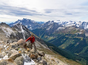
Scramble Fortress Mountain
5.022 mi / 6000 ft gainThe Approach Starting at the Trinity trailhead you'll hike the Buck Creek Trail towards Buck Creek Pass. The trail is fairly obvious once the snows have melted but if you are going early season (June-early July) you will definitely want to bring a GPS. The trail works it's way up the valley alon...Read more -
Chelan, Washington
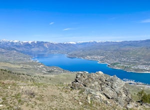
Chelan Butte
7.7 mi / 2674 ft gainChelan Butte provides sweeping views of Lake Chelan and the Columbia River and is actually located within the limits of the City of Chelan, with the trailhead sitting just outside the downtown area. While Chelan Butte is typically covered in snow during the winter providing a nice snowshoe, most ...Read more -
Leavenworth, Washington
Hiking the Lyman Lakes
5.021 mi / 2775 ft gainStart out on the Phelps Creek Trail and hike in 6.5 miles to reach the head of Spider Meadows. Continue on up the trail to the the base of the Spider Snowfield around 6200 feet for even better views of the entire Phelps Basin. Follow the trail up the snowfield for .5 miles to the top of Spider Ga...Read more

