Leavenworth, Washington
Looking for the best photography in Leavenworth? We've got you covered with the top trails, trips, hiking, backpacking, camping and more around Leavenworth. The detailed guides, photos, and reviews are all submitted by the Outbound community.
Top Photography Spots in and near Leavenworth
-
North Bend, Washington
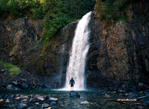
Franklin Falls via Wagon Road Trail
4.42.07 mi / 331 ft gainThis is an easy 2 mile roundtrip hike that leads to beautiful Franklin Falls. The trail is very well maintained and is easy for even young hikers to travel. The trail goes through the forest and along a gorge as you gain 400 feet in elevation to the falls. There are a few places you can scramble...Read more -
North Bend, Washington
Kaleetan Peak
9 mi / 2200 ft gainInitial note: because this is an alpine scramble, do your research before tackling this adventure, including learning the correct route and the current conditions (such as any early- or late-season snow). From the Denny Creek Trailhead, take the Denny Creek trail just over 4 miles to Melakwa Lak...Read more -
Gold Bar, Washington
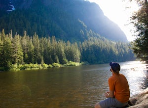
Barclay Lake
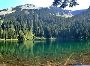
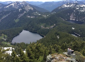
4.44.4 mi / 607 ft gainWith less than 500 feet of total elevation and 4.4 miles of round trip hiking, the Barclay Lake trail is a perfect hike for beginners, families, or those looking for a quick morning or afternoon jaunt. Yet dont let the simplicity of the hike fool you. The end result of the hike is nothing short o...Read more -
Gold Bar, Washington
Baring Mountain
4.62 mi / 3556 ft gainDon't let the low mileage trick you – this is not an easy climb. Give yourself plenty of time to summit this beast of a mountain. Starting at the Barclay Lake Trailhead, be careful not to jump onto the Barclay Lake Trail. The path to Baring Mountain is hidden down a path leading from the bathroo...Read more -
Gold Bar, Washington
Eagle Lake via Barclay Lake Trailhead
8.5 mi / 2000 ft gainStart off on the same trail as Barclay Lake. After 2.25 miles, you will arrive at Barclay Lake. This lake can be quite busy in the summer months as it is relatively easy to access, and you may see many people camping there with their kids. Continue around the lake until you almost reach the east...Read more -
Snoqualmie Pass, Washington
Hike Mount Catherine
5.03 mi / 1300 ft gainStart off on the extremely rough Forest Service 9070 road. Follow this for just over 4 miles until you see a sign for trail #1348 on the right. There is only enough room for a couple cars at the trailhead.You start off climbing right away, covering 800 feet of elevation in the first 0.80 miles of...Read more -
North Bend, Washington
Annette Lake
4.57.2 mi / 1923 ft gainFrom Seattle drive east on I-90 to exit 47 (Asahel Curtis/Denny Creek). Turn right from the off-ramp and continue 0.25 mile, then turn left on Forest Road 5590. You'll find the parking area in 0.3 mile. Between the thick second-growth forest stands and the high alpine lake, the trail rolls along...Read more -
North Bend, Washington
Rainy Lake Trail
4.09 mi / 3205 ft gainThis is an abandoned trail that heads south along Rainy Creek, off of the downstream section of the Middle Fork Snoqualmie Trail, and up to Rainy Lake. The lake is popular among fisherman, since it is home to lots of trout, but be warned -- route-finding skills are a must on this trip. I do my be...Read more -
North Bend, Washington
Granite Mountain
4.27.92 mi / 3999 ft gainThe trek up Granite Mountain is a strenuous and fairly steep hike located east of Seattle and west of Snoqualmie pass off of I-90. Take exit 47 and turn North to a T intersection, park at the Pratt lake Trailhead at approximately 1860' and right beside I-90. The trail splits just after the first...Read more -
North Bend, Washington
Overnight Hike to Pratt Lake
4.511 mi / 2300 ft gainThis overnight hike is definitely a challenge with 2,300 feet of elevation gain but all that huffing and puffing will be worth it when you reach the beautiful Pratt Lake Basin.The trail can be a bit busy in the first mile but most of the traffic is from day hikers on their way up the popular Gran...Read more -
North Bend, Washington
Middle Fork Snoqualmie River Trail
27.57 mi / 3609 ft gainThis beautiful tucked-away trail offers runners, hikers, and backpackers a new view of their favorite neighboring peaks - like Mailbox Peak and Mt. Si - from one of the most scenic river trails in the Seattle area. Often overlooked in favor of more rigorous hikes, the Middle Fork is a gently gra...Read more -
North Bend, Washington
Hike Pratt Balcony
2.2 miThis one can be a bit tricky to find. The trailhead is unmarked and is a bit hidden around a curve of Middle Fork Road so it is easy to miss. At about 9.80 miles from the junction of 468th St. and Middle Fork Road, look for two signs on the right warning of upcoming gravel patches (probably will ...Read more -
Gold Bar, Washington
Heybrook Lookout
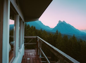
4.72.47 mi / 984 ft gainTo the trailhead, drive east on highway 2 from Everett. Just past milepost 37 you will see a gravel parking area on the left side of the highway. Wander through a mossy forest that reminds me of Olympic National Park and traverse up 1.3 miles of switch backs to ascend heybrook lookout! Dogs ar...Read more -
Gold Bar, Washington
Sunset Falls
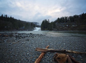
1.0Note: Please be careful when exploring the falls. We recommend not walking on the surfaces directly next to the falls as the water is moving very quickly and can pick you up quickly. The falls are home to several very sad losses. Sunset Falls is the largest and the final of the three major wate...Read more -
North Bend, Washington
Summit Mt. Defiance
5.011 mi / 3300 ft gainThis hike offers some of the best views one can see in the area. On a clear day, you'll get amazing views of Mt. Rainier. The best part is that as you start heading uphill in the first half mile, you'll get great views of McClellan Butte. Once you reach the summit of Defiance at 5584 feet, you'll...Read more -
North Bend, Washington
Bandera Mountain
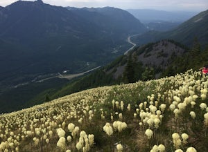
4.47.8 mi / 3176 ft gainThis hike has unreal views of Mount Rainier. On a great clear spring day, the mountain is out. It's right in your face. It's incredible. If you tackle this hike in the spring the bear grass and wildflowers are alive and blooming towards the top and it makes for some fantastic picture-taking. Once...Read more

