Leavenworth, Washington
Looking for the best hiking in Leavenworth? We've got you covered with the top trails, trips, hiking, backpacking, camping and more around Leavenworth. The detailed guides, photos, and reviews are all submitted by the Outbound community.
Top Hiking Spots in and near Leavenworth
-
Skykomish, Washington
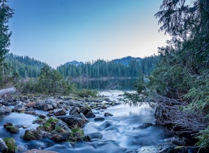
Hike to Lake Deer via Lake Dorothy Trailhead
12.6 mi / 1600 ft gainStart off by traveling along Highway 2 and turning towards the Money Creek Campground. Turn off onto Forest Road 6410 and follow that to the Lake Dorothy Trailhead (about 9 miles).This first section of the hike can be pretty crowded on a nice summer day as the trail is very family friendly and it...Read more -
Skykomish, Washington
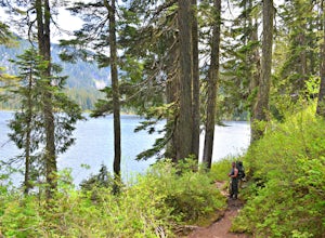
Backpack from Dorothy Lake Trailhead to Snoqualmie Lake
18 mi / 1900 ft gainThe trail was not crowded although when we got to Snoqualmie Lake there were only a couple camping spots left. The trail up from Dorothy is not too hard at all. The weather was perfect. After passing Dorothy you have to ford a creek where the bridge has been washed out. We went through it on foot...Read more -
Leavenworth, Washington
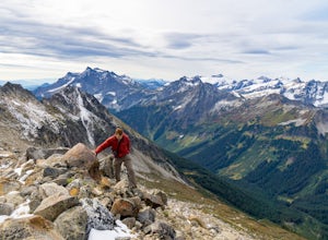
Scramble Fortress Mountain
5.022 mi / 6000 ft gainThe Approach Starting at the Trinity trailhead you'll hike the Buck Creek Trail towards Buck Creek Pass. The trail is fairly obvious once the snows have melted but if you are going early season (June-early July) you will definitely want to bring a GPS. The trail works it's way up the valley alon...Read more -
Chelan, Washington
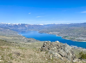
Chelan Butte
7.7 mi / 2674 ft gainChelan Butte provides sweeping views of Lake Chelan and the Columbia River and is actually located within the limits of the City of Chelan, with the trailhead sitting just outside the downtown area. While Chelan Butte is typically covered in snow during the winter providing a nice snowshoe, most ...Read more -
Leavenworth, Washington
Hiking the Lyman Lakes
5.021 mi / 2775 ft gainStart out on the Phelps Creek Trail and hike in 6.5 miles to reach the head of Spider Meadows. Continue on up the trail to the the base of the Spider Snowfield around 6200 feet for even better views of the entire Phelps Basin. Follow the trail up the snowfield for .5 miles to the top of Spider Ga...Read more -
Leavenworth, Washington
Carne Mountain
7.4 mi / 3599 ft gainDrive USFS Road 62 for 23 miles from Lake Wenatchee (turn left at Cole's Corner off of Highway 2 towards Lake Wenatchee). Turn right on USFS Road 6211 for ~2.5 miles to the end at the Phelps Creek Trailhead. Begin to hike the Phelps Creek Trail but in 1/4-1/2 a mile, take a right on the Carne Mo...Read more -
Leavenworth, Washington
Backpack to Ice Lakes Basin
20 mi / 7600 ft gainBegin your adventure at the Phelps Creek Trailhead, roughly a 4 hour drive from Seattle. Make sure your car has good clearance and traction because the last section of the forest service road gets a little rough. Only a few minutes after starting down the trail, you will reach a split that head...Read more -
Leavenworth, Washington
Spider Gap to Buck Creek Pass
5.034.4 mi / 8317 ft gainBackpacking the Spider Gap to Buck Creek Pass Loop in the Glacier Peak Wilderness is no easy task, but yields some of the most spectacular views found in Washington. Plan for at least four days in order to stay fresh and to allow for extra time to soak in the Cascadian beauty that assaults your ...Read more -
Leavenworth, Washington
Spider Meadow Trail
14.13 mi / 2923 ft gainSpider Meadow Trail is an out-and-back trail where you may see local wildlife located near Stehekin, Washington.Read more -
Snoqualmie Pass, Washington
Hike-In and Camp at Alaska Lake
Driving Directions: From Seattle drive east on I-90 to exit 54 (signed "Hyak"). Turn left (north) under the freeway and right on the frontage road marked "Gold Creek." After about 0.5 mile turn left (north) on Gold Creek Road (Forest Road 4832), and in another 0.5 mile reach a junction. To the le...Read more -
Easton, Washington
Snowshoe to Amabilis Mountain
9.5 mi / 2100 ft gainTo reach Amabilis Mountain, park at the Cabin Creek Sno Park at Exit 63 off I-90. Take the overpass across the highway to the trailhead and strap on your snowshoes. There's a maze of cross-country ski trails, but you'll want to keep to the right and follow the Berg trail for a quarter mile until ...Read more -
Snoqualmie Pass, Washington
Hike Gold Creek Pond
5.01 miThe quintessential family friendly hike, Gold Creek Pond is a simple yet spectacular hike next to Snoqualmie Pass. Easily accessible from the top of the pass (4.5 miles, 12 minute drive), the Gold Creek Pond hike is a simple addition to any itinerary if you're in the area. From Hwy 90, take exit...Read more -
Snoqualmie Pass, Washington
Snowshoe Gold Creek Pond
4 mi / 400 ft gainSince the parking lot is not plowed in the winter you have to park along the main road next to the drive way toward the hike. Once to the trial head it is smooth sailing the rest of the hike. When I went the snow was compacted so snowshoes were not necessary but they are very helpful. Once to the...Read more -
Snoqualmie Pass, Washington
Hike to Margaret Lake
6 mi / 1800 ft gainStarting at an elevation of 3,300 feet, begin the hike on a steep gravel road for 1/4 of a mile. Take a left onto a dirt road that will lead to an area of clear cuts and windy switchbacks.As daunting as this may seem, don't be discouraged. On a clear day, the surrounding peaks of Snoqualmie Pass ...Read more -
North Bend, Washington
Snowshoe Kendall Peak Lakes
9 mi / 2000 ft gainThis hike starts at the Gold Creek sno-park. You need the sno-park and discover pass for this. Park on the side of the road and start hiking up from there. Hike road up and up and up! It's very compact snow (at the moment, that will change fast with new snow coming in). We ended up leaving our sn...Read more -
North Bend, Washington
Hike to Gravel Lake
13.6 mi / 2759 ft gainStarting at the Snoqualmie Pass PCT trailhead, you start hiking through an old growth forest. This hike has a nice gradual incline with views starting near a talus field. Late June, early July wildflowers are growing like crazy along the trail. This field offers a up close view of Mt. Rainier alo...Read more

