Langley, Washington
Looking for the best photography in Langley? We've got you covered with the top trails, trips, hiking, backpacking, camping and more around Langley. The detailed guides, photos, and reviews are all submitted by the Outbound community.
Top Photography Spots in and near Langley
-
Blakely Island, Washington
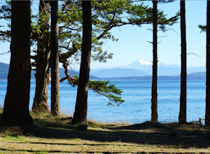
Hike and Camp at James Island
If you're looking for a weekend camping getaway to a small San Juan Island and you have a boat of substantial size or experience sea kayaking, this is the adventure for you!Launch your boat from Washington Park in Anacortes and cruise or sea kayak across Rosario Straight to James Island. There i...Read more -
Sequim, Washington
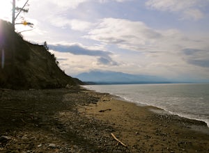
Hike Dungeness Spit
3.511 mi / 130 ft gainPark at a the north side of the Dungeness Spit Recreation Area, in the Refuge parking lot. There is a kiosk at the Refuge where you can pay an entrance fee ($3) and check the Tide Table. Only attempt the hike at low tide or the sand spit becomes narrow and you have to climb over logs.Follow the R...Read more -
Seabeck, Washington
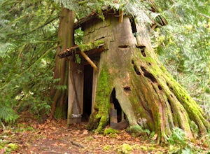
Hike to Guillemont Cove Stump House
4.52.5 miHave you ever been inside a stump house? This is your chance! Just outside of Seabeck, Washington lies a hobbit stump house tucked into a mossy forest on the shores of Guillemont Cove. Drive to Seabeck, turn right onto Miami Beach Road, bear left onto Stavis Bay road and continue for 4.5 miles...Read more -
Issaquah, Washington
Grand Ridge Trail
4.07.51 mi / 1125 ft gainThe trail system in the 1,300 acre Grand Ridge Park can currently can be accessed from two lots: High Point and Central Park, with a new lot at Duthie Hill still under construction. To get to the High Point lot take exit 20 off of I-90 (coming from Seattle), take a left and pass under the freewa...Read more -
Bremerton, Washington
Hike the Gold Creek Trail at Green Mountain
4.05 mi / 1000 ft gainThe Gold Creek Trail is one of several trails in the Green Mountain region. Although the trail is intertwined with others, it is almost impossible to start down the wrong path. The trail is well-marked and well-maintained, making this an excellent option for the family. The trail begins at the e...Read more -
Bow, Washington
Oyster Dome via Chuckanut Trail
4.36.57 mi / 1857 ft gainThe trail begins on the Pacific Northwest Trail, which ascends quickly up the side of Blanchard Mountain. The trail contains several switchbacks which wind through second-growth alder, Western red cedar, and Douglas fir forest. After about one mile there is an overlook with a bench that offers a...Read more -
Bow, Washington
North Butte via Chuckanut Trail
1.07.71 mi / 2047 ft gainThe HikeThe hike there isn't short, has several steep sections, and ends at the top of the mountain. There are cliff warnings at the top, so be careful as you explore the view! The steepest portions are at the beginning and right at the end. The trail is very well maintained (because it is so pop...Read more -
Bow, Washington
Samish Overlook
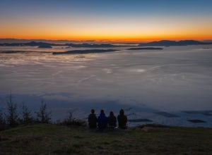
The sunset is amazing at Sammish Overlook. The view is the definition of panoramic and you almost have to strain your eyes because there is so much to look at. Plan to arrive before sunset if you want to capture some photos. This is a great "date spot" and you're likely to see couples up here pic...Read more -
Renton, Washington
Far County Falls via Licorice Fern Trail
4.24.25 mi / 801 ft gainFrom Seattle, take the I-90 E to exit 15. Make a right on 17th Ave. This street will later become Renton/Issaquah Rd. Drive about four miles then turn right on to May Valley Rd. Make a sharp right onto SE 112th St. This street will soon turn into 169th Ave SE as it turns left. The trailhead is ri...Read more -
Port Angeles, Washington
Backpack 1000 Acre Meadows
45.1 mi / 10750 ft gainThere are many different ways to reach 1000 Acre Meadows, but this guide will get you there starting at the Deer Park trailhead (5,400').Day 1: 14 miles You will start out by descending 2,400' and 4.3 miles to reach the Graywolf Camp. This is where the loop meets up with itself later on. Our goal...Read more -
Granite Falls, Washington
Dispersed Camp near Beaver Creek Group Camp, Mt. Baker Snoqualmie NF
This campsite is located along the Mountain Loop Highway. There are various options for dispersed camping around the area, as well as some you can reserve ahead of time such as the Coal Creek Campground and the Beaver Creek Group Campground. This campsite is located just before Beaver Creek grou...Read more -
Friday Harbor, Washington
Hike through the American Camp
3 miFor what was once a highly contested and disputed piece of land in the Pacific Ocean, now lays home to one of the most peaceful, tranquil, and historic hikes in the island chain. Start the hike at the parking lot of the San Juan Island National Historic Site American Camp Visitor Center. Proceed ...Read more -
Granite Falls, Washington
North Lake via Independence Lake
5.56 mi / 2431 ft gainNorth Lake is everything you could want in a subalpine lake: emerald green hues, cold, clear water, lots of brook trout and far from cell-phone reception. This backpack is perfect when the weather gets hot and sunny, though it does reside in what is known as “the wettest section of the Cascades,...Read more -
Granite Falls, Washington
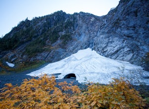
Big Four Ice Caves
4.32.38 mi / 289 ft gainDisclaimer: Hiking into the caves is extremely dangerous as there is potential for the ice to fall. We do not recommend hiking inside of them and if you choose to do so, you're doing it at your own risk. This is a short hike at just 2.3 miles roundtrip with little elevation change. The hike take...Read more -
Granite Falls, Washington
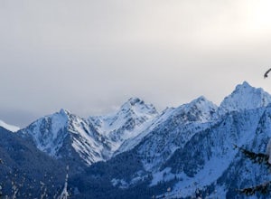
Snowshoe to Coal Lake
13 mi / 1600 ft gainhttps://www.theoutbound.com/wa...Starting out at the Deer Creek gate of Mountain Loop Highway the road is flat and uneventful for the first 2 miles or so, though it does offer some great views of the Big Four as well as a few other peaks and the babbling south fork of the Stillaguamish river. The...Read more -
Issaquah, Washington
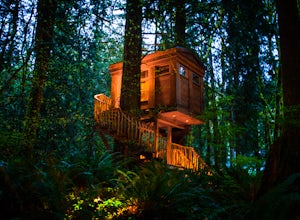
Spend a Night at TreeHouse Point
4.8This is one of the most magical and romantic places on the planet to get a good night's rest. You'll find that words will escape you when it comes to describing how this place makes you feel. With the Raging River as a backdrop, the powerful white noise will put you into one of the deepest sleeps...Read more

