Fall City, Washington
Looking for the best photography in Fall City? We've got you covered with the top trails, trips, hiking, backpacking, camping and more around Fall City. The detailed guides, photos, and reviews are all submitted by the Outbound community.
Top Photography Spots in and near Fall City
-
Snoqualmie Pass, Washington
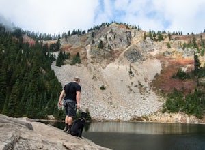
Hike to Margaret Lake
6 mi / 1800 ft gainStarting at an elevation of 3,300 feet, begin the hike on a steep gravel road for 1/4 of a mile. Take a left onto a dirt road that will lead to an area of clear cuts and windy switchbacks.As daunting as this may seem, don't be discouraged. On a clear day, the surrounding peaks of Snoqualmie Pass ...Read more -
Skykomish, Washington
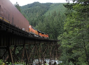
Photograph the Foss River Trestle
5.0Traveling east from Seattle on Highway 2, take a right hand turn onto Foss River Road (Road 68) just after the township of Skykomish. The pavement ends in 1.1 miles, beyond that be cautious of potholes. Continue along this road for a further 1.3 miles, at which point you will pass under a railroa...Read more -
Skykomish, Washington
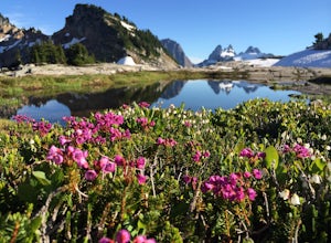
Tank Lakes via Necklace Valley
18.94 mi / 4721 ft gainTucked high in the heart of the Alpine Lakes Wilderness, Tank Lakes has everything you could ask for out of a Washington hike. You start low at the Necklace Valley trailhead just south of Skykomish along Highway 2 and meander five miles to a giant log crossing of the East Fork Foss River. From h...Read more -
Snoqualmie Pass, Washington
Hike to Rachel Lake
4.88 mi / 1600 ft gainThis hike is 8 miles roundtrip, with 1600 feet of elevation gain. Once you're on the trail, it starts heading uphill to help get your heart rate up on the hike. As you enter the Alpine Lakes Wilderness, the trail starts to level out. You'll cross a few streams and hike through a fair amount of ve...Read more -
Snoqualmie Pass, Washington
Day Hike to Lila Lakes and Alta Pass
4.312 mi / 3000 ft gainGetting There From Seattle, drive Interstate 90 to Exit 62, Signed Kachess Lake/Stampede Pass. Turn left and head north over the interstate; you'll reach Kachess Lake Campground in five miles. Turn left where the pavements ends and drive four miles on Box Canyon Road (FS Road #4930) to the Rachel...Read more -
Snoqualmie Pass, Washington
Take a Hike Up To Rampart Lakes
5.011 mi / 2200 ft gainGetting There: From I-90 East, take exit 62. Take a left, heading over the highway. After 5.2 miles, the road veers left, passing Lake Kachess Campground. Go another 0.3 miles on the gravel road and take a right at a sign for Rachel Lake/Trail 1313. At this point, the road gets a little rough, bu...Read more -
Snoqualmie Pass, Washington
Hike Alta Mountain
4.012 mi / 3300 ft gainStart off at Trail #1313 to Rachel Lake. The first 2.5 miles is a flat, slow uphill hike till you get to a river crossing. From there, the next 1.3 miles will be a 1,000 foot elevation gain to Rachel Lake. Once you arrive, this is a good spot to rest, eat some snacks, and replenish your water sup...Read more -
Snoqualmie Pass, Washington
Snowshoe to Rachel Lake
8 mi / 2100 ft gainBegin at the Rachel Lake Trailhead and fill out the registry with your individual/group information.As you start the hike heading Northwest towards the lake itself, the trail begins to steadily climb from its initial elevation of 2500 feet. Once you cross the Alpine Lake Wilderness sign, the path...Read more -
Skykomish, Washington
Beckler Peak
7.55 mi / 2139 ft gainLooking for a gradual forest hike up to a peak with 360° views of the Cascades? Beckler Peak trail winds through old growth, past rushing waterfalls, and up to a granite summit. From the top, you can see mountains in the Cascades such as Glacier Peak, Mount Baring, Mount Index, Evergreen Mounta...Read more -
Lake Stevens, Washington
Water and Snow Ski Stevens to Stevens
5.0Have you ever dreamed of snow skiing and water skiing in the same day? This March, plan your adventure of a lifetime to Stevens Pass and Lake Stevens, Washington. You will need a winter coat, a wet suit, and a heart made of love for the outdoors.Keep an eye on mountain and lake weather conditions...Read more -
Skykomish, Washington
Hike Mount Sawyer
8 mi / 1200 ft gainThis trail starts off going through the forest of fir and hemlock for the first mile. Once you reach the top of the first hill, you will get a glimpse of all the views you will have the opportunity to enjoy later on. As you descend, the trees will start to thin out. The trail follows the ridge l...Read more -
Granite Falls, Washington
Cutthroat Lakes via Walt Bailey Trail
4.06.21 mi / 1978 ft gainAlong the Mountain Loop Highway, past the crowds crawling over Mt. Pilchuck, lies the muddy, unkempt Walt Bailey Trail into a verdant subalpine basin speckled with tiny tarns. The Cutthroat Lakes are a delightful location to spend the night with optional day hikes up to exposed ridgelines and cra...Read more -
Leavenworth, Washington
Evergreen Mountain Lookout
4.52.88 mi / 1522 ft gainThis is a relatively short hike, at only 2.6 miles round trip, that takes you up to the nearly 5600 foot summit. The hike may be short but it is extremely steep, gaining 1300ft in the 1.3 miles to the summit, so be prepared for a good leg workout. On the way to the top you will walk through field...Read more -
Enumclaw, Washington
Hike to Kelly Butte
3.4 mi / 1100 ft gainAfter a rough drive to the trailhead you’ll have little time to catch your breath as the trail laces up the mountain side, but with Rainier to distract you, it won’t be long until you’re at the top with a view that is more than enough reward for your efforts. Pay very close attention to the drivi...Read more -
Snoqualmie Pass, Washington
Spectacle Lake via Pete Lake Trail
5.018.91 mi / 3058 ft gainDepending on when you arrive at the Pete Lake Trailhead, expect to be traveling with company as it is one of the more popular locations on the eastside of Snoqualmie Pass. At an elevation of 2600 feet, the beginning route is a moderate 400 feet of elevation gain. Start on your way through the va...Read more -
Snohomish County, Washington
Hike Johnson Ridge to Scorpion Mountain
9 mi / 2650 ft gainFrom Skykomish, WA drive east on SR 2 roughly 1 mile and turn left on the Beckler River Road, FS RD 65. Drive north on this road approximately 7 miles taking a sharp right at the pavement's end just before crossing the Rapid River. You are now on FS RD 6520. Continue on this road bearing left a...Read more

