Fall City, Washington
Looking for the best photography in Fall City? We've got you covered with the top trails, trips, hiking, backpacking, camping and more around Fall City. The detailed guides, photos, and reviews are all submitted by the Outbound community.
Top Photography Spots in and near Fall City
-
Enumclaw, Washington
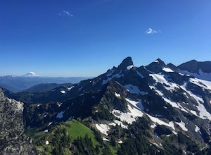
Norse Peak via Silver Creek
7.77 mi / 2405 ft gainStart out in Crystal parking lot A. There is a small and steep trail that heads up the hill labeled as Silver Creek Trail. The trail follows a horse trail for the majority of the route and gets renamed Bullion Basin Trail shortly after you enter the woods, so when it doubt keep following the hoof...Read more -
Ashford, Washington
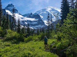
Summerland Trail
5.08.62 mi / 2359 ft gainThe Summerland trail is by far the easiest trail that I ever experienced. The trail is well maintained and for the first 3 miles you are surrounded by trees and the sound of waterfalls and rivers, and it's green everywhere. The last 1.3 miles, you encounter switchbacks and you can get some view...Read more -
Ashford, Washington
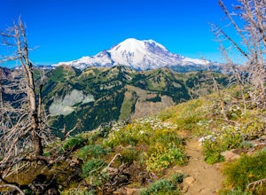
Hike to Mount Rainier's Panhandle Gap
5.012 mi / 3000 ft gainThe trail is 12 mi round trip but don’t let the distance for an out and back turn you off - this hike is fantastic and even better with a beer at the top. The trail winds its way through an old growth forest and shortly joins the Wonderland Trail. After crossing a crick the trail steepens and beg...Read more -
Ashford, Washington
Climb Little Tahoma/East Shoulder
17 mi / 7450 ft gainStart from the Summer Land Trail Head at the Fryingpan Creek parking lot just West of the White River Ranger Station in Mount Rainier National Park. Beginning at an elevation of 3,800 feet, you'll head southeast along the Summer Land Trail for 4.5 miles, tracing the Fryingpan Creek. There are a f...Read more -
Ashford, Washington
Scramble to Tamanos Mountain
10 mi / 3000 ft gainSoon after entering Mt. Rainier National Park via the White River Entrance, pull into the Owyhigh Lakes Trail parking area. From the parking lot, walk across Sunrise Road to the Owyhigh Lakes Trailhead to begin an exceptional hike to the summit of Tamanos Mountain.Start by hiking 3.5 miles on the...Read more -
Leavenworth, Washington
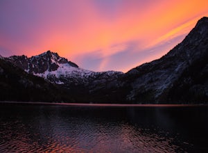
The Enchantments: Stuart Lake Trailhead to Snow Lake Trailhead
5.018.02 mi / 4626 ft gainThere are a couple different ways to tackle this hike through the stunning Central Cascade region. I recommend checking out this handy resource for more detailed info. Bottom line: this is an absolutely amazing hike for people willing to take a little bit of an ass kicking. Aasgard Pass rises 1,...Read more -
Leavenworth, Washington
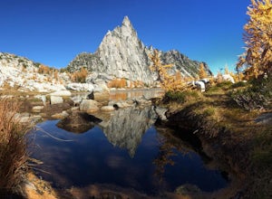
Day Hike the Enchantments
5.018.05 mi / 4675 ft gainStart at the Stuart Lake trailhead, which at 3400' is a full 2000' higher than the Snow Lake trailhead you'll finish at. Put 2.5 easy miles under your feet along Mountaineer Creek before turning left on the trail up to Colchuck Lake. The trail steepens for the next 1.5 miles before popping you ou...Read more -
Leavenworth, Washington
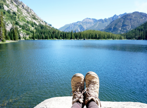
Hike to Lake Stuart
4.89 mi / 1665 ft gainBegin this hike at the Lake Stuart trailhead at the end of Eightmile road just outside of Leavenworth, Washington. The trail follows Mountaineer Creek and leads you across a log bridge over the falls. After the bridge, the trail narrows and steepens through several switchbacks. After 2.2 miles...Read more -
Leavenworth, Washington
Scramble to the Summit of Dragontail Peak
16 mi / 7000 ft gainGetting There From Leavenworth, WA, drive Icicle Creek Road for 8.5 miles until you reach Bridge Creek Campground. Turn left here onto Forest Service Road #7601 signed for the Stuart Lake Trailhead. The pavements ends and the road gains elevation quickly as your car transports you high above the ...Read more -
Leavenworth, Washington
Hike to the Enchantments' Horseshoe Lake
1.016 mi / 6000 ft gainGetting There From Leavenworth, WA, drive Icicle Creek Road for 8.5 miles until you reach Bridge Creek Campground. Turn left here onto Forest Service Road #7601 signed for the Stuart Lake Trailhead. The pavements ends and the road gains elevation quickly as your car transports you high above the ...Read more -
Leavenworth, Washington
Aasgard Pass via Stuart Lake Trail
3.511.15 mi / 4560 ft gain“These fleetingly rare sights offer a recipe for what I call ‘the Quest.’ The Quest is the force that motivates us to travel. It’s putting oneself in the perfect place at the perfect time. It’s the insatiable urge to find that quintessential moment.” - Washington AAA Journal The arrival of “gold...Read more -
Brinnon, Washington
Hike to Mt. Walker North & South Viewpoints
3.04 mi / 2000 ft gainDirections: From the Quilcene Ranger Station drive 4.6 miles south on US 101. Watch for the signs for Mount Walker View Point. Turn left onto Mount Walker Road. The trail head is about a quarter mile up the road with pull over parking on the left side of the road. In the winter and early spring, ...Read more

