Des Moines, Washington
Top Spots in and near Des Moines
-
North Bend, Washington
Camp and Trail Run from Rainbow Lake
I backpacked to and setup basecamp at Rainbow Lake and then I ran over to Island Lake. After enjoying the peace and quite I ran up to the top of Bandera Mountain and enjoyed the views. Then, I ran back to basecamp and spent the night. The following morning I ran up to the top of Mount Defiance a...Read more -
Ashford, Washington
Hike to Rainier NP's Ranger Falls
4.57 miWhen heading to the adventure, stopped at the ranger station in Carbon to get your day pass ($5.00) and then continue on to the trailhead. Park on the road next to the Carbon river around. Start the hike down an old paved road that eventually leads through some trails and then to a gravel road. T...Read more -
North Bend, Washington
Hike Pratt Balcony
2.2 miThis one can be a bit tricky to find. The trailhead is unmarked and is a bit hidden around a curve of Middle Fork Road so it is easy to miss. At about 9.80 miles from the junction of 468th St. and Middle Fork Road, look for two signs on the right warning of upcoming gravel patches (probably will ...Read more -
Brinnon, Washington
Rocky Brook Falls
4.80.25 mi / 141 ft gainTo find the falls, head north up Hwy. 101 past Brinnon, Washington and hang a left at Dosewallips Rd. Keep an eye on the mile markers. Right after mile three and crossing a small bridge, there's a parking area on the left side enough for about 6 cars. The hike to Rocky Brook Falls is a short on...Read more -
North Bend, Washington
Hike Little Saint Helens via Hansen Creek
7 mi / 1109 ft gainThe road to the hike is rough in some spots but overall any car can make it up. Quite a lot of campsites along the first mile if you choose to camp here. The trail is well maintained and easy to follow. You start out by cutting across the road and starting at the Hansen Creek trailhead. Follow t...Read more -
North Bend, Washington
Talapus & Olallie Lakes
5.71 mi / 1266 ft gainWith a moderate grade on a wide trail, the hike to Talapus Lake is the perfect introduction to the outdoors for hikers and beginning backpackers. Upon arrival at Talapus, break out lunch or pitch camp. Either way, you can cool off in the large lake. If you feel like pressing on, Ollalie Lake is j...Read more -
North Bend, Washington
Talapus Lake Trail
3.43 mi / 781 ft gainThe trail up to Talapus Lake is well graded and relatively short, at only about 2.5 miles in length RT. The trail starts off on a wide old road cut and then veers off into the old growth woods in a slowly winding uphill tack. A few mellow switch backs deliver you to the top, where a short stretch...Read more -
Brinnon, Washington
Hike to Mt. Walker North & South Viewpoints
3.04 mi / 2000 ft gainDirections: From the Quilcene Ranger Station drive 4.6 miles south on US 101. Watch for the signs for Mount Walker View Point. Turn left onto Mount Walker Road. The trail head is about a quarter mile up the road with pull over parking on the left side of the road. In the winter and early spring, ...Read more -
North Bend, Washington
Middle Fork Snoqualmie River Trail
27.57 mi / 3609 ft gainThis beautiful tucked-away trail offers runners, hikers, and backpackers a new view of their favorite neighboring peaks - like Mailbox Peak and Mt. Si - from one of the most scenic river trails in the Seattle area. Often overlooked in favor of more rigorous hikes, the Middle Fork is a gently gra...Read more -
Tumwater, Washington
Tumwater Falls Trail
3.00.8 mi / 72 ft gainTumwater Falls Trail is a loop trail that takes you by a waterfall located near Olympia, Washington.Read more -
North Bend, Washington
Otter Falls
4.08.37 mi / 853 ft gainThe hike begins at Snoqualmie Lake Trailhead, but you'll actually have to start your hike about a half mile down the road from the trailhead as some cement barricades are up. There is plenty of room to park below the barricades, and the walk up to the trial head is easy and quick. Once at the tr...Read more -
National Forest Development Road 2530, Washington
Hike to Murhut Falls
1.37 mi / 371 ft gainThe trailhead to Murhut Falls is located about 7.5 miles off US-101 S but the last couple of miles are on NF-2530 which can be potholed and rutted. I made it up the road in my 2WD sedan but it took quite some time to dodge all of the potholes. This hike is nice and quick! It starts with a small ...Read more -
Eatonville, Washington
Hike to Little Mashel Falls
4.75.3 mi / 646 ft gainIf you have been trying to get behind a waterfall Eatonville Falls is the place to hike and get a great feeling out of it. Hiking to the waterfall would lead you to a railroad and pass it would lead to a river where you would follow it down to get to the waterfall. The hike itself is pretty sim...Read more -
North Bend, Washington
Rainy Lake Trail
4.09 mi / 3205 ft gainThis is an abandoned trail that heads south along Rainy Creek, off of the downstream section of the Middle Fork Snoqualmie Trail, and up to Rainy Lake. The lake is popular among fisherman, since it is home to lots of trout, but be warned -- route-finding skills are a must on this trip. I do my be...Read more -
Ashford, Washington
Tolmie Peak's Fire Lookout
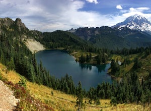
4.45.73 mi / 1250 ft gainMount Rainier is spectacular to look at, but sometimes the best views aren't from on its slopes, but just a little ways away. Tucked in the seldom-visited northwest corner of Mount Rainier National Park, the Tolmie Peak fire lookout frames the mountain's rugged slopes with a pristine alpine lake ...Read more -
27662-27664 Olympic Highway, Washington
Hike Falls View Canyon
1.5 mi / 300 ft gainThis hike is located immediately off of Highway 101 in the Falls View Campground. If the campground is closed you can park right outside of the gate (but don't block it) and hike in. Inside the gate you will see 3 paths in front of you, take a left and after about a quarter mile you will reach th...Read more

