Bellevue, Washington
Looking for the best hiking in Bellevue? We've got you covered with the top trails, trips, hiking, backpacking, camping and more around Bellevue. The detailed guides, photos, and reviews are all submitted by the Outbound community.
Top Hiking Spots in and near Bellevue
-
Carbonado, Washington
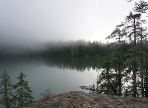
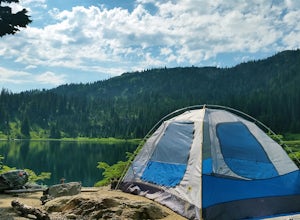
Summit Lake
4.56.13 mi / 1499 ft gainSummit Lake, nestled in a small basin just north of Mt. Rainier National Park in the Clearwater Wilderness, has everything a hiker could want in a day-hike or easy overnight backpack. The views, the well-maintained trail, and a perfect distance make this hike a must-do for anybody in the Pacific ...Read more -
Carbonado, Washington
Hike Bearhead Mountain
5.06 mi / 1800 ft gainFormerly the site of an old fire lookout, Bearhead Mountain located in the Clearwater Wilderness, provides great unobstructed views of the north side of Mount Rainier, Little Tahoma, and many other surrounding Cascade mountain peaks. In the summer months you are likely to encounter great wildflow...Read more -
Mason County, Washington
Climb the Brothers (South Climb)
4.517 mi / 6062 ft gainThe Brothers is a notable peak on the border of Olympic National Park. The dual summits are a distinguishing feature of the Olympic Range, viewed from Seattle. This is a challenging route, testing a climber's route finding skills, physical fitness, and mental fortitude. From the parking lot, you ...Read more -
Granite Falls, Washington
Vesper Peak Trail
4.06.59 mi / 3927 ft gainThis hike is very strenuous, but nothing unconquerable! The views at sunset were once in a lifetime and something I will remember for the rest of my life. The first half mile or so of the trail begins in a wooded area then opens up to views of the lower valley. After hiking for about another ½ t...Read more -
Skykomish, Washington
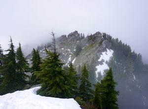
Beckler Peak
7.55 mi / 2139 ft gainLooking for a gradual forest hike up to a peak with 360° views of the Cascades? Beckler Peak trail winds through old growth, past rushing waterfalls, and up to a granite summit. From the top, you can see mountains in the Cascades such as Glacier Peak, Mount Baring, Mount Index, Evergreen Mounta...Read more -
Mason County, Washington
Lena Lake
4.56.24 mi / 1644 ft gainThe trail climbs gently up and is accessible almost every season, weather permitting. Snowshoes may be needed December-February, so make sure and check with the Hoodsport Ranger Station. Just 45 minutes north of Hoodsport (a darling small town on the shores of Puget Sound), this trailhead has sp...Read more -
Mason County, Washington
Upper Lena Lake
5.012.61 mi / 4239 ft gainThe hike to Upper Lena Lake is a beautiful one. It first takes you past Lena Lake, which is a very popular weekend destination for families. Luckily you're pushing on to Upper Lena Lake that sits in a peaceful alpine meadow with Mt. Lena and Mt. Bretherton towering above. The first part of the t...Read more -
Granite Falls, Washington
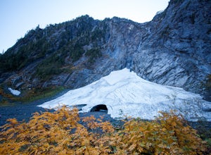
Big Four Ice Caves
4.32.38 mi / 289 ft gainDisclaimer: Hiking into the caves is extremely dangerous as there is potential for the ice to fall. We do not recommend hiking inside of them and if you choose to do so, you're doing it at your own risk. This is a short hike at just 2.3 miles roundtrip with little elevation change. The hike take...Read more -
Arlington, Washington
Three Fingers Lookout
4.514.31 mi / 4357 ft gainApproximately 11 miles east of Granite Falls, WA, on the Mt. Loop Highway, turn onto Forest Service road 41 and follow this road for 18.0 miles to the trailhead. The road is quite rough and it is recommended you have a four-wheel drive vehicle. There is a washout about halfway along the road, an...Read more -
Granite Falls, Washington
Dispersed Camp near Beaver Creek Group Camp, Mt. Baker Snoqualmie NF
This campsite is located along the Mountain Loop Highway. There are various options for dispersed camping around the area, as well as some you can reserve ahead of time such as the Coal Creek Campground and the Beaver Creek Group Campground. This campsite is located just before Beaver Creek grou...Read more -
Port Townsend, Washington
Hike to Point Wilson
5.02.5 mi / 0 ft gainThis trail offers amazing views of Mt. Baker, Vancouver Island, the San Juan Islands, and the Cascade Mountains. The Point Wilson trail is located in Fort Worden State Park on the Olympic Peninsula, along the Strait of Juan De Fuca. The trail is 2.5 miles round trip, and is accessible regardless ...Read more -
Granite Falls, Washington
Mt. Dickerman Summit
7.93 mi / 3675 ft gainIn general, this is a strenuous hike or snowshoe at approximately 8 miles round trip with nearly 4000 elevation gain. Be aware of current snow conditions and avalanche risk if heading up in the winter. Do not attempt a winter trip without proper knowledge, skill, and gear. Some previous winter tr...Read more -
Granite Falls, Washington
Hike to Perry Creek Falls & Mount Forgotten Meadows
11.5 mi / 3700 ft gainMost visitors park at this trailhead to hike Dickerman Mountain. Until this spring, so did I. However, don't overlook this stunning valley hike to Perry Creek, Mount Forgotten Meadows, and the scramble up Mount Forgotten!Begin this hike on the Perry Creek trail, which begins on the far left sid...Read more -
Snohomish County, Washington
Hike to Glacier Basin
13 mi / 2600 ft gainStart off by traveling down the Mountain Loop Highway, arriving at the Barlow Pass Trailhead. You will walk about 200ft to reach an old gated road. This road will lead you towards Monte Cristo. About 1.5 miles down the road, the road will start to turn into a trail that runs along the river. You ...Read more -
Snoqualmie Pass, Washington
Hike to Rachel Lake
4.88 mi / 1600 ft gainThis hike is 8 miles roundtrip, with 1600 feet of elevation gain. Once you're on the trail, it starts heading uphill to help get your heart rate up on the hike. As you enter the Alpine Lakes Wilderness, the trail starts to level out. You'll cross a few streams and hike through a fair amount of ve...Read more -
Snoqualmie Pass, Washington
Day Hike to Lila Lakes and Alta Pass
4.312 mi / 3000 ft gainGetting There From Seattle, drive Interstate 90 to Exit 62, Signed Kachess Lake/Stampede Pass. Turn left and head north over the interstate; you'll reach Kachess Lake Campground in five miles. Turn left where the pavements ends and drive four miles on Box Canyon Road (FS Road #4930) to the Rachel...Read more

