Stanardsville, Virginia
Looking for the best hiking in Stanardsville? We've got you covered with the top trails, trips, hiking, backpacking, camping and more around Stanardsville. The detailed guides, photos, and reviews are all submitted by the Outbound community.
Top Hiking Spots in and near Stanardsville
-
North Garden, Virginia
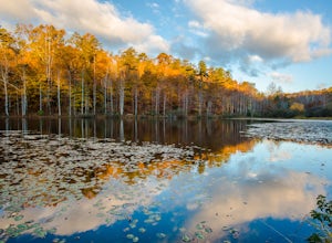
Explore Walnut Creek Park
4.2Just 25 minutes outside of Charlottesville, this is a great spot to take the family for the day and get some sunshine. If you are into mountain biking, you're in the right place. There are 13 miles of mountain bike trails that circle the lake. At the end of your ride, there are 2 beaches to stre...Read more -
Rileyville, Virginia
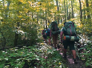
Backpack Jeremy's Run Trail, Shenandoah NP
3.310 miThis hike is best done as a two-day, one-night backpacking trip, however it can be done as a day hike if you don't wish to backpack.Jeremy’s Run is a beautifully forested 10 mile roundtrip hike with numerous stream-crossing. The trailhead starts at the Elkwallow Picnic area, at about mile 24 of S...Read more -
Washington, Virginia
Hike Little Devil Stairs
4.75.5 mi / 1480 ft gainThis hike starts with an immediate stream crossing -- how wet your feet get depends on the water level but bring an extra pair of socks! The first mile consists of a typical Shenandoah hike -- uphill on a dirt path and along a stream. But soon you reach the base of Little Devil Stairs. This po...Read more -
Wildwood, Virginia
Pleasant Grove Park: Heritage Trail and Beach Grove Loop
4.64 mi / 361 ft gainPleasant Grove Park has miles and miles of trails and you could easily hike a ten-mile loop if you linked everything together. This particular trail, Heritage Trail and Beach Grove Loop, is a 4.6 mile loop in the southern part of Pleasant Grove, which takes a little under two hours to complete de...Read more -
Rileyville, Virginia
Hike to Overall Run Falls
5.06.1 mi / 1700 ft gainStart at the Hogback parking lot at MP 21.1 on the Skyline Drive. Take the Appalachian Trail south for 0.8 miles, and turn right onto the Tuscarora-Overall Run Trail. After 0.5 miles you will come to another intersection-keep right to stay on the Tuscarora-Overall Run Trail. A final intersection...Read more -
Afton, Virginia
Humpback Rocks
4.61.73 mi / 833 ft gainThis little hike is one of the most popular in the area, and for good reason! It's a short and steep one mile to the top, but the views of the Blue Ridge Mountains and Shenandoah National Park to the east, are some of the best around. It's somewhat of a tradition for students from the Universit...Read more -
Appalachian Trail, Virginia
Hike North Mount Marshall in Shenandoah NP
1 mi / 350 ft gainPark at the Mount Marshall parking area at ~MP 15.6 on the Skyline Drive. From the back of the parking lot, take the white-blazed Appalachian Trail north for a short 0.4 miles to a large rock outcrop with views south. After finished exploring this outcrop, continue on the AT for another 0.1 mil...Read more -
Lyndhurst, Virginia
Hike to Shamokin Falls
4.42.2 mi / 950 ft gainStarting from the Dripping Rock Parking area at MP 10 on the Blue Ridge Parkway, head north on the white blazed Appalachian Trail (trail leading into woods from parking lot- don't cross the road). In about 20 steps the trail splits- go right. In another 20 steps or so the trail splits again but t...Read more -
Dayton, Virginia
Climb Hidden Rocks
5.0Amazing rock climbing can be found just outside Harrisonburg, VA at a series of crags hiding in the beautiful landscape of GW National Forest. Hidden Rocks offers amazing climbing and bouldering for intermediate level or well-guided beginners.Near the end of Hone Quarry Road is a small, self-pay ...Read more -
South River, Virginia
Hike to Compton Peak
5.0This unique hike on the Appalachian Trail in Shenandoah National Park is 2.4 miles round trip with an 835' elevation gain, and leads you to two viewpoints as well as a cool rock outcrop.Access this hike from the Compton Gap parking area (elevation 2,145') on the Skyline Drive at Mile 10.4. Cross ...Read more -
Bentonville, Virginia
Hike the Shenandoah River State Park Loop
5.08 mi / 650 ft gainShenandoah River State Park is located in the heart of the Shenandoah Valley. The park is full of well-maintained trails great for hiking and mountain biking. The trails both parallel the banks of the river as it snakes through the Shenandoah Valley and through the rolling hills, which provides...Read more -
Lyndhurst, Virginia
Backpack Three Ridges Loop
4.614.2 mi / 3960 ft gainFrom the parking area at Reids Gap, start off on the white-blazed A.T heading south as the trail begins on the left side of a clearing. You will begin climbing Meadow Mountain shortly and in .8 miles arrive at the top of the ridge, where you will continue on downhill for another .8 miles until y...Read more -
Roseland, Virginia
Backpack Reeds Gap to Rockfish Gap
5.020 miNote: We usually get a chance to take this trip in the summer, so please pay attention to the weather and pack accordingly. This description is for a July/August hike and the temperatures were in the 80s during the day and 60s at night. During this time of year rain showers are always a possibili...Read more -
Lyndhurst, Virginia
Camp at Sherando Lake
4.0Sherando Lake is a beautifully maintained dog/family friendly campground situated between two lakes. Upper Sherando Lake is available for fishing only but the larger, 25 acre, Lower Sherando Lake offers swimming, fishing, kayaking, and relaxing on the beach. The campground is divided into three ...Read more -
Basye, Virginia
Orkney Springs Trail
4.94 mi / 1440 ft gainEasy to get to from Bryce resort, Orkney Springs Trail is a moderate to challenging trail. It starts with an easy trail through the woods but does get very steep in mile 2 in what seems like a very rocky dried-out river bed. There is a spectacular view around mile 2. If that's what you’re after y...Read more -
Front Royal, Virginia
Explore Skyline Drive In Winter
4.5Skyline Drive is a winding highway that cuts straight through Shenandoah National Park. Being that we are in the south, you will find that the road is closed for the majority of the winter, and usually at the very mention of snow. The first few years of living here it was incredibly frustrating...Read more

