Purcellville, Virginia
Looking for the best photography in Purcellville? We've got you covered with the top trails, trips, hiking, backpacking, camping and more around Purcellville. The detailed guides, photos, and reviews are all submitted by the Outbound community.
Top Photography Spots in and near Purcellville
-
Thurmont, Maryland
Hike Catoctin Mountain
4.58.4 mi / 1370 ft gainPark at Catoctin Mountain Visitor Center. The hike starts at the end of the gravel parking lot across from the visitor center. This is definitely a popular hiking location, so come early on the weekends to guarantee a parking spot and to avoid the crowds. To start, take the right trail towards th...Read more -
Thurmont, Maryland
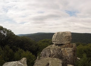
Hike Chimney Rock at Catoctin Mountain Park
4.25 mi / 600 ft gainChimney Rock is the quintessential breathtaking view that makes a hike worthwhile. By parking at the most northeast parking lot on the trail map you are able to include the sweeping views of Thurmont Vista, and Wolf Rock on your way to Chimney Rock. Highly recommend visiting in the fall, and on w...Read more -
Bentonville, Virginia
Hike the Shenandoah River State Park Loop
5.08 mi / 650 ft gainShenandoah River State Park is located in the heart of the Shenandoah Valley. The park is full of well-maintained trails great for hiking and mountain biking. The trails both parallel the banks of the river as it snakes through the Shenandoah Valley and through the rolling hills, which provides...Read more -
Washington, District of Columbia
Hike the Soapstone Valley Trail
4.02 miThis is an out-and-back trail that starts and ends on different roads, but you will have better luck parking on Albemarle Street NW (where I have indicated the trailhead is on the map). This is a long street with plenty of street parking, just pay attention to the signs to see how long you can le...Read more -
Bentonville, Virginia
Photograph Range View Overlook
5.0Range View Overlook in Shenandoah National Park is an amazing spot to watch the sunrise and sunset where the Blue Ridge Mountains meet the rolling hills. Range View Overlook has views of Jenkins Mountain to the south, Pignet Mountain and Mary’s Rock to the southwest, and Hogback Mountain to the w...Read more -
Washington, District of Columbia
Visit the National Mall in Washington D.C.
4.67 miEveryone has so many things on their plates these days that take all their time up. It is hard to get away for adventures or to experience new things. The National Mall in Washington D.C. is within an hour from millions of people on the East Coast. This centralized location makes the National Mal...Read more -
Washington, District of Columbia
Photograph Sunrise at the Lincoln Memorial
4.8Located on the far-west portion of the National Mall in Washington, D.C. stands the Lincoln Memorial. At almost 100 feet tall, this majestic structure overlooks the reflecting pool and offers an iconic view of the Washington Monument. Parking is almost always an issue near the Lincoln Memorial, ...Read more -
Rileyville, Virginia
Hike to Overall Run Falls
5.06.1 mi / 1700 ft gainStart at the Hogback parking lot at MP 21.1 on the Skyline Drive. Take the Appalachian Trail south for 0.8 miles, and turn right onto the Tuscarora-Overall Run Trail. After 0.5 miles you will come to another intersection-keep right to stay on the Tuscarora-Overall Run Trail. A final intersection...Read more -
Washington, Virginia
Hike Little Devil Stairs
4.75.5 mi / 1480 ft gainThis hike starts with an immediate stream crossing -- how wet your feet get depends on the water level but bring an extra pair of socks! The first mile consists of a typical Shenandoah hike -- uphill on a dirt path and along a stream. But soon you reach the base of Little Devil Stairs. This po...Read more -
Rileyville, Virginia
Backpack Jeremy's Run Trail, Shenandoah NP
3.310 miThis hike is best done as a two-day, one-night backpacking trip, however it can be done as a day hike if you don't wish to backpack.Jeremy’s Run is a beautifully forested 10 mile roundtrip hike with numerous stream-crossing. The trailhead starts at the Elkwallow Picnic area, at about mile 24 of S...Read more -
Washington, District of Columbia
Visit Kenilworth Aquatic Gardens
4.51.5 miThe Kenilworth Aquatic Gardens are a unique spot in Washington, D.C. The grounds are full of ponds, boardwalks, and a trail that connects you to the Anacostia River Trail. The main draw of this park are the ponds full of lotus flowers. During the summer months, they grow tall with colors ranging ...Read more -
Johnny's Road, Virginia
Camp along the South Fork Shenandoah River
3.0From Luray, follow Bixler's Ferry Road until you cross the river. The road will then T, go to the right along South Page Valley Road. Follow this road for about 6.5 miles until you pass Shenandoah River Outfitters. Shortly after this it will turn into a gravel road. Drive along the gravel road fo...Read more -
Lorton, Virginia
Woodmarsh Trail
4.02.83 mi / 154 ft gainJust at the entrance to Mason Neck State Park is the Woodmarsh Trail. The entire loop is about 3 miles. This is a pleasant easy hike that is relatively flat with no rocks to speak of. The trail wanders through a forest and passes by a large swamp along the Potomac River. There is one well built o...Read more -
Luray, Virginia
Mary's Rock via Appalachian Trail
3.36 mi / 1214 ft gainIf you're driving south on Skyline Drive, park in the lot on the right side of Skyline Drive immediately after you cross Route 211/Thornton Gap entrance. If you're driving north on Skyline Drive, the lot will be on the left side immediately before the Thornton Gap entrance. The trailhead is at t...Read more -
Luray, Virginia
Photograph Buck Hollow Overlook
Buck Hollow Overlook is one of 72 beautiful overlooks that are on Skyline Drive. Skyline Dive is the road that winds through the heart of Shenandoah National Park. Over 105 miles long, Skyline Drive offers great views of the surrounding Blue Ride Mountains and valleys while simultaneously offeri...Read more -
Luray, Virginia
Photograph Hazel Mountain Overlook
4.0Skyline Dive runs through the heart of Shenandoah National Park. Consisting of 72 overlooks over 105 miles, Skyline Drive offers great views of the surrounding Blue Ride Mountains and valleys. Hazel Mountain Overlook is located at mile marker 33 along Skyline Drive and is one of a handful of ov...Read more

