Mount Solon, Virginia
Top Spots in and near Mount Solon
-
Roseland, Virginia
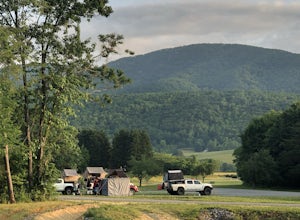
Camp at Devil’s Backbone Basecamp
5.0This place has it all : a bomb fire pit, live music, distillery, restaurant, 48 taps, mountain views, and more! Not to mention, it’s in a great location for exploring. It’s close to tons of breweries, wineries, and cideries, it’s just a few miles from the Appalachian trail, and close to Shenando...Read more -
Quicksburg, Virginia
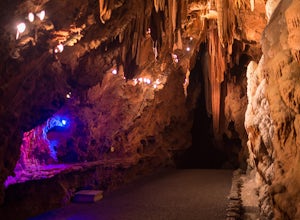
Explore the Shenandoah Caverns
4.5Located west of Washington D.C. off Interstate 81 (exit 269) Shenandoah Caverns is a nice little place tucked away in the Virginia country side. Upon arrival you will be able to park your vehicle for free in the lot right across the street. The building you want to enter is called "The Yellow Bar...Read more -
Tyro, Virginia
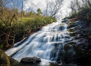
Crabtree Falls
4.53.05 mi / 1161 ft gainThis is an approximately 3 mile roundtrip hike. It will usually take anywhere from 1-2 hours to get up, depending on your experience and who you have with you, and about an hour down. As you come off of route 56, you will come up to the trailhead where there is a large parking area with restroom...Read more -
Goshen, Virginia
Hike Goshen Pass
4.35.6 mi / 1200 ft gainThe parking for the trailhead is down an unmarked gravel/dirt road about 1.5 miles upriver from the Virginia Wayside rest area on Route 39 West. You'll see the swing bridge out across the river and the road will be immediately after this on your right. The road goes back about 200 yards to the pa...Read more -
Elkton, Virginia
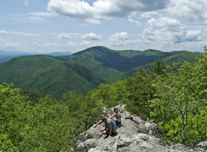
Bearfence Mountain Loop
4.81.04 mi / 220 ft gainThis is one of my favorite hikes in Shenandoah National Park for its views, easy access to the trail, and the option to combine it with a much further hike on the AT. There is also a really fun little rock scramble at the top that scares a lot of people away, but makes for a more secluded summit,...Read more -
Riverton, West Virginia
Spruce Knob Observation Tower
4.50.34 mi / 33 ft gainDriving to the top of Spruce Mountain is perhaps the most difficult part of the journey. Once at the top of Spruce Mountain, park and head south along a short, 0.2 mile long trail that leads to the official state highpoint of Spruce Knob. Be sure to find the USGS marker near the base of the obser...Read more -
Rockbridge Baths, Virginia
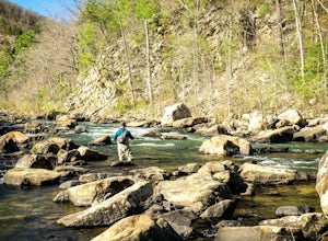
Fly Fish Goshen Pass
5.0The fly fishing on the Maury River is one of a kind through the Goshen Pass. The Pass is littered with huge boulders, which actually makes it possible to fish without waders, although it's much easier and more enjoyable with waders.From Lexington, VA, take Route 39 towards Goshen for approximatel...Read more -
Rockbridge Baths, Virginia
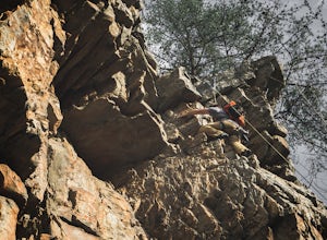
Rock Climb at Goshen Pass
5.0Goshen Pass is a beautiful area for kayaking and fishing in Bath County, Virginia near Lexington. But not as well known is the fact that there are a few places that are great for rock climbing. You'll want to park at the swinging bridge which is two miles past the picnic area on route 39 once you...Read more -
Elkton, Virginia
Photograph The Point Overlook
4.0The Point is the best overlook off of Skyline Drive to watch the sun set behind the Blue Ridge Mountains. The Point Overlook is one of 72 overlooks for people to enjoy the beauty of Shenandoah National Park as they drive along Skyline Drive. Skyline Drive is the road that winds through the hear...Read more -
Stanley, Virginia
Hike to Bear Church Rock via Bootens Gap
3.59.4 mi / 800 ft gainThe trail leads along the ridge of Jones Mountain to the gorgeous views at Bear Church Rock, and it's the perfect hike for those seeking solitude - didn't see another soul the entire time on a holiday weekend.From the parking lot, head out left on the AT northbound. In .4 miles you will come to a...Read more -
Meadows Lane, Virginia
Camp near Crabtree Meadows in GWNF
5.0As stated, the campsites are free. They do not require reservations or permits and are on a first come, first served basis. Regardless of which direction you're coming from, you will be traveling on Crabtree Falls Highway until reaching Meadows Lane. This is a gravel access road that requires 4WD...Read more -
Tyro, Virginia
Spy Rock via Cash Hollow
4.95.71 mi / 1191 ft gainThe hike is part of the George Washington National Forest, and can easily be combined with nearby Crabtree Falls (300ft cascading waterfall with a hike to the top). The entire trip is 5.7 miles, and there are nice campsites at the base of the summit (no water source) if you want to add on this pr...Read more -
Tyro, Virginia
The Priest via Shoe Creek Trail
4.43.01 mi / 843 ft gainStarting at the Upper Crabtree Falls Parking area, continue up the "road" on Shoe Creek Trail for half a mile until you come to the intersection of the Appalachian Trail. That will be the steepest part of the hike. Look for two rocks on either side of the trail with white blazes on them. Take a l...Read more -
Stanley, Virginia
Hike to Naked Creek Falls
3.01 mi / 1000 ft gainPlease note that there is no trail leading to these falls. This hike is for advanced hikers.Park your car at Naked Creek Overlook in Shenandoah National Park and walk through the field staying to the left. As you start to enter the woods you will hear the creek running on your left. Make your wa...Read more -
Basye, Virginia
Orkney Springs Trail
4.94 mi / 1440 ft gainEasy to get to from Bryce resort, Orkney Springs Trail is a moderate to challenging trail. It starts with an easy trail through the woods but does get very steep in mile 2 in what seems like a very rocky dried-out river bed. There is a spectacular view around mile 2. If that's what you’re after y...Read more -
Rapidan, Virginia
Hike to Historical Rapidan Camp in Shenandoah National Park
5.04.5 mi / 890 ft gainFor this hike park at the Milam Gap parking lot located at mile 52.8 on Skyline Drive. Once parked you will cross Skyline Drive to reach the trail. Hikers will follow the blue blazes along the trail and creek. After you have crossed the creek twice you will come to a larger waterfall. At this po...Read more

