McLean, Virginia
Top Spots in and near McLean
-
Elkridge, Maryland
Hike the Cascade Falls and Rootball Loop Trail
4.72.4 mi / 285 ft gainPark on the shoulder of Landing Drive (see map) to access the trailhead. This trail is open April-September. Dogs allowed on leash.Read more -
Knoxville, Maryland
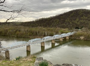
Explore Point of Rocks/ Potomac River Overlook
4.00.2 mi / 95 ft gainPark at the Chesapeake and Ohio Canal parking lot. Walk to the US 15 and cross the road. Trail is not marked, though its faint traces can be detected as you continue on. GPS is recommended. Enjoy the overlook and when you're ready to go back, retrace your steps.Read more -
Elkridge, Maryland
Cascade Falls Loop
3.02.31 mi / 381 ft gainThis hike is a great place to escape the city feel of Baltimore and disappear into the wilderness. Enter through the Avalon Area entrance. There is a cash fee to enter the park. Once you pass the front gate continue past the initial picnic area. Continue through the park to the Orange Grove Area...Read more -
Nanjemoy, Maryland
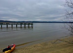
Paddle through the Ghost Fleet of the Potomac at Mallows Bay
4.5The Ghost Fleet of Mallows Bay, as it's now known, is the result of our great nation's call for 1,000 wartime transport vessels to be built in 18 months. The quick deadline led to hasty construction and, when World War I ended before the contract was fulfilled, hundreds of ships sat unused. Attem...Read more -
Huntingtown, Maryland
Paddle the Patuxent River through Maryland
While there are many parks along its length, one of the best places to explore along the 115 mile long Patuxent River is by putting in at Kings Landing Park. There is ample parking near the launch, and while vehicles are not allowed to park near the water, vehicles are encouraged to open the gat...Read more -
Annapolis, Maryland
Kayak into downtown Annapolis via Spa Creek
There is no better way to travel into Annapolis then by under your own power on water. Put in your kayak, canoe, or stand up paddle board at the Truxton Park Boat Launch (run by the City Parks Department) and paddle into downtown Annapolis on Spa Creek. Pass other boaters, beautiful waterfront ...Read more -
Eldersburg, Maryland
Mineral Hill Trail
4.02.04 mi / 282 ft gainMineral Hill Trail is an out-and-back trail that takes you by a lake located near Finksburg, Maryland.Read more -
Owings Mills, Maryland
Serpentine Trail
4.52.39 mi / 226 ft gainPark in the area off of Deer Park road to access the trail. Dogs are welcome on leash. Trail can get muddy in the spring, and there are some stream crossings.Read more -
Owings Mills, Maryland
Soldiers Delight Loop
4.75.33 mi / 466 ft gainFrom Deer Park Road, parking is available at the nature center or the scenic overlook (about 100 yards up the road). I typically park at the overlook as this affords the ability to hike trails on either side of the road, and always finish the hike back at the car. From the parking area you are ju...Read more -
Bluemont, Virginia
Hike to Bears Den Overlook
4.41.31 mi / 164 ft gainBears Den is a collection of rocks and boulders that overlooks the Shenandoah Valley in northern Virginia, just off the Appalachian Trail. You have two options to access this overlook: park at the bottom of the mountain and hike up to the overlook via the trail, or drive to the top and access the...Read more -
Bluemont, Virginia
Hike to Raven Rock
4.35 mi / 1000 ft gainStarting at a small parking lot right off of Route 7 (wuick right onto Pine Grove Road) this hike takes you North on the Appalachian Trail in a very hilly/rocky part of the trail. Expect to gain and lose 300 feet+ multiple times! It's about 2.5 miles each way so budget at least a few hours to go ...Read more -
Knoxville, Maryland
Hike the AT to Weverton Cliffs
4.93 mi / 1500 ft gainThe trailhead is located right off Weverton Cliff's Road in Knoxville, Maryland. Park at a Park and Ride on the right side of the road, then walk right out of the parking lot down Weverton Cliff's Road until you see the white blazes of the Appalachian Trail. Follow that trail for 1.5 miles along ...Read more -
Purcellville, Virginia
Explore Potomac Wayside Park
4.00.25 mi / 75 ft gainThis is a small park along route 340 in Purcellville, Virginia near Harper's Ferry. After you have parked, look for the park sign which will be a few feet behind you. There is a trail that will take you down to the bottom of the waterfall and eventually to the Potomac River. There is also a trail...Read more -
Baltimore, Maryland
Hike the Fort McHenry Trail
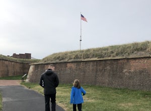
3.50.9 mi / 16 ft gainPark in the lot and head out either direction on this short loop trail. Trail can get crowded, so be prepared to share the space.Read more -
Cool Spring Path South Parking, Virginia
Hike Cool Spring Path
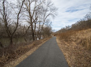
4.02 mi / 70 ft gainThe Cool Spring Path South is an old golf course that has been and still is in the process of being returned to its natural state by Shenandoah University. The paved paths from the golf course make this an easy hike for anyone. For those who may be in a wheelchair, this loop should be fully acces...Read more -
Knoxville, Maryland
Hike to Maryland Heights
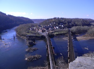
4.82.8 mi / 900 ft gainMaryland Heights is at the convergence of Maryland, West Virginia and Virginia, as well as the Potomac and Shenandoah Rivers. The Appalachian Trail and C&O Canal Towpath are also easily accessible from the trailhead parking lot. The parking lot holds about 16 cars and is between Locks 33 and ...Read more

