McGaheysville, Virginia
Looking for the best photography in McGaheysville? We've got you covered with the top trails, trips, hiking, backpacking, camping and more around McGaheysville. The detailed guides, photos, and reviews are all submitted by the Outbound community.
Top Photography Spots in and near McGaheysville
-
Free Union, Virginia
Photograph Brown Mountain Overlook
At mile post 77 off of Skyline Drive, Brown Mountain Overlook offers photographers a western view of the Blue Ridge Mountains, Shenandoah National Park, and the Shenandoah Valley. At 2,840 feet, Brown Mountain Overlook is one of 72 beautiful overlooks that are on Skyline Drive located in the nort...Read more -
Free Union, Virginia
Hike Frazier Discovery Trail
5.01.3 mi / 950 ft gainThere are two ways to the summit: the first is a 1.3 mile loop that starts at the Loft Mountain Wayside parking lot at mile marker 79.5 off of Skyline Drive in the southern district of Shenandoah National Park. The second way is a 3.7 mile hike out and back from the Loft Mountain Campground, but...Read more -
Crozet, Virginia
Hike to Doyles Falls
4.93.2 mi / 1190 ft gainFrom the parking lot at MP 81.1 on the Skyline Drive, take the trailhead to the left of the sign with the trail map. Immediately you'll cross over the Appalachian Trail-stay straight on the blue-blazed trail to Doyles Falls. The trail will descend rapidly for 1.3 miles to Upper Doyles Falls (28' ...Read more -
Appalachian Trail, Virginia
Blackrock Summit, Shenandoah NP
4.71.11 mi / 253 ft gainThere are two route options, both are under 2 miles and are suitable for hikers of all experience levels. The shortest option, a 1-mile circuit, follows the Appalachian Trail from the Blackrock Summit parking area, which is just north of mile marker 85 on Skyline Drive. With only 175-feet of ele...Read more -
Stanardsville, Virginia
Hike South River Falls
4.54.4 miThe trail head for the South River Falls Trail is located at mile marker 63 off of Skyline Drive via the South River Picnic Area. Loop around the picnic area until you reach the Eastern corner where you will find a sign and a map marking the beginning of the 4.2-mile trail. Over the first mile...Read more -
Grottoes, Virginia
Photograph Moormans River Overlook
5.0Moormans River Overlook is one of the few eastern facing overlooks in Shenandoah National Park’s Southern District, which makes this a prime location for watching the sun rise when in this part of the park. At mile post 92 off of Skyline Drive, Moormans River Overlook offers photographers a 180 ...Read more -
Elkton, Virginia
Bearfence Mountain Loop
4.81.04 mi / 220 ft gainThis is one of my favorite hikes in Shenandoah National Park for its views, easy access to the trail, and the option to combine it with a much further hike on the AT. There is also a really fun little rock scramble at the top that scares a lot of people away, but makes for a more secluded summit,...Read more -
Elkton, Virginia
Photograph The Point Overlook
4.0The Point is the best overlook off of Skyline Drive to watch the sun set behind the Blue Ridge Mountains. The Point Overlook is one of 72 overlooks for people to enjoy the beauty of Shenandoah National Park as they drive along Skyline Drive. Skyline Drive is the road that winds through the hear...Read more -
Crozet, Virginia
Hike Moorman's River
4.52.5 miAlong the hike, there are four "official" swimming holes to jump in, but you can make your own at any time. Go in the springtime for a great waterfall at the end the feeds into a swimming hole, and in the fall for a wonderland of foliage. The official name of this hike is Moorman's River, but an...Read more -
Crozet, Virginia
Photograph Charlottesville Reservoir
4.7The reservoir is located in the Piedmont Hills just outside the city of Charlottesville, Virginia. So technically Charlottesville Reservoir is not in Shenandoah National Park, but it is only a few feet outside of the park, and it has an outstanding view of the Blue Ridge Mountains that make up th...Read more -
Stanley, Virginia
Hike to Bear Church Rock via Bootens Gap
3.59.4 mi / 800 ft gainThe trail leads along the ridge of Jones Mountain to the gorgeous views at Bear Church Rock, and it's the perfect hike for those seeking solitude - didn't see another soul the entire time on a holiday weekend.From the parking lot, head out left on the AT northbound. In .4 miles you will come to a...Read more -
Crozet, Virginia
Hike Turk Mountain
4.02.2 mi / 700 ft gainFrom the parking area at Turk Gap (MP 94.1), cross over the Skyline Drive. The Appalachian Trail (AT) intersects right here, and take the AT south by taking the trail on the left. After 0.2 miles you will turn right off of the AT onto the blue-blazed Turk Mountain Trail. The trail junctions me...Read more -
Stanley, Virginia
Hike to Naked Creek Falls
3.01 mi / 1000 ft gainPlease note that there is no trail leading to these falls. This hike is for advanced hikers.Park your car at Naked Creek Overlook in Shenandoah National Park and walk through the field staying to the left. As you start to enter the woods you will hear the creek running on your left. Make your wa...Read more -
Rapidan, Virginia
Hike to Historical Rapidan Camp in Shenandoah National Park
5.04.5 mi / 890 ft gainFor this hike park at the Milam Gap parking lot located at mile 52.8 on Skyline Drive. Once parked you will cross Skyline Drive to reach the trail. Hikers will follow the blue blazes along the trail and creek. After you have crossed the creek twice you will come to a larger waterfall. At this po...Read more -
Stanley, Virginia
Big Meadows Loop
4.71 mi / 30 ft gainBig Meadows is home to many types of wildlife and is a great location to photograph many different types of animals. The best time to see the wildlife in the meadow is near dawn and dusk. White-tailed deer and a variety of local birds are the most common animals seen in the meadow, and because o...Read more -
Stanley, Virginia
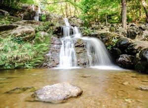
Dark Hollow Falls
4.61.32 mi / 440 ft gainCatch the trailhead to these falls at mile 50.7 on Skyline Drive, just north of Big Meadows Lodge and Campground and the trailhead is just to the left of the parking lot. This is an easy 1.4 mile roundtrip hike, straight down to get to the falls, and straight up to arrive back at your car. Many...Read more

