Fancy Gap, Virginia
Top Spots in and near Fancy Gap
-
Mouth of Wilson, Virginia
Hike and Fish Cabin Creek Trail
5.01.8 mi / 400 ft gainStarting at the Massie Gap Parking Area follow the paved road down towards the woods. You will see a gravel dirt path off the side of the road to your right that heads back towards the woods. A couple steps down the trail you will see a metal pole with "Cabin Creek Trail" written on it. Follow th...Read more -
Newport, Virginia
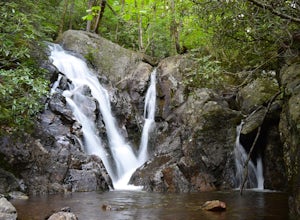
Photograph Sinking Creek Falls
5.0Park at the Clover Hollow Covered Bridge, and walk or bike 1/3 mile along Clover Hollow Rd in the direction of Blue Grass Trail Rd or to the pin dropped in the location below.When you can see the waterfall, carefully walk down the bank where you'll have perfect angles of the waterfall and surrou...Read more -
Mouth of Wilson, Virginia
Wilburn Ridge and Massie Gap Loop
5.02.32 mi / 318 ft gainTo reach the trail head, park in the Massie Gap Parking Lot. This is the parking lot for most of the trails in the park, so it can fill up very quickly, but you are able to park along the side of the road. Massie Gap as two parking areas: one intended for overnight hikers and one for day hikers...Read more -
Mouth of Wilson, Virginia
Twin Pinnacles via Big Pinnacles Trail
5.02 mi / 525 ft gainTo reach the Big Pinnacle Trail Head, park at the Massie Gap Day Parking area, and then follow the road west (away from Massie Gap) until you reach the trail head located on the left side of the road. Follow the Big Pinnacles Trail for 0.4 miles until it intersects with the Twin Pinnacles Trail....Read more -
Mouth of Wilson, Virginia
Mount Rogers Loop
5.015.6 mi / 1079 ft gainFor an awesome 2-3 day trip, start hiking at the Massie Gap trailhead, which can be reached from Grayson Highlands State Park. Take the Rhododendron Trail up the ridge to connect with the AT, keeping an eye out for wild ponies in the Massie Gap area as they like to hang out here. Some of these po...Read more -
Newport, Virginia
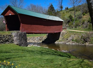
Fish Sinking Creek at Clover Hollow Queens Truss Bridge
5.0Park alongside of the road at the bridge where 2-3 cars can fit. From here you can fish in Sinking Creek with a great view of this historic landmark. The majority of fish are native brook's and can be caught on a smaller 4-5 wt rod using dry flies.The covered bridge was built in 1916 and spans 70...Read more -
Pearisburg, Virginia
Hike Angels Rest and the Wilburn Valley Overlook
4.6For a tough hike with rewarding views, check out Angels Rest and the Wilburn Valley Overlook. Easily accessible from US-460 near Pearisburg, this hike along the Appalachian Trail gains a total of 1600’ elevation is a 4.6 mile round trip hike. Angels Rest is a large boulder that overlooks the New...Read more -
Purlear, North Carolina
The Lump Trail
4.00.27 mi / 82 ft gainThe Lump Trail is an out-and-back trail where you may see beautiful wildflowers located near Purlear, North Carolina.Read more -
Ripplemead, Virginia
Cascade Falls
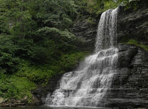
4.93.81 mi / 732 ft gainThe 66' Cascade Falls located in Giles Count is arguably one of the most beautiful waterfalls in Virginia. This classic hike is 4.0 miles and gains 800' in elevation. Located in Pembroke, Virginia, access the trail head by taking Cascade Drive (VA-623) off of US-460 and drive 3.3 miles to the p...Read more -
Marion, Virginia
Hike Molly's Knob
5.03.4 mi / 1100 ft gainThe parking lot is located on the east side of the lake, just before the group lodge on Lake Drive. The Molly’s Knob trail begins just uphill on the right and is marked by white blazes. You can also take an alternate route and follow the Lake Loop Trail (located to the left of the parking area)...Read more -
Marion, Virginia
Hike the Lake Trail Loop at Hungry Mother SP
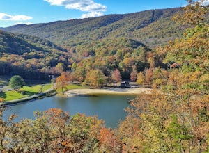
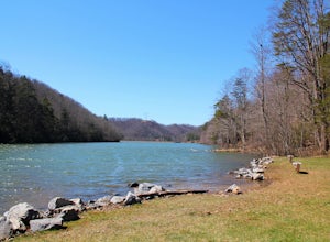
6 mi / 800 ft gainHungry Mother State Park is located in the picturesque Blue Ridge Mountains in Southern Virginia. Located inside the state park is the Lake Trail Loop that winds itself around the man-made reservoir and the park. Hikers can access the trail in numerous locations throughout the park but the easies...Read more -
Pembroke, Virginia
Bald Knob Trail
4.80.93 mi / 387 ft gainUnobstructed views with little hiking effort make Bald Knob one of the best locations to see the sunset in southwestern Virginia. Easy to access from US-460 in Giles County, take Mountain Lake Road (VA-700) for 7 miles and park in the gravel lot on the left by the intersection of VA-613 and Moun...Read more -
Narrows, Virginia
Rice Fields via Appalachian Trail
5.05.24 mi / 1302 ft gainThis hike begins on the Appalachian Trail just north of Pearisburg, Virginia. To get to the trail head, take Route 460 and turn on to Clendennin Road(Route 641). Take Clendennin road 1.5 miles and then turn left on to Pocahontas road. In about 300ft you will pass a cattle grate and an old barbed ...Read more -
Ripplemead, Virginia
Hike Barney's Wall
4.68.4 mi / 1600 ft gainThis hike begins in the parking lot for Cascade Falls. Keep left at the first and second intersections to stay on the Upper Trail. At the third intersection, stay straight (don't turn right) to stay on the Conservancy Trail.Follow the Conservancy Trail for 0.4 miles, and continue on it when it br...Read more -
Troutdale, Virginia
Hike the Appalachian Trail from Elk Garden to Buzzard Rock
5.06.6 mi / 1000 ft gainStarting at the Elk Garden Parking Area hike the Appalachian Trail south (do not cross the road, follow the trail from the parking area). Hike along the trail following the white blazes and at 2.4 miles you'll reach a campsite on your left. This is a great place to camp overnight if you decide to...Read more

