Etlan, Virginia
Top Spots in and near Etlan
-
Boyce, Virginia
Trail Run the AT in the G.R. Thompson
7 mi / 900 ft gainTake Fire Trail Road and start your run at the parking area (labeled in the map). The trail puts you directly onto the AT, where you will turn right (southbound) to start the run (or hike). You'll stay on the AT for roughly 3.5 miles down to the Trillium Trail Parking area. At that point, turn ar...Read more -
Basye, Virginia
Orkney Springs Trail
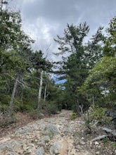
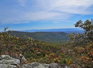
4.94 mi / 1440 ft gainEasy to get to from Bryce resort, Orkney Springs Trail is a moderate to challenging trail. It starts with an easy trail through the woods but does get very steep in mile 2 in what seems like a very rocky dried-out river bed. There is a spectacular view around mile 2. If that's what you’re after y...Read more -
Orkney Springs, Virginia
Hike Laurel Run
6.6 mi / 2100 ft gainThere are two parking spots for this trail. Park at the lower lot if the gate is closed, if the gate is open, continue up the road for another mile until you reach another closed gate. Park here. If the gate is closed you will need to hike a mile up the road to get to the trail head.From the seco...Read more -
Sky Meadows State Park, Virginia
Camp at Sky Meadows State Park
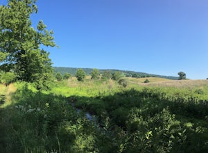
5.02 miCamping at Sky Meadows State Park is a great location to backpack with young kids or if you are new to backpacking. The campground has 18 primitive walk-in campsites located 1.03 miles from the overnight parking lot at the park entrance. Reservations can be made online. After checking-in and park...Read more -
Wardensville, West Virginia
Hike Big Schloss
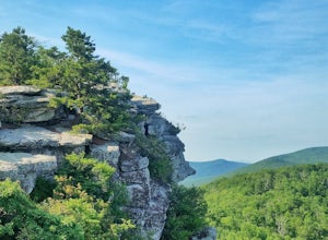
5.04.2 mi / 1000 ft gainBig Schloss (the German word for “palace”) is a popular hike in the George Washington National Forest. The trailhead is conveniently located at the Wolf Gap Campground. To begin, follow the path behind the restrooms at the parking lot. Cross the paved road where you will find a trail map with ...Read more -
Wardensville, West Virginia
Tibbet Knob via Wolf Gap
5.03.17 mi / 702 ft gainPark for free at Wolf Gap Campground and cross the road where you will pass some picnic tables and campsites. Follow the signs to the yellow-blazed Tibbet Knob trail. In half a mile, there is a little path to a summit on your left where you can catch a glimpse of Mill Mountain and Big Schloss. ...Read more -
Wardensville, West Virginia
Camp at Wolf Gap
5.0Wolf Gap is a FREE year round campground located just outside of Woodstock, VA. It is a great base camp for several scenic hikes like the Tibbet Knob trail (trailhead is just across the road) and the popular Big Schloss trail (trailhead begins at campsite number 9) -- super convenient if you hav...Read more -
Wardensville, West Virginia
Big Schloss via Wolf Gap Trail
5.04.27 mi / 997 ft gainBig Schloss via Wolf Gap Trail is an out-and-back trail that takes you by a river located near Lost City, West Virginia.Read more -
Marshall, Virginia
Hike to the Piedmont Overlook
5.00.61 mi / 400 ft gainIn just a .61 mile trail, Piedmont Overlook has so much to offer in terms of views and although it is fairly steep, anyone can do it! After arriving at Sky Meadows State Park start heading up to the white park office building, this is where the trail begins. To get to the trail head follow Bosto...Read more -
Charlottesville, Virginia
Hang Out At Riverview Park
4.5Riverview park has tons of options for getting outside around Charlottesville, VA. Part of the Rivanna Trail runs through here, so if you are really ambitious, this trail goes around the entire city. There are paved trails right along the river, so you can choose your activity. Running, biking, a...Read more -
Crozet, Virginia
Photograph Charlottesville Reservoir
4.7The reservoir is located in the Piedmont Hills just outside the city of Charlottesville, Virginia. So technically Charlottesville Reservoir is not in Shenandoah National Park, but it is only a few feet outside of the park, and it has an outstanding view of the Blue Ridge Mountains that make up th...Read more -
Crozet, Virginia
Hike Moorman's River
4.52.5 miAlong the hike, there are four "official" swimming holes to jump in, but you can make your own at any time. Go in the springtime for a great waterfall at the end the feeds into a swimming hole, and in the fall for a wonderland of foliage. The official name of this hike is Moorman's River, but an...Read more -
Grottoes, Virginia
Photograph Moormans River Overlook
5.0Moormans River Overlook is one of the few eastern facing overlooks in Shenandoah National Park’s Southern District, which makes this a prime location for watching the sun rise when in this part of the park. At mile post 92 off of Skyline Drive, Moormans River Overlook offers photographers a 180 ...Read more -
Charlottesville, Virginia
Kayak Beaver Creek Lake
4.3This little lake close to Charlottesville is my favorite place for an after work kayak, SUP, or just picnic by the water. It's a 20min drive from town, and the perfect place to watch the sunset over the Blue Ridge with water views. No gasoline powered motors allowed, but anything else you can g...Read more -
Wardensville, West Virginia
White Rocks Loop, George Washington NF
4.59.26 mi / 1690 ft gainThe trail begins near the upper parking area next to a closed gate. If you park in the lower parking area, you'll have to walk about .3 miles up the road to get to this gate. Start out on the forest service (FS) orange-blazed trail, following it for about a quarter mile. From there head onto Old...Read more -
Crozet, Virginia
Hike Turk Mountain
4.02.2 mi / 700 ft gainFrom the parking area at Turk Gap (MP 94.1), cross over the Skyline Drive. The Appalachian Trail (AT) intersects right here, and take the AT south by taking the trail on the left. After 0.2 miles you will turn right off of the AT onto the blue-blazed Turk Mountain Trail. The trail junctions me...Read more


