Duffield, Virginia
Looking for the best photography in Duffield? We've got you covered with the top trails, trips, hiking, backpacking, camping and more around Duffield. The detailed guides, photos, and reviews are all submitted by the Outbound community.
Top Photography Spots in and near Duffield
-
Duffield, Virginia
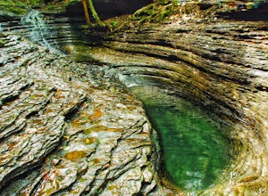
Hike the Devil's Bathtub
5.03.96 mi / 250 ft gainThe Devil’s Bathtub is a deep pool of blue-green water known for being a great swimming hole and a beautiful natural feature. This hike is a 3.2 mile out and back hike with 250 feet elevation gain. There are at least 15 stream crossings, so extreme caution should be taken during periods of mediu...Read more -
Kingsport, Tennessee
Bay's Mountain Firetower
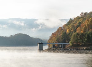
4.83.67 mi / 768 ft gainBay's Mountain Firetower overlooks the city of Kingsport, the South Fork Holston River, and the surrounding Tennessee mountains. Part of Bay's Mountain State Park, this is the most popular hike of the 25 miles of trails. The hike to the fire tower passes the Kingsport Reservoir which is essential...Read more -
Colonial Heights, Tennessee
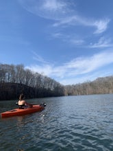
Kayak Patrick Henry Reservoir
5.0Patrick Henry Reservoir in Warriors Path State Park is a great location for kayaking, canoeing and stand up paddling. The reservoir is not always very clean, but it can still be very beautiful when you're on the water. In the Summer and Fall, the trees are beautiful to view. There is also a small...Read more -
Johnson City, Tennessee
Gray Quarry
5.0Gray Quarry is a perfect destination for scuba diving in TN! The quarry is about 70 feet deep with ~3 acres of clear water. They have sunk a plane, bus, truck, firetruck, boat, seedoos, and more to the bottom. There is also a large variety of aquatic animals in the quarry. This is an awesome, loc...Read more -
Thorn Hill, Tennessee
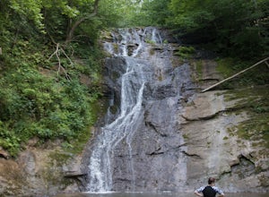
Photograph and Swim at Elrod Falls
5.0Elrod Falls is a great place to cool off in a cool clear river stream. It is located near a very small town in East Tennessee and is a great secluded place if you want to get away from people. When you get to the area you will see signs for it on the side of the road. When you get to the field an...Read more -
Ewing, Virginia
Hike to White Rocks
5.06 mi / 1500 ft gainStarting at the Ewing Trailhead, in Ewing, VA, you will meander up the ridge for about 2.5 mi before meeting up with Ridge Trail. The ascent is approximately 1500 ft up the side of the majestic White Rock Ridge. Mud, loose rocks, and some very steep climbs are included.Once at the top, left takes...Read more -
Ewing, Virginia
Backpack to White Rocks in Cumberland Gap National Historic Park
6.4 mi / 2000 ft gainCumberland Gap National Historic Park encompasses more than 20,000 acres of mountainous terrain spread out across Virginia, Tennessee, and Kentucky. The park offers miles of trails and many historic curiosities, including the actual saddle where pioneers first found their way over the Cumberland ...Read more -
Bluff City, Tennessee
Spelunk Worley's Cave
5.03.5 mi / 100 ft gainWorley’s Cave, also known as Morrill Cave, lies just outside of Boone across the Tennessee border. It is the second longest cave in the state of Tennessee at a whopping 4.4 miles in total length. It is a non-lit cavern that’s path is lit only by those who venture in its depths (i.e. headlamps, la...Read more -
Johnson City, Tennessee
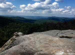
Sunset Point
5.00.65 mi / 223 ft gainSunset Point is an overlook located in Buffalo Mountain State Park. The trail is a short hike up along the White Rock loop trail then a short walk off the trail to get to the overlook. There is a clearing with a few benches that has wide open views to the west. The short hike up to the point shou...Read more -
Bristol, Tennessee
Emmett Trail
5.02.16 mi / 194 ft gainThe Emmett Trail is one of the TVA South Holston Tailwater Trails. This trail began as a footpath created by anglers. The trail now has gravel, which makes for easier access for families and pets. The trailhead begins on Piney Hill Road where it the traverses down to the waters edge and leads to ...Read more -
Bristol, Tennessee
Osceola Island Loop
5.01.52 mi / 95 ft gainThe Osceola Island Loop is a 1.50 mile gravel loop on an island in the South Holston River. There are multiple benches along the loop to stop and observe the wildlife. Fishing is a common activity along the edge of the trail. There is a large parking area and bathrooms at the start of the trail.Read more -
Bristol, Tennessee
Bouton Loop Trail
5.01.45 mi / 157 ft gainThe Bouton Trail Loop is an approximately 1.5 mile round trip on TVA land. There is a gravel parking lot with an information sign and trail map. Sections of the trail are gravel and sections are dirt. There are multiple places along the trail that cut off and lead down to the river for prime fish...Read more -
Bristol, Tennessee
Explore the South Holston Dam
5.0Coming from US-421 turn off on Emmett Rd and keep left to get on Holston View Dam Rd and continue straight on this road by the river. There are parking spaces by the river below the dam and short easy trails to walk on next to the river. You’ll see fly fishers in the river below the dam on early ...Read more -
Unicoi, Tennessee
Pinnacle Mountain Fire Tower via Fire Tower Road
5.03.47 mi / 663 ft gainPinnacle Mountain hosts one of the nicest fire towers on the East Coast of the United States. The fire tower is relatively new, sturdy, and has a large 360 degree viewing area at the top. The tower overlooks the Downtown Johnson City area, Elizabethton, Erwin, and the rest of the Buffalo Mountain...Read more -
Unicoi, Tennessee
Pinnacle Mountain Trail
8.81 mi / 2700 ft gainPinnacle Mountain is a long, grinding climb to the top. The singletrack winds up 1,500 feet of elevation for nearly 5 miles with few downhill sections. Once at the top, take a rest and climb the fire tower that overlooks the Downtown Johnson City area, Elizabethton, Erwin, and the rest of the Buf...Read more -
Elizabethton, Tennessee
Flint Mill Trail
5.02.44 mi / 1302 ft gainFlint Mill Trail is an approximately 2.4 mile out-and-back trail in the Cherokee National Forrest. The trailhead is located on Flatwoods Road in Elizabethton, TN. The trail has a rather steep incline and is considered challenging. There is a 1,264 foot altitude change from the base to the top . T...Read more

