Thetford, Vermont
Top Spots in and near Thetford
-
Franconia, New Hampshire
Hike Artists Bluff
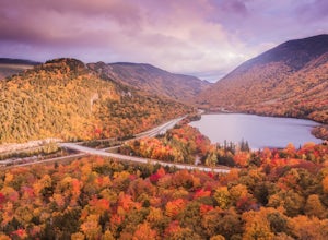
4.31.5 miStarting from the Bald Mountain trailhead, the Artists Bluff trail takes you up a short but steep 1.5 mile path to a beautiful rocky overlook of Franconia Notch State Park. This is the perfect hike to find incredible views of the park and some amazing foliage in autumn. We parked across the stree...Read more -
Franconia, New Hampshire
Hike to the Summit of Cannon Mountain via Kinsman Ridge trail
5.04 mi / 3000 ft gainDriving north on I-93 in New Hampshire, Cannon Mountain can be seen on the left just a few miles after exit 32. It is a massive cliff that towers over the highway, thousands-of-feet tall. Parking for the trail head is left off of exit 34B. If you look left as you're driving into the paved parking...Read more -
Thornton, New Hampshire
Hike Mount Tecumseh via Tripoli Road
6.2 mi / 2545 ft gainThis short hike starts out from the Tecumseh Trailhead parking lot along Tripoli Road at an elevation of 1,820 feet. The trail heads south from the parking area and almost immediately crosses a few brooks which may be difficult at high water. The first mile or so is a relatively gradual ascent. O...Read more -
Lincoln, New Hampshire
Franconia Falls
6.77 mi / 459 ft gainFranconia Falls Trail, starting at the Lincoln Woods Trailhead, features natural waterslides, a swimming hole, and fun for all ages. The Franconia Falls Trail is located in White Mountain National Forest, allows dogs, and is a perfect day trip year round! This trail is also frequently used in th...Read more -
Lincoln, New Hampshire
Hike to Bondcliff
5.018 mi / 3110 ft gainPark at the Lincoln Woods Visitors Center off the Kancamagus Highway where the Lincoln Woods Trailhead begins. Because of such a long hike, it's best to start at daybreak, or as early as possible to make it back before dark. The trail starts at the beginning of a suspension bridge crossing the Ea...Read more -
Lincoln, New Hampshire
Franconia Brook Trail
15.94 mi / 1122 ft gainThe Franconia Brook Trail is a 16 mile out and back trail in White Mountain National Forest. The trail features a river, and is primarily used for hiking. This trail is also great for cross country skiing or snowshoeing in the winter. The trailhead is approximately eight miles from Thirteen Fall...Read more -
Mendon, Vermont
Hike to Killington Peak
5.03.4 miThe trail head (Bucklin Trail) is found a couple of miles up Wheelerville Road on the left. Wheerlerville is a dirt road that will be muddy in the spring and summer. The drive is long enough that you will think you did something wrong, but you haven't! the trail head will eventually pop up.The tr...Read more -
Thornton, New Hampshire
Hike the Lafayette-Lincoln Loop
2.35.2 miBegin at the Mt. Tecumseh trailhead. You will hike for 1.2 miles before your first vista. Continue from there another mile until you arrive at the junction with the Sosman Trail. Stay right and continue another 0.3 miles to reach the summit of Mt. Tecumseh. At just over 4,000' this peak offers in...Read more -
Lincoln, New Hampshire
Summit Mount Hancock and South Hancock
9.8 mi / 2220 ft gainThe Hancock trailhead is located at the infamous hairpin turn of the Kancamagus Highway in the White Mountains. The trail itself crosses the road and starts at 2000 feet of elevation on the Hancock Notch trail. It remains fairly flat for the first 3 miles of the trail. After 1.8 miles you will hi...Read more -
Lincoln, New Hampshire
Osceola Mountain via Greeley Pond
4.06.8 mi / 2677 ft gainStart out at the Greeley Pond trailhead off of the Kancamagus Highway. After 1.3 miles the trail splits--bear right to get onto the Mt. Osceola Trail. Continue 1.5 miles to the summit. This summit hike offers a different kind of reward. Views are limited from the peak of Mt. Osceoloa, which allow...Read more -
Salisbury, Vermont
Camp at Lake Dunmore
The campground office for Branbury state park is on the opposite side of Route 53 from the pin on the map here, but the best campsites are where the pin is. Start by going and talking to the rangers at the office, they are super friendly and very helpful for recommendations of hikes or things to...Read more -
Newbury, New Hampshire
Hike to Lake Solitude, NH
4.04.8 mi / 2510 ft gainThe two most popular routes to Lake Solitude are the Newbury Trail and Andrew Brook Trail. The round-trip distance of the hikes are 4.8 miles and 3.8 miles. Both could be described as moderate in terms of difficulty. The Newbury trail is accessed from Lakeview Ave and Andrew Brook Trail can be a...Read more -
Waterbury Center, Vermont
Hike Mt. Hunger
5.04.2 mi / 2263 ft gainMt Hunger stands at 3540 ft and face Vermont's tallest mountain, Mt Mansfield. At 45 min drive from Burlington, this is a challenging out and back hike. The views it offers and the waterfalls you will find along the path, makes it a good alternative to the overcrowded trails of Mt Mansfield. Th...Read more -
Duxbury, Vermont
Camel's Hump Summit via Monroe Trail
4.86.22 mi / 2572 ft gainYou'll begin your Monroe Trail hike at approximately 1500', parking in one of three designated gravel lots along Camel's Hump Road in Duxbury. This trail is 6.8 miles round trip, and gains approximately 2583' in elevation. It is located on the east side of the mountain. Much of your hike will ...Read more -
Bristol, Vermont
Explore Bartlett Falls
5.0The 14 foot falls plunge into a deep pool, perfect for cliff jumping. There is even a shallow end for younger children. Always take caution when cliff jumping. Make sure your path is clear of rocks. Direction: Turn east on Lincoln Gap Road from Rt. 116 a mile north of Bristol. The falls are vis...Read more -
Huntington, Vermont
Camel's Hump Summit via the Burrows Trail
4.04.4 mi / 2228 ft gainThis adventure takes you up the Burrows Trail from the Huntington side of Camel's Hump. There are multiple trails to the summit, but this trail is the shortest. It is 2.4 miles to the summit with 2300' elevation gain. The trailhead is accessed from the aptly named Camel's Hump Road out of Huntin...Read more

