Londonderry, Vermont
Top Spots in and near Londonderry
-
Clemons, New York
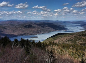
Hike to Black Mountain in Lake George, NY
6.7 mi / 1046 ft gainBlack Mountain is located on the Eastern side of Lake George and is the tallest mountain above Lake George. The trailhead is located on Pike Brook Road (off from Hulett's Rd, Route 6) in Clemons, NY. The parking area is about one mile up Pike Brook Road, on the right.This hike to Black Mountain i...Read more -
Cropseyville, New York
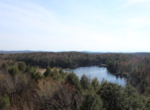
Hike Dickinson Hill Fire Tower
4.53 mi / 200 ft gainOnce you drive onto N. Long Pond Road you will follow it appproximately 1.5 miles to the end. From the parking you can take the short walk back on the road to the start of the trail. The trail is actually a rough Fire Tower Road. You will follow this for about 1.3 miles. Here you will see a se...Read more -
Jaffrey, New Hampshire
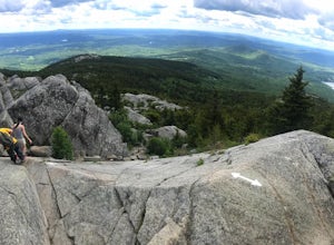
Hike MT Monadnock via White Arrow Trail
4.3 mi / 1485 ft gainArriving at the Old Toll Road/Halfway House Trail head you will have $5 entrance fee. Starting on the Old Toll road you'll find yourself walking on a gradual incline into the beautiful New Hampshire wilderness. Everything you see and smell is fresh and vibrant. Following the road for 1.1 miles yo...Read more -
Williamstown, Massachusetts
Hike Mt. Greylock via Money Brook Trail
9.7 mi / 3034 ft gainPark in the parking lot on Hopper Rd. Walk to the end of the road where you will find the Hopper Trailhead. Take the right fork. The Money Brook trail will take you to a waterfall, the Mt. Greylock summit, and back to the end of Hopper Rd. The trail is long but worth the hike, exploring parts of ...Read more -
Jaffrey, New Hampshire
Mount Monadnock via White Dot Trail
4.43.46 mi / 1699 ft gainMonadnock State Park is located in and around the 3,165-ft. Mount Monadnock. Mount Monadnock is crisscrossed by many miles of well-maintained hiking trails. The popular White Dot Trail (2.2 miles) is the shortest but steepest ascent to the summit, accessible from the Monadnock State Park headquar...Read more -
Jaffrey, New Hampshire
Mount Monadnock via White Dot & White Cross Loop
4.53.7 mi / 1686 ft gainThe White Dot Trail is the shortest, steepest ascent to the summit, while White Cross has a slightly easier grade down with very little difference in distance. Therefore, per the park's rangers, the best way to conquer this loop is White Dot up, White Cross down.The White Dot Trail begins at Mon...Read more -
Williamstown, Massachusetts
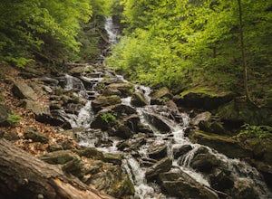
Hike the March Cataract Falls Trail
4.02.2 mi / 511 ft gainPark at the Junction of Sperry Rd and Rockwell Rd. To get to the trailhead, hike along Sperry Road for about 30 minutes. (Not to the end of the road, see map below.) Then hike along the March Cataract Trail, an out-and-back. You can bring dogs on leash. The trail is short but steep in some parts ...Read more -
Fort Ann, New York
Hike to Shelving Rock Falls
1 mi / 50 ft gainThe hike to beautiful Shelving Rock Falls is only a half mile and well worth the side trip if visiting the east side of Lake George. Shelving Rock Road, the road to the parking area, is long, winding, and unpaved, but maintained pretty well and passable in a sedan. You'll want to take the road a...Read more -
Fort Ann, New York
Hike Shelving Rock Mountain
3.4 mi / 650 ft gainThe trailhead for Shelving Rock Mountain has enough room for about five cars but additional parking can be found on the road leading to it. Be sure to sign the log book and begin the hike by passing around the "stop" car barrier.The trail starts off following a small stream (on your right) but yo...Read more -
Adams, Massachusetts
Explore Bellevue Falls
5.0When you reach the falls, you can cliff jump into a large swimming hole at the base. The best time to visit the falls is from April to November. Please note that dogs are not permitted here. Parking is at a cemetery, and the gates are open from 8am to 9pm. Use common sense before cliff jumping - ...Read more -
Erving, Massachusetts
Rattlesnake Loop to Red Trail
1.97 mi / 676 ft gainRattlesnake Loop to Red Trail is a loop trail that provides a good opportunity to view wildlife located near Erving, Massachusetts.Read more -
Salisbury, Vermont
Camp at Lake Dunmore
The campground office for Branbury state park is on the opposite side of Route 53 from the pin on the map here, but the best campsites are where the pin is. Start by going and talking to the rangers at the office, they are super friendly and very helpful for recommendations of hikes or things to...Read more -
Hancock, Vermont
Hike at Texas Falls Recreation Area
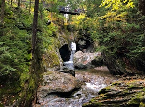
5.01 mi / 209 ft gainDirectly across from the main parking area are the viewing access points of Texas Falls. A footbridge crosses high above the flume and gorge, offering the best views. Crossing the bridge, there are plenty of other great view points with wooden railings keeping you away from the steep drops. ...Read more

