Pine Valley, Utah
Top Spots in and near Pine Valley
-
Rockville, Utah
Grafton Ghost Town
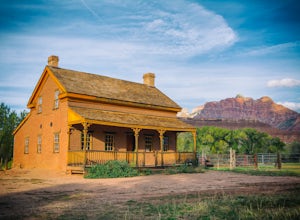
4.8Grafton Ghost Town is an abandoned small town 7 miles outside Zion National Park and the modern towns of Rockville and Springdale, Utah. To get there from Highway 9, get off on Bridge Lane residential road and cross the Virgin River on a historic single track iron bridge- then head west. At th...Read more -
Hurricane, Utah
Camp on Wire Mesa
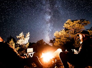
5.0Wire Mesa off the Smithsonian Butte Backcountry Byway is a fantastic place to camp in southeastern Utah even if you do not plan on visiting Zion, just a few miles to the north. There several backcountry campsites on the Mesa, with the northwestern-most site giving the best views overlooking the V...Read more -
Rockville, Utah
Camp off the Smithsonian Butte Backcountry Byway
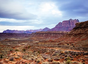
5.09.5 mi / 800 ft gainSmithsonian Butte Backcountry Byway is gorgeous 9.5 mile road that runs between Rockville near the entrance to Zion National Park and Apple Valley UT, and affords excellent places to camp & boondock *as long* as it is 0.5 miles from the road itself (and there are numerous turn offs). To get ...Read more -
Hurricane, Utah
Camp Under Zion's Watchman
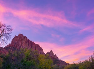
4.3Watchman Campground is one of the most popular campgrounds at Zion National Park. With a prime location only a ¼ mile away from the South entrance and gorgeous scenery right outside of your tent, including the tall sandstone cliffs that surround it, it’s easy to see why this campground is everyon...Read more -
Hurricane, Utah
Pine Creek Bridge
4.41.46 mi / 69 ft gainThe view of the Watchman from Canyon Junction Bridge was formerly one of the most highly photographed views in Zion National Park. Per Zion National Park regulations, standing on the Canyon Junction Bridge for photographs is not permitted. Your best alternative is Pine Creek Bridge, a pedestrian ...Read more -
Springdale, Utah
The Narrows, Zion NP
4.99.73 miHiking the narrows in Zion National Park is one of my favorite hikes and something I return for almost every year, I can still remember my first visit as a kid. There's no other place like it in the National Park system and the stunning beauty of its towering walls and vibrant river make it a top...Read more -
Hurricane, Utah
Zion Canyon Scenic Dr
5.012.7 miZion Canyon Scenic Drive is the main road through Zion NP. There is a fee to drive through the park, and it can only be seen via shuttle during the high tourist season. If doing the entire scenic drive, on Hwy 9 from I-15 to Mt. Carmel Junction, you will pass through the surrounding cities of H...Read more -
Hurricane, Utah
Lower Emerald Pool Trail
5.01.42 mi / 476 ft gainLower Emerald Pool Trail is an out-and-back trail that takes you by a waterfall located near Springdale, Utah.Read more -
Hurricane, Utah
Hike the Sand Bench Trail
3.62 mi / 500 ft gainThe Sand Bench Trail is a loop trail and starts at the Court of the Patriarchs shuttle stop. The trail makes a loop which is approximately 3.6 miles long. The trail can be accessed across the road from the shuttle stop. Look for a water tank and bridge crossing the Virgin River. Although often o...Read more -
Hurricane, Utah
Upper Emerald Pool
4.32.92 mi / 600 ft gainStart this trail walking across the bridge over the Virgin River into the start of the trails that lead to the pools. The path takes you through the bottoms of the water falls and you see them falling over the rocks above you. Though this sight may be totally awesome, be careful as you walk alo...Read more -
Springdale, Utah
Court of the Patriarchs Viewpoint Trail
5.00.12 mi / 26 ft gainCourt of the Patriarchs Viewpoint Trail is an out-and-back trail where you may see beautiful wildflowers located near Springdale, Utah.Read more -
Springdale, Utah
Angels Landing, West Rim, Telephone Loop
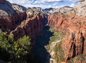
15.34 mi / 4304 ft gainThe Angels Landing, West Rim, Telephone Loop Trail is a 14+ mile heavily-trafficked loop trail located in Zion National Park near Springdale, Utah. This iconic trail offers incredible views of Zion Canyon and is rated as difficult, with steep drop-offs on both sides of the narrow ridgeline sect...Read more -
Hurricane, Utah
Aid Climbing Moonlight Buttress
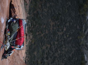
Moonlight Buttress follows an amazing system of cracks up some really solid sandstone. The route is 5.8 C1 and is very straightforward. Hauling on the first few pitches is an absolute nightmare, but spending the night on the wall is spectacular. To get more info on the route check out the followi...Read more -
Springdale, Utah
Angels Landing
4.74.24 mi / 1488 ft gainAngels Landing has long been one of my favorite Zion National Park hikes. The hike is thrilling, extremely photogenic, and appeals to those who enjoy exchanging leg power for views. The hike to the top isn't long, 2+ miles, but you'll definitely feel the 1500 feet of gain! The trail features a mo...Read more -
Washington County, Utah
Zion National Park Bus stop 8
2.7According to the park, there is nothing at this spot, so not many people stop. If you do not like large crowds, this is the perfect place to stop. There is a small trail that leads to the river and a beautiful vista with the massive canyon walls on all sides. There are several areas in this part ...Read more -
Springdale, Utah
Hike Observation Point
5.06.8 mi / 2100 ft gainThis is the best trail in Zion Canyon to beat the crowds while experiencing the awe and wonder it has to offer. We take this trail every time we visit Zion and never tire of it. It is an 8 mile out and back hike that takes you up, up, up then down, down, down. Be prepared to get your heart going!...Read more

