Panguitch, Utah
Top Spots in and near Panguitch
-
Springdale, Utah
Canyoneering Keyhole Canyon
4.0Keyhole Canyon is an experience for the adventurous, thrill seeking explorer. Hidden between the jagged mountains of Zion National Park, this canyon sits roadside, just two miles from the east entrance. Before we continue, please note that Canyoneering is a dangerous sport. This canyon is not for...Read more -
New Harmony, Utah
Kolob Arch
4.713.86 miIn the lesser traveled area of Zion National Park sits Kolob Arch, a sandstone arch high up on a cliff tucked back in the canyon. To get to Kolob Arch take exit 40 on I-15 in Utah. You'll see a Zion National Park Visitor's Center. Here you can fill up on water, use the bathroom, and get a map to...Read more -
New Harmony, Utah
Backpack Kolob Canyons, Zion NP
5.016 mi / 1000 ft gainOverview Starting at Lee Pass trailhead the trail descends down to run alongside the Timber Creek, past the open finger canyons of the nearby cliffs. At roughly mile 3 the trail will bend slowly to the left and climb up before descending again to run upstream and alongside La Verkin creek. Cam...Read more -
New Harmony, Utah
Trans-Zion Trek, Zion NP
5.0100.6 miThe following adventure guide for the Trans-Zion Trek will actually consist of six separate trails. The trails listed below are listed in order, going West to East. If the individual trail adventure is composed on the site as going east to west, it will be indicated that the reverse hike will be...Read more -
New Harmony, Utah
Backpack the La Verkin Creek Trail
5.014 mi / 1200 ft gainI've visited Zion National Park twice this year and the experience between the two visitations were like night and day. Zion National Park is by no means a secret, and for good reason. Hikes such as Angels Landing, and the Narrows are locations which are sought after by every outdoorsman and novi...Read more -
New Harmony, Utah
Middle Fork Taylor Creek in Kolob Canyon
4.04.86 mi / 889 ft gainThe Taylor Creek trailhead sits in the little-explored part of Zion National Park known as Kolob Canyon just south of Cedar City. The trail starts at around 6,000 feet and then drops a little lower in to the canyon and runs along Taylor Creek. With 450 feet of elevation change along the five-mile...Read more -
Hurricane, Utah
Upper Emerald Pool
4.32.92 mi / 600 ft gainStart this trail walking across the bridge over the Virgin River into the start of the trails that lead to the pools. The path takes you through the bottoms of the water falls and you see them falling over the rocks above you. Though this sight may be totally awesome, be careful as you walk alo...Read more -
Hurricane, Utah
Lower Emerald Pool Trail
5.01.42 mi / 476 ft gainLower Emerald Pool Trail is an out-and-back trail that takes you by a waterfall located near Springdale, Utah.Read more -
Sevier, Utah
Photograph Big Rock Candy Mountain
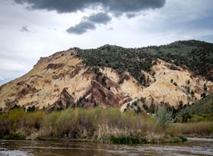
As you head south on Hwy 89 south of I-70 in central Utah, you wind through a picturesque canyon along the Sevier River. As the canyon opens up, Big Rock Candy Mountain's caramel colored hillside comes into full view. The caramel color is a stark contrast to the other mountains covered in pinion ...Read more -
Kanab, Utah
Visit the Gunsmoke Movie Set
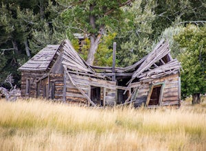
4.0The television series of Gunsmoke was an American classic. 635 episodes aired on prime time television over the course of twenty years, from 1955 to 1975. The movie set was the largest set constructed in the Kanab area. After the filming ended, the buildings were not maintained and became heav...Read more -
Escalante, Utah
Covered Wagon Natural Bridge Trail
4.00.59 mi / 66 ft gainCovered Wagon Natural Bridge Trail is an out-and-back trail where you may see beautiful wildflowers located near Escalante, Utah.Read more -
Springdale, Utah
Hike Many Pools
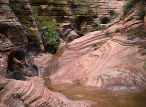
4.62 miTo get there, drive about .8 miles east of the smaller tunnel on the Zion-Mt. Carmel highway. There will be a place to pull out and park on a large turn. Continue walking down the road about 150 yards east and cross the street before the next turn. There is no marked trail, but there should be a ...Read more -
Kanab, Utah
Sand Caves of Kanab
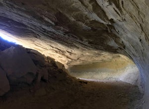
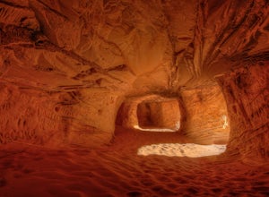
4.51.17 mi / 69 ft gainTo get to this cave, drive north of Kanab on Highway 89. Just after you pass Best Friends Animal Sanctuary, you will see these caves on the right. To hike to the caves, try accessing the trail from as far to the left as possible. The hike isn't strenuous or tricky in that case. The other thing t...Read more -
Springdale, Utah
Court of the Patriarchs Viewpoint Trail
5.00.12 mi / 26 ft gainCourt of the Patriarchs Viewpoint Trail is an out-and-back trail where you may see beautiful wildflowers located near Springdale, Utah.Read more -
Hurricane, Utah
Hike the Sand Bench Trail
3.62 mi / 500 ft gainThe Sand Bench Trail is a loop trail and starts at the Court of the Patriarchs shuttle stop. The trail makes a loop which is approximately 3.6 miles long. The trail can be accessed across the road from the shuttle stop. Look for a water tank and bridge crossing the Virgin River. Although often o...Read more -
Virgin, Utah
Hop Valley Trail, Zion NP
3.014.58 mi / 1000 ft gainThis 6.5 mile (one-way) trek is a multi-functional trail. The trail can serve as standalone trail allowing hikers to get in either a solid in-and-out day hike or as a leg to a much bigger and epic Trans-Zion Trek. For those interested in the later, the Hop Valley Trail is the leg of the journey t...Read more

