Ogden, Utah
Looking for the best photography in Ogden? We've got you covered with the top trails, trips, hiking, backpacking, camping and more around Ogden. The detailed guides, photos, and reviews are all submitted by the Outbound community.
Top Photography Spots in and near Ogden
-
Salt Lake City, Utah
Trail Run Burch Hollow Trail
5.3 mi / 2412 ft gainThe Burch Hollow trailhead is about a quarter mile up the Pipeline trail in Millcreek Canyon. After hiking along the switchbacks of the Pipeline trail, you'll see a sharp turn in the trail that leads you up the side of the mountain. This turn can easily be missed so keep a good look out for it. C...Read more -
Logan, Utah
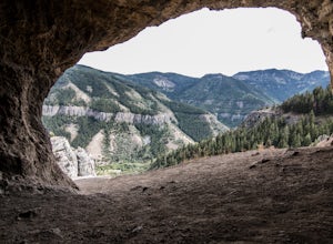
Hike to the Wind Caves, UT
4.53.7 mi / 1000 ft gainAs you drive up Logan Canyon, you'll see the trailhead on the left side of the road, just after Guinavah-Malibu Campground. It's a fairly steep hike, but also very well maintained. The Wind Caves are probably the most popular hike in Northern Utah and for a good reason. As you can see in the pict...Read more -
Salt Lake City, Utah
Hike Bowman Fork to Baker Pass
5.08.3 mi / 3375 ft gainTo get to the trailhead, drive up Millcreek Canyon about 4.5 miles until you reach the Terraces Picnic area. Turn here and drive up the small road until you reach the parking lot by the bathrooms. You'll see the Bowman Fork trailhead marker next to the parking lot. The trail climbs steadily and i...Read more -
Salt Lake City, Utah
Hike Neff's Canyon
4.3From the parking lot, you will follow a 4-wheel drive track that runs straight up to the beginning of the different trailheads. You can also take an actual trail up to that same spot, situated below the 4-wheel gravel track on the righthand side.There are a few different trails that merge togethe...Read more -
Holladay, Utah
Mt. Olympus Trail
4.76.46 mi / 4124 ft gainThe trail begins right on Wasatch Blvd. and after the first 0.5 miles you're into the Superior Wilderness. This is a very strenuous hike and you will be gaining elevation the whole way from the parking lot (4830 ft) to the summit (9026 ft). About .2 mile from the summit you will reach a saddle....Read more -
Tooele County, Utah
Stansbury Island Trail
2.88.87 mi / 2585 ft gainRarely will you ever see another person at the underrated Stansbury Island, the second largest island within the Great Salt Lake in Utah - even though a dirt causeway connects it to land, it is still considered an island. The lack of crowds make this a good place to hike, take photos, and enjoy t...Read more -
Salt Lake City, Utah
Mountain Bike Dog Lake, Millcreek Canyon
4.4 mi / 1260 ft gainIf it’s an even day and you’re in Salt Lake and you’re in possession of a mountain bike, put down your phone and spend the next 2 hours in pure bliss. Mountain bikers are only allowed to use the trails of upper Millcreek Canyon on even days, which makes for a busy route, but well worth it. This i...Read more -
Holladay, Utah
Winter Hike to Mt. Olympus
5.07 mi / 4200 ft gainApproach: You can access the well traveled Mount Olympus Trail the same as you would any other season. Park in the trailhead lot or along Wasatch Blvd. The trail starts on the south side of the parking lot.Route Description: Even in the winter the Mount Olympus trail should be pretty straightforw...Read more -
Holladay, Utah
Hike Heughs Canyon (Olympus Waterfall)
4.52 mi / 1000 ft gainHeughs Canyon starts right on the edge of Salt Lake City, but within minutes, you’re in a shady forest next to a gurgling stream. This is the prefect after-work hike that can be enjoyed year-round. Two miles round-trip and just over 1,000 feet, the path takes you to a beautiful waterfall that flo...Read more -
Park City, Utah
Hike, Run, Bike Rob's Trail in Park City
4.02.8 mi / 705 ft gainRob's Trail is a perennial favorite among Park City locals for year-round hiking, trail running, or mountain biking. The trail is primarily an out-and-back, but it if you go a bit further it can be combined with other trails to create a loop. The trail meanders through aspen and pine trees on the...Read more -
Salt Lake County, Utah
Hidden Falls
4.20.16 mi / 138 ft gainHidden Falls is a beautiful little waterfall with minimal crowds. When I say minimal, I mean I've only seen another person there 1 of the 5 or 6 times that I have been. Take it in. Stay a while. Scramble around the small canyon for different perspectives of the falls or the creek. If you don't ha...Read more -
Salt Lake City, Utah
Snowshoe Lake Blanche
5.05.6 miLake Blanche is an extremely popular hike along the Wasatch Range in Utah. During the summer and fall months the lake, wildlife, flowers, and Sundial Peak as a backdrop offer spectacular views.Lake Blanche is one of the most beautiful and scenic lakes in Utah and turns into a winter wonderland on...Read more -
Salt Lake County, Utah
Lake Blanche Trail
4.56.76 mi / 2766 ft gainThe hike is only 6 miles roundtrip, but it's pretty steep the whole way. It will take about 1.5 - 2 hrs to get up and about 45 min - 1hr to get back down. This can be longer depending on weather conditions and if you choose to loop the lake. At the Mills B Trailhead, you will head to the far end ...Read more -
Salt Lake County, Utah
Lake Blanche & Sundial Peak
5.09.52 mi / 4098 ft gainThis is a popular hike all year round, but less popular in the winter. If you’re backpacking you’ll most likely be alone. In winter, the lake is covered in snow, but Sundial Peak is one of the most picturesque mountains in the Wasatch. Especially when it is dusted with snow. You’ll also be far en...Read more -
Brighton, Utah
Hike or Trail Run Butler Fork
5.07.2 mi / 1964 ft gainTo get to the trailhead, drive up Big Cottonwood Canyon 8 miles. The parking lot is on the left side of the road. The first half mile is the steepest of the whole trail so don't get too intimidated by it, it mellows out a lot after. You will come to fork in the trail about a mile in, you can eith...Read more -
Brighton, Utah
Backcountry Ski Butler Fork
2 miThe trail head for Butler Fork is 8 miles up Big Cottonwood Canyon on the left side of the road. Throw your gear on and head up the trail. Continue along the skin track and after about 20 minutes you'll come upon a fork in the trail. The right trail will take you up the East Fork towards Butler B...Read more

