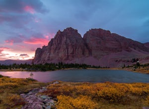
Oakley, Utah
Looking for the best backpacking in Oakley? We've got you covered with the top trails, trips, hiking, backpacking, camping and more around Oakley. The detailed guides, photos, and reviews are all submitted by the Outbound community.
Top Backpacking Spots in and near Oakley
-
Evanston, Utah
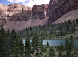
Amethyst Basin via Christmas Meadows
4.512.57 mi / 2303 ft gainDirections: The trail leaves from the Christmas Meadows Trailhead. From Mirror Lake Scenic Byway (US 150) turn on Christmas Meadows Rd. The campground and trailhead are around 3.5 miles down the road dirt road. The road is suitable for low clearance vehicles. Trip Length: 6 miles each way + opt...Read more -
Evanston, Utah
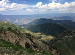
Kermsuh Lake Trail
5.013.04 mi / 1722 ft gainKermsuh Lake Trail is an out-and-back trail that takes you by a lake located near Oakley, Utah.Read more -
Evanston, Utah
Camping and Skiing at Lily Lake
When driving to the trailhead you must go through Evanston Wyoming to get there. The trailhead is located near the Bear River Lodge off the Mirror Lake Highway (UT 150).The Lily Lake area in the Uintas is full of snowy landscapes waiting to be explored on skis, snowshoes, or even a snowmobile. Yo...Read more -
Bountiful, Utah
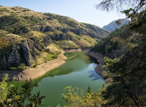
Backpack to Rudy's Flat
4.07 miRudy's Flat is a great overnight hike with plenty of tent or hammock space and multiple established fire rings. This hike offers multiple options for distance depending on your availability and skill level.From the Mueller Park Canyon trailhead (5,234 ft), hikers will experience a gradual ascent ...Read more -
Pleasant Grove, Utah
Rock Climbing American Fork Canyon
4.7American Fork Canyon, UT has a rich history in outdoor activity. Little do most people know that American Fork was the birth place of steep, overhanging, sport climbing. Developed by locals, now legends, in the climbing world like Boone Speed and Jeff Pedersen amongst others. This canyon came ...Read more -
Evanston, Utah
Backpack Mount Beulah via East Fork of the Bear River Trailhead
5.018 mi / 3423 ft gainGetting thereThis trip could be crammed into a really long day or even two days, but give yourself three days to really enjoy the area and not be too pressed for time.Your departure point is the East Fork of the Bear River Trailhead on the north slope of the Uintah Mountains. For most, this will ...Read more -
Draper, Utah
Lone Peak via the Cherry Creek Logging Trail
14.8 mi / 6378 ft gainYou start this trail at the Orson Smith Park in Draper. It joins with the Bonneville Shoreline Trail briefly before turning off onto the cherry creek logging trail. It switchbacks for a long ways exposed on towards the valley. It is fairly steep in places, but doable. I had tennis shoes with ...Read more -
Sandy, Utah
Climbing in the Lone Peak Cirque
4.0Lone Peak reaches 11,253 feet at its summit. It's alpine feel is unique as it stands above the busy city below. While this gem is one of the highlights in the Wasatch range, it must be earned. A long steep approach, best done at night in the summer months, deposits you in the high meadow surround...Read more -
Evanston, Utah
Backpack to Dead Horse Lake
5.021 mi / 1400 ft gainDead Horse Lake is a lightly trafficked and highly scenic route in the High Uintas Wilderness. The trail is easy enough to do overnight but I recommend taking an extra day to explore the area around Dead Horse Lake. From the trailhead you will hike south on the West Fork Blacks Fork trail. The...Read more -
Springville, Utah
Maple Mountain (aka Spanish Fork Peak)
10.56 mi / 4524 ft gainThe trail starts out very easy, but keep an eye out for the fork in the trail at the creek. It's easy to miss. It's right at the metal bench that will be on the left. Cross the creek and continue another quarter mile or so when you'll notice another branch to your left. Keep going straight here a...Read more -
Huntsville, Utah
Hike the Skull Creek Trail of Causey Reservoir
4.8 mi / 400 ft gainTo get to the trailhead from Ogden, Utah, take 12th street east up canyon and around Pine View Reservoir. When you get to Huntsville, turn right and continue to head east up the canyon. IN 8 miles you will come to a sign for Causey Road. Turn right here and follow the road to the dam. Turn right ...Read more -
Evanston, Utah
Backpack to Red Caslte Lake and Mt. Wilson
27 mi / 4200 ft gainUtah's 13ers are generally overshadowed by their 14er neighbors to the east, but do not be fooled, Utah's 13ers require a tremendous amount of effort to summit. The closest 13er to a road, Tokewanna, is about 18 miles round trip. The farthest 13er peaks are more than 30 miles round trip. These pe...Read more -
Evanston, Utah
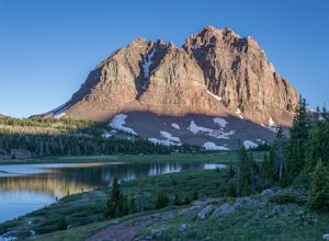
Red Castle and Red Castle Lakes
4.623.13 mi / 2149 ft gainThe Red Castle is a stunning formation of crumbling red rock that rises around several small lakes, high in the Uinta Mountains. The trail begins at the China Meadows Trailhead. From there, it heads south for about 8 miles, winding through lodgepole pine forests and skirting vast alpine meadows, ...Read more

