Layton, Utah
Looking for the best hiking in Layton? We've got you covered with the top trails, trips, hiking, backpacking, camping and more around Layton. The detailed guides, photos, and reviews are all submitted by the Outbound community.
Top Hiking Spots in and near Layton
-
Alta, Utah
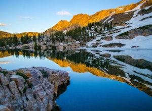
Cecret Lake from Albion Basin
4.94.48 mi / 1214 ft gainThe out-and-back trail from Albion Basin to Cecret Lake climbs a gentle slope and along the way there are interpretive signs with information about the basin, its plants, animals and geology. From the lake you can return the same way you came, or explore the area more. If you head there during t...Read more -
Salt Lake City, Utah
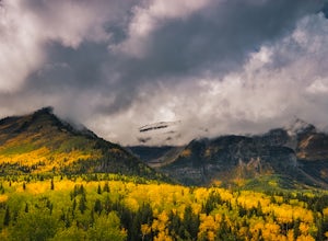
Photograph Guardsman Pass & The Alpine Loop
5.0Since this is a loop you can start at either end, but this is the way we did it. Start driving up Big Cottonwood Canyon. Enjoy the views and take in the impressive peaks on either side of the road. See the changes in vegetation as you gain elevation in the canyon. As you near the top and pass Sol...Read more -
Brighton, Utah
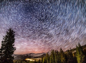
Photograph Star Trails at Silver Lake
1 miSilver Lake is one of the easiest, most accessible hikes in the Wasatch, located at the top of Big Cottonwood Canyon, Utah, close to the ski resorts of Brighton and Solitude.The lake is accessible all year; with a boardwalk or a well-signed path circling the lake through spring to fall. In the wi...Read more -
Brighton, Utah
Hike and Camp at the Twin Lakes Reservoir
5 mi / 650 ft gainThe trailhead begins at the Solitude Nordic Center. Walking around Silver Lake, you get a chance to observe the ducks and lovely wetlands area. This trail then leads you into the lower aspens, and if you are hiking just as fall colors have begun to emerge, they create a glowing effect in the wood...Read more -
Salt Lake City, Utah
Silver Lake
3.80.94 mi / 49 ft gainThis quick hike to a beautiful lake in the Wasatch Mountains is perfect for the whole family. Park at the visitor center at the Silver Lake Recreation Area near Brighton Ski Resort, pick up a trail map and walk behind the building to find the trailhead. You can also pick up a wildflower guide at ...Read more -
Wellsville, Utah
Box Elder Peak
4.37.57 mi / 3986 ft gainFrom the Rattlesnake Trailhead (about a mile northeast of the Sherwood Hills Resort on U.S. 89) to the peak is just under 4.5 miles. The hike is great exercise, as it's relatively steep. The steep angle provides for stunning views along the entire trail, making this one of the most picturesque hi...Read more -
Salt Lake City, Utah
Hike Mount Wolverine
4 mi / 1425 ft gainThis mountain can be conquered two ways and is a great after-work adventure to watch the sunset, an early morning trail run, or a fun family challenge. The trail is 4 miles and 1,425 feet elevation gain (from the Alta side) or 6 miles and 2,050 feet (from the Brighton side). Both routes converge ...Read more -
Salt Lake City, Utah
Backpack Lake Catherine and Bag Sunset Peak
3.53 mi / 1200 ft gainAny chance to get into the backcountry of the Wasatch Mountains is worth it. Many people day hike in the area, but not very many backpack in. The trail meets up with the Great Western Trail and overlooks Lake Catherine. The best place to camp is in the woods next to the lake. Hike down to the lak...Read more -
Salt Lake City, Utah
Hike Catherine Pass
4 mi / 1115 ft gainCatherine Pass is a must do if you are in the Salt Lake vicinity in July. The wildflowers are mind-blowing. But it’s a great hike to do in the Spring, after Alta Ski Resort has closed, and the Fall as well. It costs $6 per vehicle to drive to the trailhead, or $10 per person to ride the lift (if...Read more -
Brighton, Utah
Hike Lakes Mary, Martha and Catherine (Brighton Lakes)
4.64.41 mi / 1253 ft gainThis trail is a local favorite because you can make it as hard or as easy as you want it to be! You can stop at the first lake which is only 1 mile from the parkinglot, or you can go to the top of one or more of the 5 peaks that are surrounding the lakes for an added challenge. It is 3.5 miles ro...Read more -
Draper, Utah
Lone Peak via the Cherry Creek Logging Trail
14.8 mi / 6378 ft gainYou start this trail at the Orson Smith Park in Draper. It joins with the Bonneville Shoreline Trail briefly before turning off onto the cherry creek logging trail. It switchbacks for a long ways exposed on towards the valley. It is fairly steep in places, but doable. I had tennis shoes with ...Read more -
Salt Lake City, Utah
Night Photography at Brighton
4.01 mi / 500 ft gainPark at the main parking lot at Brighton Ski Resort and head up the hill (under the Majestic Lift is a good place to start). Hiking is generally easy, even with snow on the ground, due to compaction of the snowpack during the daytime. However, snowshoeing and skinning with skis can be a good alte...Read more -
Draper, Utah
Lone Peak via Jacobs Ladder
4.714.2 mi / 6713 ft gainThe main trail to Lone Peak is via Jacobs Ladder. To get to the start of the trailhead you need to drive on a dirt road for a little bit until you get to a little parking area (start of the road indicated on the map). The trail starts just south of where you park on the dirt road. The Jacobs Lad...Read more -
Salt Lake City, Utah
Hike Clayton Peak in Utah's Wasatch Mountains
4.03 mi / 1600 ft gainClayton Peak is approximately 1.5 miles from Guardsman Pass (3 miles round trip), and you'll gain about 1,600 feet of climbing. There is parking on top of the pass, but it fills up quickly with hikers and mountain bikers during peak season as this serves as the trailhead for Bloods Lake, Jupiter...Read more -
Salt Lake City, Utah
Backpack to Bloods and Lackawaxen Lakes
4.84 mi / 1040 ft gainThis trail is just outside of Big Cottonwood Canyon which forbids both dogs and swimming due to the Salt Lake watershed. As a result, dogs and swimming are more than welcome. Blood Lake and Lackawaxen Lake Trailhead can be reached by driving up Big Cottonwood approximately 15 miles until the tur...Read more -
Alta, Utah
Cecret Lake
4.41.78 mi / 509 ft gainCecret Lake is reached by driving up Little Cottonwood Canyon to Albion Basin above Alta Ski Resort. The hike is just under 1 mile to the lake and should take about 30 minutes. The hike goes through fields full of wildflowers and wildlife is abundant. Moose, deer, and various wildlife can be s...Read more

