Kamas, Utah
Looking for the best hiking in Kamas? We've got you covered with the top trails, trips, hiking, backpacking, camping and more around Kamas. The detailed guides, photos, and reviews are all submitted by the Outbound community.
Top Hiking Spots in and near Kamas
-
Provo, Utah
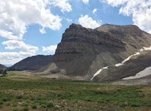
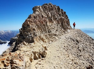
Hike the North Summit of Mount Timpanogos
5.016 miTo reach the north summit of Timpanogos you start out just like you would if you were going to the main summit. There are 2 different trail options to choose from; The Aspen Grove trail near Sundance Ski resort or the Timpanooke trail through American Fork Canyon. I will put the start point on th...Read more -
Provo, Utah
Hike Mount Timpanogos via Aspen Grove
4.014 mi / 5140 ft gainThe Aspen Grove trail is shorter but a bit steeper than the Timpanooke Trail. This usually means that fewer people take this route, and on an extremely popular mountain like Timpanogos, that’s a good thing. The trail is 14 miles round trip with an elevation gain of 5,140 feet. The hike begins at...Read more -
Provo, Utah
Hike to Scout Falls
2.8 mi / 675 ft gainStarting at a little over 7,300 feet, the Timpooneke Trailhead offers a beautiful alpine setting for starting your hike. Several trails originate from the same parking lot so you will want to make sure you get on the correct trail. The parking lot can also get quite full on summer days as people ...Read more -
Provo, Utah
Timpanogos Basin via Timpooneke Trail
5.09.78 mi / 3015 ft gainThe wildflowers are normally at their peak from mid to end of July or the beginning of August. Depending on the amount of snow that year and how wet of a spring we had it could vary a little bit. But anytime during the mid summer you will encounter amazing Indian Paintbrush, Lupine, and other co...Read more -
Provo, Utah
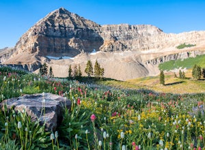
Mount Timpanogos via Timpanogos Trail #053
4.815.72 mi / 4970 ft gainThe Timpooneke trailhead is located in American Fork Canyon, next to the Timpooneke Campground. There is a $6 fee to enter the canyon, unless you have a National Park Pass with which you get in free. On the weekends, it may be difficult to find parking at the Timpooneke Campground, so arrive earl...Read more -
Sandy, Utah
Explore Little Cottonwood Canyon's Lisa Falls
3.8Lisa Falls sits approximately 0.22 miles from Little Cottonwood Canyon Road. While the trail is not long or particularly steep, there are some large step ups that could be difficult for either the very old or very young. Nonetheless, this is a great option for a family outing.Once you arrive at t...Read more -
Salt Lake City, Utah
Hike Stairs Gulch
4.2Drive up Big Cottonwood Canyon for around 2.8 miles, parking will be along the road and there will be a large rock waterfall on the right hand side of the road. The trailhead is just a short distance from that rock fall (40.623824, -111.743208)Stairs Gulch is an easy, short hike, unless you're lo...Read more -
Salt Lake City, Utah
Salt Lake Overlook via Desolation Trail
4.14.76 mi / 1729 ft gainThis popular trail follows a portion of the Desolation Trail leaving from Mill Creek Canyon. The trail to the overlook is 4.75 miles round trip with a 1700 ft elevation gain. You begin at the Desolation Trailhead and then turn around once you have a view of the Salt Lake Valley. It is a perfect h...Read more -
Salt Lake County, Utah
Hike Thayne Canyon
6 mi / 2800 ft gainIf you want to avoid the crowds heading to the Salt Lake Overlook and are looking for a bigger challenge with better views, Thayne Canyon is the ticket. The trail is 6 miles roundtrip with 2,800 feet of elevation gain. It’s a great evening hike and the peak is a nice place to watch the sunset. Th...Read more -
Hanna, Utah
Explore Grandaddy Basin
5.0Grandaddy Lake is the largest lake in the High Unitas. While Grandaddy Lake can have plenty of hikers, there are over twenty lakes within a two-hour hike within the Grandaddy Basin. Most hikers don’t go beyond Grandaddy lake, making the area a fantastic area to explore and camp. Elevation in the ...Read more -
Salt Lake City, Utah
Grandeur Peak East Trail
4.45.97 mi / 2513 ft gainThis is the peak that can be seen from the valley located between Millcreek Canyon and Parleys Canyon. There are 2 trails that head up to this peak, but the one up Millcreek Canyon at the top of Church Fork is by far the more popular/enjoyable one (and the one described here). The other one heads...Read more -
Salt Lake City, Utah
Little Mountain in Emigration Canyon
4.34 mi / 440 ft gainJust off of Highway 80, head up Emigration Canyon Road to the trailhead. There is a large parking area on the opposite side of the road from the trailhead. The parking area comes equipped with a bathroom if you need one. To get started, cross the road and start heading uphill. Keep in mind that...Read more -
Provo, Utah
Hike Big Springs Hollow Loop
4.05 mi / 600 ft gainArriving to Big Springs Hollow is relatively easy. Drive up Provo Canyon and turn right onto South Fork Rd at Vivian Park. As you pass Vivian Park, you'll continue for 3 miles on South Fork Rd until you reach Big Springs Park. Continue up to the Upper level parking and the trailhead will be in...Read more -
Salt Lake City, Utah
Hike Mt. Aire
4.54 mi / 2000 ft gainMount Aire, standing around 8600 ft, certainly isn't the most inspiring peak in or around Salt Lake City, but to me it serves as a quick summit to catch the sunset when I'm short on time.Getting There:Start by heading up Mill Creek Canyon Rd. After passing the ranger booth, drive about 5.5 miles ...Read more -
Salt Lake City, Utah
Hike Neff's Canyon
4.3From the parking lot, you will follow a 4-wheel drive track that runs straight up to the beginning of the different trailheads. You can also take an actual trail up to that same spot, situated below the 4-wheel gravel track on the righthand side.There are a few different trails that merge togethe...Read more -
Provo, Utah
Upper Falls
2.70.54 mi / 423 ft gainComing from Provo, at about 2.5 miles make a right hand turn for Nunn's Park/ Bridal Veil. Go straight through the intersections and pass Bridal Veil Falls (on your right) and continue until you see a park on your right (Upper Falls Park). Park here and cross the bridge over the creek and then fo...Read more

