Draper, Utah
Looking for the best hiking in Draper? We've got you covered with the top trails, trips, hiking, backpacking, camping and more around Draper. The detailed guides, photos, and reviews are all submitted by the Outbound community.
Top Hiking Spots in and near Draper
-
Brighton, Utah
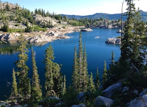
Hike Lakes Mary, Martha and Catherine (Brighton Lakes)
4.64.41 mi / 1253 ft gainThis trail is a local favorite because you can make it as hard or as easy as you want it to be! You can stop at the first lake which is only 1 mile from the parkinglot, or you can go to the top of one or more of the 5 peaks that are surrounding the lakes for an added challenge. It is 3.5 miles ro...Read more -
Salt Lake City, Utah
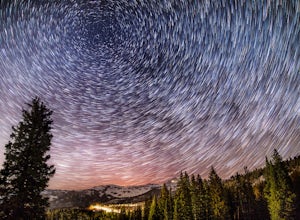
Night Photography at Brighton
4.01 mi / 500 ft gainPark at the main parking lot at Brighton Ski Resort and head up the hill (under the Majestic Lift is a good place to start). Hiking is generally easy, even with snow on the ground, due to compaction of the snowpack during the daytime. However, snowshoeing and skinning with skis can be a good alte...Read more -
Salt Lake City, Utah
Silver Lake
3.80.94 mi / 49 ft gainThis quick hike to a beautiful lake in the Wasatch Mountains is perfect for the whole family. Park at the visitor center at the Silver Lake Recreation Area near Brighton Ski Resort, pick up a trail map and walk behind the building to find the trailhead. You can also pick up a wildflower guide at ...Read more -
Brighton, Utah
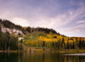
Hike and Camp at the Twin Lakes Reservoir
5 mi / 650 ft gainThe trailhead begins at the Solitude Nordic Center. Walking around Silver Lake, you get a chance to observe the ducks and lovely wetlands area. This trail then leads you into the lower aspens, and if you are hiking just as fall colors have begun to emerge, they create a glowing effect in the wood...Read more -
Salt Lake City, Utah
Backcountry Ski USA Bowl
1.6 mi / 1700 ft gainTo get the the trailhead, drive up Big Cottonwood Canyon until you reach the upper entrance into Solitude Ski Resort. You can park on the road just below the entrance to the resort. Across the street is a road called Old Stage Road, this is where the trail head begins. The road is covered in snow...Read more -
Salt Lake City, Utah
Mountain Bike Dog Lake, Millcreek Canyon
4.4 mi / 1260 ft gainIf it’s an even day and you’re in Salt Lake and you’re in possession of a mountain bike, put down your phone and spend the next 2 hours in pure bliss. Mountain bikers are only allowed to use the trails of upper Millcreek Canyon on even days, which makes for a busy route, but well worth it. This i...Read more -
Salt Lake City, Utah
Trail Run Upper Big Water Trail to Dog Lake
4.06.2 mi / 1267 ft gainDrive all the way to the top of Millcreek Canyon until you can't drive any further. (They close the road further down the canyon in the winter so this trail is not accessible to cars in the winter.) There is a small parking lot at the end of the road, park here. The trail head is going to be on t...Read more -
Salt Lake City, Utah
Hike Old Red Pine Road Trail
5.04.2 mi / 1000 ft gainThe trail begins at the parking lot at the very top of Millcreek, called Upper Big Water. The trail begins on the east side of the lot, where bathrooms are available. Walk to trail sign and head left to Old Pine Road Trail.From there, the trail remains relatively flat with some steep gains. The t...Read more -
Provo, Utah
Hike the North Summit of Mount Timpanogos
5.016 miTo reach the north summit of Timpanogos you start out just like you would if you were going to the main summit. There are 2 different trail options to choose from; The Aspen Grove trail near Sundance Ski resort or the Timpanooke trail through American Fork Canyon. I will put the start point on th...Read more -
Provo, Utah
Hike Mount Timpanogos via Aspen Grove
4.014 mi / 5140 ft gainThe Aspen Grove trail is shorter but a bit steeper than the Timpanooke Trail. This usually means that fewer people take this route, and on an extremely popular mountain like Timpanogos, that’s a good thing. The trail is 14 miles round trip with an elevation gain of 5,140 feet. The hike begins at...Read more -
Provo, Utah
Hike to Stewart Falls
4.34 miThe canyon is closed during snowfall so this is only accessible between May-Nov usually. It is best during the fall when the leaves have changed color, but let's be honest, it's always great. Head up Provo Canyon and follow the signs to make a left going into Sundance. Follow the road past the sk...Read more -
Salt Lake City, Utah
Photograph Guardsman Pass & The Alpine Loop
5.0Since this is a loop you can start at either end, but this is the way we did it. Start driving up Big Cottonwood Canyon. Enjoy the views and take in the impressive peaks on either side of the road. See the changes in vegetation as you gain elevation in the canyon. As you near the top and pass Sol...Read more -
Salt Lake City, Utah
Hike the Living Room
4.42.5 mi / 1000 ft gainBecause if its proximity to downtown Salt Lake, this is a great quick hike to do after work. Although it's short, it is fairly steep, climbing nearly 1000 feet in 1.25 miles. However, most people can do it without too much difficulty. This is a good family hike and allows dogs on leashes. Due to ...Read more -
Salt Lake City, Utah
Hike or Run Mount Wire
3.74.5 mi / 2082 ft gainThis 4.5 out-and-back trail starts just south of the Natural History Museum at the University of Utah. Park in the museum parking lot and walk up the stairs to the Bonneville Shoreline Trail. Then head south along the BST for a few minutes until you reach a big yellow sign with 174 on it. Turn le...Read more -
Salt Lake City, Utah
Hike or Trail Run Mount Van Cott
4.03 mi / 1400 ft gainThere are many different trailheads that will take you to the top of Mount Van Cott, but the main trailhead is up Red Butte Canyon. Drive up the canyon until you reach the parking lot where the canyon gate is blocking the road. After parking your car here, head up the dirt road on foot until you ...Read more -
Salt Lake City, Utah
Backpack to Bloods and Lackawaxen Lakes
4.84 mi / 1040 ft gainThis trail is just outside of Big Cottonwood Canyon which forbids both dogs and swimming due to the Salt Lake watershed. As a result, dogs and swimming are more than welcome. Blood Lake and Lackawaxen Lake Trailhead can be reached by driving up Big Cottonwood approximately 15 miles until the tur...Read more

