Donut Falls Trailhead, Utah
Looking for the best hiking in Donut Falls Trailhead? We've got you covered with the top trails, trips, hiking, backpacking, camping and more around Donut Falls Trailhead. The detailed guides, photos, and reviews are all submitted by the Outbound community.
Top Hiking Spots in and near Donut Falls Trailhead
-
Salt Lake City, Utah
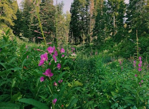
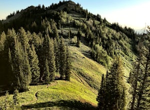
Hike Bowman Fork to Baker Pass
5.08.3 mi / 3375 ft gainTo get to the trailhead, drive up Millcreek Canyon about 4.5 miles until you reach the Terraces Picnic area. Turn here and drive up the small road until you reach the parking lot by the bathrooms. You'll see the Bowman Fork trailhead marker next to the parking lot. The trail climbs steadily and i...Read more -
Sandy, Utah
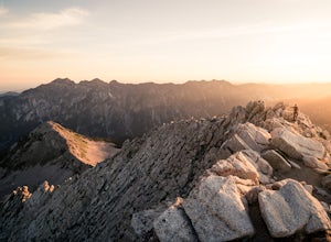
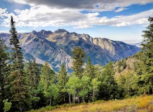
Summit the Pfeifferhorn
5.09 mi / 3700 ft gainStarting at the White Pine Trailhead in Little Cottonwood Canyon, UT, hike southwest until reaching the junction to Red Pine Canyon. Take the trail that crosses the stream and continues west around the ridge. The trail will quickly turn south and begin to gain elevation. Continue west as you pass...Read more -
Sandy, Utah
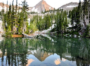
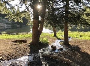
Hike to Maybird Lakes (Maybird Gulch)
5.07.5 mi / 2000 ft gainThis out and back hike begins at the same trailhead as White Pine Lake and Red Pine Lake which are both a lot more popular that Maybird Lakes. You follow the trail to Red Pine Lake for the first 2.5 miles and then there is a bridge and you follow that across the river to get on the trail to Maybi...Read more -
Sandy, Utah
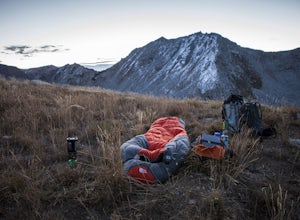
Camp at the Cottonwood Ridgeline
Begin at the White Pine Trailhead in Little Cottonwood Canyon. Follow the trail up toward Red Pine Lake. The trail gets a little hard to follow after the lake, but find your way up to the ridge between Pfeifferhorn and White Baldy. Set up camp and enjoy a night in the high mountains. Morning will...Read more -
Sandy, Utah
Winter Hike the Pfeifferhorn
5.09 mi / 3600 ft gainRising to a height of 11,326 feet, the Pfeifferhorn is one of the most majestic and iconic peaks in the Wasatch Mountains, and also one of the most popular mountains to hike. During the summer and fall, there is a well beaten trail all the way to the summit, but during the winter and spring, this...Read more -
Sandy, Utah
Ski or Snowboard Pink Pine Ridge
Arrive at the White Pine Trailhead early and start up from the main trailhead. Stay on that trail until you hit the river (Most of the time the river is buried, so look for a sign sticking up out of the snow) and the fork to go up to White Pine or Red Pine. Cross the river heading west and contin...Read more -
Sandy, Utah
Backcountry Ski White Pine Fork
7 miThe White Pine Trailhead is up Little Cottonwood Canyon on the south side of the road just before you get to Snowbird Ski Resort. The parking lot fills up very quickly so an early start is recommended. The skin track starts in the southwest corner of the parking lot near the bathrooms. You will f...Read more -
Salt Lake City, Utah
Trail Run Burch Hollow Trail
5.3 mi / 2412 ft gainThe Burch Hollow trailhead is about a quarter mile up the Pipeline trail in Millcreek Canyon. After hiking along the switchbacks of the Pipeline trail, you'll see a sharp turn in the trail that leads you up the side of the mountain. This turn can easily be missed so keep a good look out for it. C...Read more -
Salt Lake City, Utah
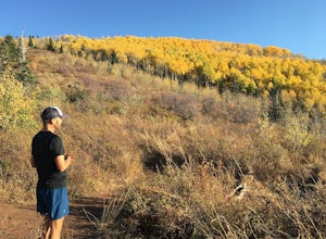
Hike Clayton Peak in Utah's Wasatch Mountains
4.03 mi / 1600 ft gainClayton Peak is approximately 1.5 miles from Guardsman Pass (3 miles round trip), and you'll gain about 1,600 feet of climbing. There is parking on top of the pass, but it fills up quickly with hikers and mountain bikers during peak season as this serves as the trailhead for Bloods Lake, Jupiter...Read more -
Salt Lake City, Utah
Backpack to Bloods and Lackawaxen Lakes
4.84 mi / 1040 ft gainThis trail is just outside of Big Cottonwood Canyon which forbids both dogs and swimming due to the Salt Lake watershed. As a result, dogs and swimming are more than welcome. Blood Lake and Lackawaxen Lake Trailhead can be reached by driving up Big Cottonwood approximately 15 miles until the tur...Read more -
Salt Lake City, Utah
Hike Porter Fork, Millcreek Canyon
5.06.8 mi / 3250 ft gainPorter Fork starts at the aptly named Porter Fork Trailhead about 4 miles up Millcreek Canyon. It’s actually Porter Fork Road for the first 1.5 miles of the trail. This section is a pleasant, paved path winding up through a dozen or so cabins. You’ll gain about 1,000 feet. If you make it past the...Read more -
Salt Lake City, Utah
Trail Run or Hike Lambs Canyon
4.04 mi / 1531 ft gainTake I-80 East through Parley's Canyon and get off at the Lambs Canyon Exit. Stay right off the exit and start heading up the canyon. You will follow the road 1.5 miles. You will see the trail head on the right side of the road with a small area to park on the left next to the bathrooms.The trail...Read more -
Park City, Utah
Hike Fantasy Ridge to Desolation Peak from Canyons Village
5.06.5 mi / 2000 ft gainThe easiest way to start this hiking only trail is to jump on the Red Pine Gondola at the Canyons Village of Park City Mountain Resort. If you have an Epic Pass, the lift is free. Otherwise, you'll need to buy a ticket to ride to the base of Red Pine Lodge. From the base of Red Pine Lodge (8,000...Read more -
Sandy, Utah
Explore Little Cottonwood Canyon's Lisa Falls
3.8Lisa Falls sits approximately 0.22 miles from Little Cottonwood Canyon Road. While the trail is not long or particularly steep, there are some large step ups that could be difficult for either the very old or very young. Nonetheless, this is a great option for a family outing.Once you arrive at t...Read more -
Park City, Utah
Hike, Run, Bike Rob's Trail in Park City
4.02.8 mi / 705 ft gainRob's Trail is a perennial favorite among Park City locals for year-round hiking, trail running, or mountain biking. The trail is primarily an out-and-back, but it if you go a bit further it can be combined with other trails to create a loop. The trail meanders through aspen and pine trees on the...Read more -
Salt Lake County, Utah
Hike Thayne Canyon
6 mi / 2800 ft gainIf you want to avoid the crowds heading to the Salt Lake Overlook and are looking for a bigger challenge with better views, Thayne Canyon is the ticket. The trail is 6 miles roundtrip with 2,800 feet of elevation gain. It’s a great evening hike and the peak is a nice place to watch the sunset. Th...Read more

