Castle Valley, Utah
Looking for the best photography in Castle Valley? We've got you covered with the top trails, trips, hiking, backpacking, camping and more around Castle Valley. The detailed guides, photos, and reviews are all submitted by the Outbound community.
Top Photography Spots in and near Castle Valley
-
Monticello, Utah
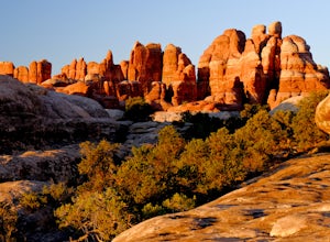
Hike Chesler Park and Joint Trails, Canyonlands NP
4.510 mi / 1755 ft gainThis world class hiking route circumnavigates Chesler Park by way of open meadows, slots, subterranean alcoves, stairways and slick rock.Begin at the Elephant Hill Trailhead and head south following signage for the Joint Trail / Chesler Park along the way. Once you arrive at Chesler Park turn lef...Read more -
Monticello, Utah
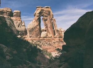
Hiking Druid Arch
5.010.28 mi / 1594 ft gainImportant Note: Druid Arch is located on the eastern side of Canyonlands National Park in the Needles District. It is not located at the main entrance to the park. Stop by the Needles Visitor Center and pick up a map. Your starting point, Elephant Hill Trailhead is then located 6.3 miles west of ...Read more -
Wayne County, Utah
Canyoneering High Spur Canyon
5 miFrom Moab, the drive to the canyon is approximately 4 hours long and much of it is on sandy or rocky dirt roads so it’s best to drive a 4x4 vehicle with good clearance. Drive past Hans Flat Ranger Station on the west side of Canyonlands National Park and make your way to the trailhead on Deadman’...Read more -
Mack, Colorado
Hike the Trail Through Time Paleontological Trail
1.5 miThe trail is adjacent to an active dinosaur quarry, and while there were no scientists at work while we were there, apparently you can see paleontologists at work in the spring and summer.Take the interpretive trail up towards the small mesa and check out the signs pointing out fossils along the ...Read more -
Green River, Utah
Explore a Manmade Geyser in Utah
3.0Four and a half miles from the town of Green River, Utah, Crystal Geyser is one of the few manmade geysers as a result of the area's historical mining industry. This cold-water geyser usually erupts every eight to 20 hours. Getting There Getting to the geyser is easy and the site can be accessed ...Read more -
Monticello, Utah
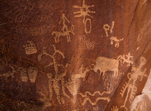
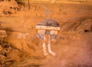
Explore the Newspaper Rock Ancient Petroglyphs
4.7After leaving Moab, turn off Highway 191 on to 211. The drive will wind over the mesa tops and down into red rock canyon country. Enjoy the changing seasons whether the red cliffs are covered in snow or spring desert flowers are blooming.Watch for cattle as this is open range country. Also watch ...Read more -
Fruita, Colorado
Backpack in the Black Ridge Canyons Wilderness
4.2 mi / 1000 ft gainIf you're looking to backpack outside of the highly publicized areas of Colorado (aka the Rockies), head out to Western CO for some amazing experiences. Located 4 hours west of Denver along I-70 is the McInnis Canyon National Conservation Area (NCA). Overseen by the Bureau of Land Management (BLM...Read more -
Fruita, Colorado
Hike the Rattlesnake Arches Trail in Black Ridge Wilderness
4.03.2 mi / 300 ft gainPut simply, Rattlesnake Arches is home to some of the most beautiful views you'll ever experience in the United States. This portion of the Rattlesnake Arches Trail follows along the upper rim of the canyon and allows you to experience 9 total arches within about 2 miles of hiking. The hike along...Read more -
Grand Junction, Colorado
Running Ute Canyon in Colorado National Monument
8.6 miUte Canyon Trail is a mostly undeveloped 4.3 mile trail (8.6 round trip) in Colorado National Monument that offers technical descents, route finding, water crossings, and gorgeous red rock walls. The trailhead is just a few miles off I-70 from the town of Fruita—it's well worth the trip. Remember...Read more -
Grand Junction, Colorado
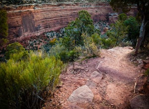
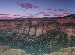
Photograph Colorado National Monument
4.2Driving through Colorado National Monument was very easy and gorgeous. Very scenic drive with many lookouts to stop at. Every lookout has a spot to park and you can just jump out and photograph the book cliffs and canyons. I stopped at almost all of the lookouts and they are all breathtaking. I d...Read more -
Fruita, Colorado
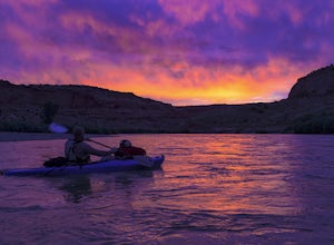
Float Ruby-Horsethief Canyons
To do the entire 26-mile float, put in at the Loma River access, several miles west of Fruita and just a short drive from I-70. From the Loma access there is no other easy access point until 26 miles later, at Westwater in Utah.Once on the water you will be able to relax and enjoy the beautiful s...Read more -
Monticello, Utah
Backpack Salt Creek
33 mi / 1000 ft gainThe Needles District of Canyonlands receives 6 times as many backpackers as its more popular neighbor across the Colorado River, Island in the Sky. The Needles has an excellent trail network that is incredibly diverse, featuring amazing rock features as well as grassy meadows and savannahs. Whil...Read more

