Boulder, Utah
Looking for the best photography in Boulder? We've got you covered with the top trails, trips, hiking, backpacking, camping and more around Boulder. The detailed guides, photos, and reviews are all submitted by the Outbound community.
Top Photography Spots in and near Boulder
-
Garfield County, Utah
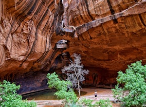
Golden Cathedral Trail
4.59.27 mi / 1398 ft gainFrom highway 12, drive south down the hole in the rock road for about 17 miles to a dirt road on the left that is well marked for Egypt. Follow that dirt road 9.9 miles to the Egypt Trailhead. There is a BLM trail register at the trail head. After that, take one of the numerous ways down to the E...Read more -
Torrey, Utah
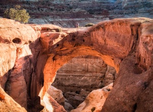
Cassidy Arch Trail
4.43.08 mi / 1283 ft gainFollow the scenic road just past the Fruita Campground to the first dirt road on the left. The dirt road meanders through cool rock formations (great for night photography) and eventually dramatic cliffs that you will be climbing up. The parking area is obvious and there are primitive restrooms. ...Read more -
Fruita Campground, Utah
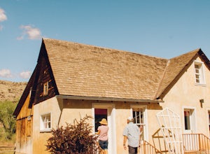
Explore the Orchards and Gifford House of Capitol Reef
4.5Inside Capitol Reef National Park, you’ll find a wonderful treasure. There are acres of orchards inside the park, all of which you are welcome to roam around and explore, you’ll see old farms buildings from the Mormon settlers that came through that are still kept up! Not to mention they have hor...Read more -
Torrey, Utah
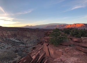
Sunset Point, Capitol Reef NP
2.53 mi / 1047 ft gainSunset Point Trail is an quick and easy 0.4 mile hike near the entrance of the park that provides you with beautiful views of the Capital Reef rim from the opposite side of the park. As the evening descends the setting sun illuminates the red rim rock formations giving them the best photographic ...Read more -
Wayne County, Utah
Navajo Knobs
9.11 mi / 2018 ft gainNavajo Knobs is one of Capital Reef’s most spectacular hikes. It brings you, moderately, to one of Capital Reef’s most spectacular viewpoints of the main park’s viewpoints. (Tip: Upon arriving at the park the Ranger recommended this as her favorite hike, and it lived up to the hype! If you’re lo...Read more -
Wayne County, Utah
Hickman Natural Bridge Trail
4.51.82 mi / 413 ft gainStarting at 5350' in elevation, the hike to Hickman natural bridge is one of the best hikes in Capitol Reef National Park for families with small children. The hike is just under two miles round trip and doesn't include any steep or exposed sections. You'll begin your hike next to the Fremont Ri...Read more -
Torrey, Utah
Hike the Chimney Rock Loop, Capitol Reef NP
5.03.46 mi / 909 ft gainFrom the trailhead, the trek starts off pretty step. You will reach a fork near the top of the plateau which starts the official loop. At the junction go left (counterclockwise). The trail offers wonderful views along the way. The loop will bring you on top of "chimney rock" for views over Hwy 24...Read more -
Torrey, Utah
Capitol Reef's Sulphur Creek Route
4.85.87 mi / 1191 ft gainThis is a point-to-point hike that either requires a shuttle or 3 mile walk along highway 24. The starting trailhead is the Chimney Rock Trailhead which has limited parking. The ending trailhead is the Capitol Reef National Park Visitors Center. We only had one car so I dropped everyone off at th...Read more -
Torrey, Utah
Photograph Cathedral Valley
5.0First let me preface that a high clearance vehicle is needed for this adventure. Provided that, prepare for a journey into some very remote and beautiful desert in the middle of Capitol Reef National Park.In total the scenic loop is 57 miles of washboard riddled roads that lead to the spectacular...Read more -
Torrey, Utah
Camp at McMillan Springs In The Henry Mountains
McMillan Springs Campground is south of Hanksville, Utah and within the Henry Mountains, which run north and south between Canyonlands, and Capitol Reef National Parks. Situated at 8,400 feet, McMillan Springs Campground has moderate temperatures and is managed by the BLM, so fees are donation b...Read more -
Kane County, Utah
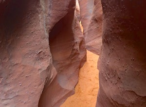
Peek-a-Boo and Spooky Canyons
4.75.44 mi / 584 ft gainThis hike is located in the Grand-Staircase-Escalante Monument and the nearest town is Escalante, Utah. From Escalante, you take Hole-in-the-Rock Road 26 miles to the Dry Fork road turn-off. The Hole-in-the-Rock road It is a dirt road, and while I did see some sedans and minivans, I suggest a veh...Read more -
Garfield County, Utah
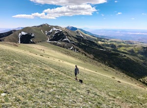
Hike Mount Ellen in Utah's Henry Mountains
4.04 mi / 1091 ft gainMount Ellen is considered an Ultra Prominent Peak. What's that you may ask? Well, Ultra Prominent Peaks are determined by how high the summit rises above its surroundings. Rising 5,812 feet above the desert floor with a summit elevation of 11,527 feet, Mount Ellen is the third most prominent peak...Read more -
Wayne County, Utah
Hike Lower Cathedral Valley Overlook
2 mi / 150 ft gainNow most of the pictures you see from Capitol Reef are from cathedral valley. But not many take the time to get above the most photographed area of the park. Off of Hartnet Road, at mile 17.6 you will find a small dirt parking lot for the trailhead (were talking middle of nowhere, so no pit toile...Read more -
Wayne County, Utah
Drive the Cathedral Valley Loop
60 miThese set of roads are classified as 4x4 high clearance vehical roads. Not to mention this part of the park is remote and only about 10% of visitors access it. To get to Cathedral Valley, we were recommended to drive a “loop” by the park ranger, that entailed about 60 miles of high clearance dirt...Read more -
Kane County, Utah
Hike to Grosvenor Arch
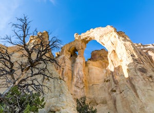
5.01.16 mi / 285 ft gainGrosvenor Arch is a sandstone double arch located in Grand Staircase-Escalante National Monument. The arch is named after Gilbert Hovey Grosvenor, a president of the National Geographic Society. To reach the arch, park in the trailhead parking lot off Last Chance Creek Road. The arches are vis...Read more -
Wayne County, Utah
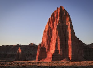
Explore the Temple of the Sun & Moon and Glass Mountain
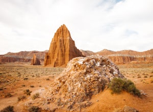
The temple of the sun and moon are accessed from Cathedral Rd. in Capitol Reef National Park, the road is a 4x4 high clearance vehical road. Upon arriving at the Temples which are called “monoliths”, the giant rocks protrude from the earth, and are something like a fine piece of art. This is a po...Read more

