Kendalia, Texas
Looking for the best mountain biking in Kendalia? We've got you covered with the top trails, trips, hiking, backpacking, camping and more around Kendalia. The detailed guides, photos, and reviews are all submitted by the Outbound community.
Top Mountain Biking Spots in and near Kendalia
-
San Marcos, Texas
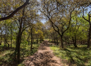
Hike the Ringtail Ridge Trail
4.01.93 mi / 91 ft gainThis trail is shared by hikers, trail runners, mountain bikers, and dog walkers. The trail is open for use year round, featuring beautiful wildflowers in the spring. The trail can be slightly hard to spot - a good place to park is next to a church off Old Hwy 80, and a spur trail will take you t...Read more -
San Marcos, Texas
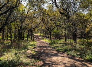
Hike Lower Purgatory Creek Greenspace To Dante's Trail Loop
3.5 mi / 173 ft gainThe Lower Purgatory Creek Greenspace to Dante's Trail Loop is a 3.5 mile loop hike located in San Marcos, Texas. The trail is great for hiking, biking and general exercise. It's shaded for the most part. The trail is very rocky and uneven at certain points, but flat and smooth at others. It's a f...Read more -
San Marcos, Texas
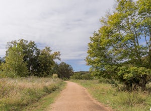
Purgatory Creek Natural Area Loop
4.07.77 mi / 568 ft gainPark in the dirt lot off of Hunter Road (see map) to access the trail. Trail is open year round and is dog-friendly.Read more -
San Marcos, Texas
Hike Limbo Loop
1 mi / 55 ft gainThe Limbo Loop is a 1-mile loop hike in San Marcos, Texas found within the Purgatory Creek Green space. The trail is a filled with nature and wildlife. The trail is beautiful during the spring, with an abundance of wildflowers. It is mostly shaded, with few inclines. The trail is family and dog-...Read more -
San Marcos, Texas
Hike Limbo, Dante, and Ripheus Loop
2 mi / 98 ft gainThe Limbo, Dante, and Ripheus Loop is a 2-mile loop hike in San Marcos, Texas found within the Purgatory Creek Green space. The trail is a filled with nature and is perfect for escaping the business of town. The trail is beautiful during the spring, with an abundance of wildflowers. It is mostly ...Read more -
San Marcos, Texas
Hike Limbo, Dante, Old West, Beatrice, And Ovid East Loop
5.03 mi / 131 ft gainThe Limbo, Dante, Old West, Beatrice, and Ovid East Loop is a 2.98 mile loop trail that begins in Prospect Park and makes a loop around through the Purgatory Greenspace in San Marcos, Texas. The trail is mostly shaded and a little rocky at certain sections. However, this is a great hiking trail ...Read more -
San Marcos, Texas
Hike the Spring Lake Preserve Loop
4.31 mi / 380 ft gainThe Spring Lake Preserve Trail is a 4.3 mile loop trail located within the The Meadows Center for Water and the Environment in San Marcos, Texas. The hike offers beautiful and scenic lake views. It's perfect for families and those of all ages. There are a wide variety of nature and wildlife spott...Read more -
San Antonio, Texas
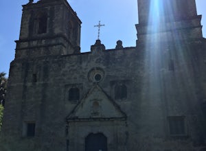
Hike Missions San Jose-San Juan
5.06.52 mi / 190 ft gainThe Missions San Jose-San Juan trail is used for hiking and mountain biking, and is accessible year-round. Dogs are allowed on trail but must be kept on leash. Please avoid these trails at night due to the remoteness of certain areas on the trail.Read more -
Lakeway, Texas
Hike Hamilton Greenbelt
5.1 mi / 374 ft gainThe Hamilton Greenbelt is a 5.1 mile out-and-back neighborhood hike located in Lakeway, just 15 miles outside of downtown Austin. The trail is located in a neighborhood and is extremely well-maintained. At the entrance of the trail you will find a little garden area with a small waterfall and a s...Read more -
Austin, Texas
Take a Stroll on the Dick Nichols Park Trail
1.09 mi / 16 ft gainThe Dick Nichols Park Trail is a 1 mile loop neighborhood park trail located in Southwest Austin. The trail is completely flat and is entirely paved. It circles the park and is equally shaded and exposed. It's very kid-friendly and perfect for walking the dog, biking, trail running, hiking, and e...Read more -
Austin, Texas
Hike the Western Oaks Trail
1.74 mi / 49 ft gainThe Western Oaks Trail is a 1.7 mile trail located in the Legend Oaks neighborhood in Southwest Austin, Texas. The trail is looping however there are several interconnecting trails which can shorten or lengthen the duration of the hike. The trail is mostly flat and made of crushed gravel. It is p...Read more -
Spicewood, Texas
Camp at Pace Bend Park
4.4Pace Bend is a favorite camping and day use destination near Austin, Texas. The park is approximately 45 minutes West of Austin located off of Hwy 71 and offers visitors a wide range of recreational activities. There is an entrance fee of $10 per vehicle for Day Use only and $15 per vehicle for p...Read more -
Spicewood, Texas
Hike through Muleshoe Bend Recreation Area
5.05.4 mi / 365 ft gainSpend all day wandering the endless fields of bluebonnets above the banks of the Colorado River in this hill country oasis. MuleshoeBend Recreation Area is just 50 minutes outside of Austin in Spicewood, TX. It has 540 acres of trails, camping, and picnic tables. The highlight of this park is the...Read more -
Austin, Texas
Stephenson Preserve Loop
2.17 mi / 243 ft gainThe Stevenson Preserve Trail is a 1.5 mile loop hike located in South Austin. The outer trail makes a large loop around the entire park, however there are several interconnecting trails within the loop. This trail system is part of the Stephenson Preserve, which is also connected to the Longview ...Read more -
Austin, Texas
Hike Mary Moore Searight Park Trail
2.1 mi / 65 ft gainThe outer loop trail at Mary Moore Searight park is 2.1 miles and is interconnected by several smaller trails, which can be used to shorten the length of the hike. The trail is relatively easy with very few inclines and declines. The trail is mostly very thin crushed gravel and great for an easy ...Read more -
Travis County, Texas
Hike Violet Crown Trail: Zilker to 360 Trailhead
3.03.7 mi / 282 ft gainThe Violet Crown Trail: Zilker to 360 is 3.7 mile out-and-back stretch through the Barton Creek Greenbelt. The trail begins in Zilker Park and follows Barton Creek all the way south to Loop 360. Parking can be found at Zilker Park. Though on weekends and during the summer time, the park is usuall...Read more

