Burnet, Texas
Looking for the best mountain biking in Burnet? We've got you covered with the top trails, trips, hiking, backpacking, camping and more around Burnet. The detailed guides, photos, and reviews are all submitted by the Outbound community.
Top Mountain Biking Spots in and near Burnet
-
Burnet, Texas
Hike the Inks Lake State Park Trail
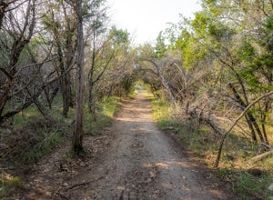
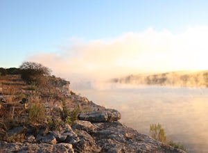
4.04.7 mi / 347 ft gainThe Inks Lake State Park Trail is a 4.7 mile loop trail located within Inks Lake State Park, just outside of Burnet, Texas. Only a small portion of the trail follows the lake, then it veers off through the rocky and hilly terrain of the Texas Hill Country. The trail is only partially shaded at ti...Read more -
Spicewood, Texas
Hike through Muleshoe Bend Recreation Area
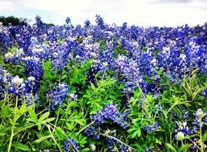
5.05.4 mi / 365 ft gainSpend all day wandering the endless fields of bluebonnets above the banks of the Colorado River in this hill country oasis. MuleshoeBend Recreation Area is just 50 minutes outside of Austin in Spicewood, TX. It has 540 acres of trails, camping, and picnic tables. The highlight of this park is the...Read more -
Liberty Hill, Texas
Hike the Good Water Trail
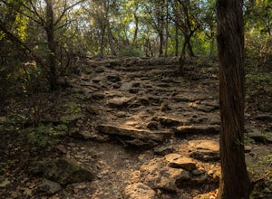
5.012.6 mi / 1270 ft gainThe Good Water Trail which is part of the larger Good Water Loop, is a 12.6 mile point-to-point hike. This trail is heavily trafficked by both hikers and mountain bikers alike. It's a great trail for scenic views, nature, and wildlife. Please be advised that the trail is severely rocky and uneven...Read more -
Spicewood, Texas
Camp at Pace Bend Park
4.4Pace Bend is a favorite camping and day use destination near Austin, Texas. The park is approximately 45 minutes West of Austin located off of Hwy 71 and offers visitors a wide range of recreational activities. There is an entrance fee of $10 per vehicle for Day Use only and $15 per vehicle for p...Read more -
Georgetown, Texas
Hike Good Water Trail Loop From Cedar Breaks
10.1 mi / 688 ft gainThe Good Water Trail Loop from Cedar Breaks is a 10.1 mile loop hike that begins within Cedar Breaks Park, just northeast of Georgetown, Texas. The trail is heavily trafficked and even more so on weekends. There are several inclines and declines, but nothing too significant. The trail has rough t...Read more -
Georgetown, Texas
Hike the San Gabriel River Trail
7.6 mi / 498 ft gainThe San Gabriel River trailhead is found within Cedar Breaks Park, just northeast of Georgetown, Texas. The trail is a 7.6 mile moderate out-and-back trail. The trail is heavily trafficked and even more so on weekends. There are several inclines and declines, but nothing too significant. The trai...Read more -
Cedar Park, Texas
Hike the Brushy Creek Regional Trail
4.56.5 mi / 85 ft gainPark in the big lot off E Little Elm Trail Road (see map) to access the trailhead. Trail is accessible year round and is dog-friendly.Read more -
Johnson City, Texas
Hike the Wolf Mountain Trail
7.4 mi / 416 ft gainThe Wolf Mountain Trail is a 7.2 mile loop hike within Pedernales Falls State Park, right outside of Johnson City, Texas. The trail is pretty wide and great for all sorts of exercising and social distancing. The trail is relatively moderate and well maintained. There is little shade but it is st...Read more -
Lakeway, Texas
Hike Hamilton Greenbelt
5.1 mi / 374 ft gainThe Hamilton Greenbelt is a 5.1 mile out-and-back neighborhood hike located in Lakeway, just 15 miles outside of downtown Austin. The trail is located in a neighborhood and is extremely well-maintained. At the entrance of the trail you will find a little garden area with a small waterfall and a s...Read more -
Johnson City, Texas
Hike Wolf Mountain And Juniper Ridge Trail Loop
11.2 mi / 472 ft gainWolf Mountain and Juniper Ridge Trail Loop is a 11.2 mile loop hike within Pedernales Falls State Park, right outside of Johnson City, Texas. The trail is pretty wide and great for all sorts of exercising and social distancing. The trail is relatively moderate and well maintained. There is littl...Read more -
Johnson City, Texas
Hike Juniper Spring Via Wolf Mountain And Juniper Ridge
8.4 mi / 462 ft gainJuniper Spring via Wolf Mountain and Juniper Ridge is a 8.4 mile loop hike within Pedernales Falls State Park, right outside of Johnson City, Texas. This trail is moderately trafficked. The trail is pretty wide and great for all sorts of exercising and social distancing. The trail is relatively ...Read more -
Johnson City, Texas
Hike Wolf Mountain, Juniper Ridge And South Loop Equestrian Trail
6.6 mi / 374 ft gainThe Wolf Mountain, Juniper Ridge and South Loop Equestrian Trail is a 6.6 mile loop hike within Pedernales Falls State Park, right outside of Johnson City, Texas. The trail is pretty wide and great for all sorts of exercising and social distancing. The trail is relatively moderate, with few incl...Read more -
Georgetown, Texas
Hike San Gabriel River From Blue Hole
10.4 mi / 380 ft gainSan Gabriel River from Blue Hole is a 10.4 mile out and back hike that follows along the North San Gabriel River in Georgetown, Texas. The trail is moderately trafficked. A large majority of the trail is paved, shaded, and well-maintained. It provides beautiful views of the river with an abundan...Read more -
Austin, Texas
Hike the Little Fern Trail
0.5 mi / 140 ft gainThe Little Fern Trail is a 1.9 mile out-and-back hike that is a part of the River Place Nature Trail. It is perfect for hiking, walking, running, and biking. The trail is open for use year-round and is easy to follow, with lots of small, side waterfalls and lush greenery scattered along. The tree...Read more -
Austin, Texas
St. Edwards Green and Red Loop
2.8 mi / 328 ft gainSt. Edwards Green and Red Loop is a 2.7 mile loop hike located in northwest, Austin, Texas. The trail is heavily trafficked, but has a great nature scene, including a multitude of bird species and wildflowers. Bull creek flows through the trail, creating a waterfall at one point which makes for a...Read more -
Austin, Texas
Hike the Great Hills Park Trail
2.31 mi / 127 ft gainThe Great Hills Park trail is a 2.3 mile point-to-point nature trail found within the Great Hills neighborhood of Northwest Austin. The trail is perfect for cycling, hiking, or just for taking a regular walk. The hike features a multitude of wildlife and is primarily shaded. There are several bat...Read more


