Briarcliff, Texas
Top Spots in and near Briarcliff
-
Johnson City, Texas
Explore Pedernales Falls
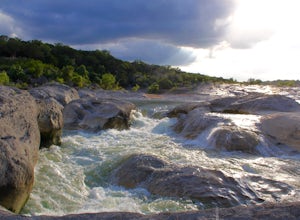
4.80.6 mi / 104 ft gainPedernales Falls drops 50 feet in elevation over 3,000 feet of titled, layered steps of limestone along the Pedernales River in Blanco County. In order to reach the falls you must enter Pedernales Falls State Park and follow the park road until the very end. There you'll find a parking lot and it...Read more -
Round Mountain, Texas
Twin Falls Nature Trail at Pedernales Falls State Park
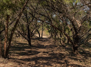
0.51 mi / 75 ft gainTwin Falls Nature Trail is a half mile loop trail located within Pedernales Falls State Park between Dripping Springs and Johnson, City, Texas. The trail head is located near the campgrounds and parking can be found near the bathrooms. It is an easy trail with a very slight descent. The trail its...Read more -
Johnson City, Texas
Hike the Wolf Mountain Trail
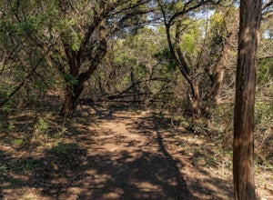
7.4 mi / 416 ft gainThe Wolf Mountain Trail is a 7.2 mile loop hike within Pedernales Falls State Park, right outside of Johnson City, Texas. The trail is pretty wide and great for all sorts of exercising and social distancing. The trail is relatively moderate and well maintained. There is little shade but it is st...Read more -
Johnson City, Texas
Hike Juniper Spring Via Wolf Mountain And Juniper Ridge
8.4 mi / 462 ft gainJuniper Spring via Wolf Mountain and Juniper Ridge is a 8.4 mile loop hike within Pedernales Falls State Park, right outside of Johnson City, Texas. This trail is moderately trafficked. The trail is pretty wide and great for all sorts of exercising and social distancing. The trail is relatively ...Read more -
Johnson City, Texas
Hike Wolf Mountain And Juniper Ridge Trail Loop
11.2 mi / 472 ft gainWolf Mountain and Juniper Ridge Trail Loop is a 11.2 mile loop hike within Pedernales Falls State Park, right outside of Johnson City, Texas. The trail is pretty wide and great for all sorts of exercising and social distancing. The trail is relatively moderate and well maintained. There is littl...Read more -
Johnson City, Texas
Hike Wolf Mountain, Juniper Ridge And South Loop Equestrian Trail
6.6 mi / 374 ft gainThe Wolf Mountain, Juniper Ridge and South Loop Equestrian Trail is a 6.6 mile loop hike within Pedernales Falls State Park, right outside of Johnson City, Texas. The trail is pretty wide and great for all sorts of exercising and social distancing. The trail is relatively moderate, with few incl...Read more -
Austin, Texas
Watch the Sunrise at Highway Scenic Overlook
This spot is located right off of the North Capital of Texas Highway (Loop 360) on the west side of Austin. It faces east and is perfect for catching the sunrise over the city or just overall chillin'. It provides easy and accessible parking. It's a popular spot for sunset and sunrise. There are ...Read more -
Austin, Texas
Wild Basin Wilderness Preserve Loop
4.01.8 mi / 262 ft gainWild Basin Wilderness Preserve is managed as part of the Balcones Canyonlands Preserve and consists of 227 acres of beautiful Hill Country woodlands owned jointly by Travis County (164.4 acres) and St. Edwards University (62.6 acres). Wild Basin is open to visitors who can hike the 2.5 miles of t...Read more -
Austin, Texas
St. Edwards Park Greenbelt Loop
0.75 mi / 43 ft gainParked in parking lot and walked yellow trail until it met up with the river then followed the river to the blue, purple, green trails back to parking lot. With many stops for photographs this little loop took less than an hour. North red is a little trail is longer. Where the yellow/orange/red ...Read more -
Austin, Texas
St. Edwards Park Yellow & Blue Trails
4.71.24 miSt. Edwards Park offers 2 main trails taking you along a creek, up hill trails with gorgeous views from atop a bluff, through exposed meadows filled with prairie grasses and cacti, and to a small swimming hole with a rope swing. The Creek Trail is a much easier, family friendly hike compared to ...Read more -
Austin, Texas
St. Edwards Green and Red Loop
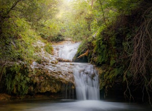
2.8 mi / 328 ft gainSt. Edwards Green and Red Loop is a 2.7 mile loop hike located in northwest, Austin, Texas. The trail is heavily trafficked, but has a great nature scene, including a multitude of bird species and wildflowers. Bull creek flows through the trail, creating a waterfall at one point which makes for a...Read more -
Austin, Texas
Hike the Bull Creek Loop
4 mi / 100 ft gainPart park, part preserve, St. Edwards Park is not too well known, even among long time Austin residents. It's hidden away on old Spicewood Springs Road, beyond the Loop 360 boundary beyond which most people do not venture. The park consists of two parts, one park and one preserve. The portion of ...Read more -
Cedar Park, Texas
Hike the Brushy Creek Regional Trail
4.56.5 mi / 85 ft gainPark in the big lot off E Little Elm Trail Road (see map) to access the trailhead. Trail is accessible year round and is dog-friendly.Read more -
Austin, Texas
Photograph Pennybacker Bridge (Austin 360 Bridge)
4.30.5 mi / 75 ft gainIf you're looking for excellent views of hill country, the skyline, or just an awesome place to watch the sunset this is the place to be. If you're heading southbound from 183 on 360 just before you reach the bridge there will be a dirt parking lot on your right. There are trailheads on the easts...Read more -
Austin, Texas
Hike the 360/Pennybacker Bridge Overlook Trail
1.8 mi / 167 ft gainThis is a pretty challenging hike but the view is most definitely worth the effort. There are two sides you can hike up on: the east and west. The west side is more popular as it gives a view of the Austin skyline as well the Pennybacker Bridge. However, the east side is good for sunset viewing. ...Read more -
Austin, Texas
Bull Creek South to North
3.67 mi / 335 ft gainThe Bull Creek Trail is an Out-and-Back trail along Bull Creek; it's a pretty beginner to intermediate hike. The trail follows along Bull Creek which runs between the hills of the Austin Hill Country. There are several waterfalls which can be found along the creek. The trail has multiple access p...Read more

