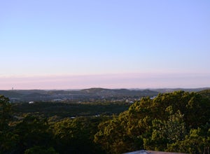
Blanco, Texas
Looking for the best hiking in Blanco? We've got you covered with the top trails, trips, hiking, backpacking, camping and more around Blanco. The detailed guides, photos, and reviews are all submitted by the Outbound community.
Top Hiking Spots in and near Blanco
-
San Marcos, Texas
Hike Lower Purgatory Creek Greenspace To Dante's Trail Loop
3.5 mi / 173 ft gainThe Lower Purgatory Creek Greenspace to Dante's Trail Loop is a 3.5 mile loop hike located in San Marcos, Texas. The trail is great for hiking, biking and general exercise. It's shaded for the most part. The trail is very rocky and uneven at certain points, but flat and smooth at others. It's a f...Read more -
San Marcos, Texas
Dante's, Lower Purgatory Creek and Blue Trail Loop
2.74 mi / 249 ft gainDante's, Lower Purgatory Creek and Blue Trail Loop is a 2.7 mile loop hike located in San Marcos, Texas. Located outside of downtown, it serves as a great nature trail for hiking, biking, and general exercise. It's primarily shaded and is a very moderate trail. It is not heavily trafficked, espec...Read more -
San Marcos, Texas
Purgatory Creek Natural Area Loop
4.07.77 mi / 568 ft gainPark in the dirt lot off of Hunter Road (see map) to access the trail. Trail is open year round and is dog-friendly.Read more -
Lakeway, Texas
Hike Hamilton Greenbelt
5.1 mi / 374 ft gainThe Hamilton Greenbelt is a 5.1 mile out-and-back neighborhood hike located in Lakeway, just 15 miles outside of downtown Austin. The trail is located in a neighborhood and is extremely well-maintained. At the entrance of the trail you will find a little garden area with a small waterfall and a s...Read more -
San Marcos, Texas
Hike the Spring Lake Preserve Loop
4.31 mi / 380 ft gainThe Spring Lake Preserve Trail is a 4.3 mile loop trail located within the The Meadows Center for Water and the Environment in San Marcos, Texas. The hike offers beautiful and scenic lake views. It's perfect for families and those of all ages. There are a wide variety of nature and wildlife spott...Read more -
San Marcos, Texas
Hike Spring Lake Wetland Walk
5.00.7 mi / 6 ft gainThe Spring Lake Wetland Walk is a 0.7 mile loop hike located in The Meadows Center for Water and Environment. It's a great walk with a self-guided tour purposed for learning about the surrounding nature, wildlife, and invasive species. This area is not particularly great for exercising or anythin...Read more -
Spicewood, Texas
Camp at Pace Bend Park
4.4Pace Bend is a favorite camping and day use destination near Austin, Texas. The park is approximately 45 minutes West of Austin located off of Hwy 71 and offers visitors a wide range of recreational activities. There is an entrance fee of $10 per vehicle for Day Use only and $15 per vehicle for p...Read more -
Spicewood, Texas
Climb at Pace Bend Park
The "must have" campsite is along Marshall Cove in Pace Bend Park. From the park's entrance head straight along the road and take the 3rd left onto the Marshall Cove turnout. The sites are not numbered, but locating the site is pretty easy--it's on the left-hand side of the the road along the edg...Read more -
Spicewood, Texas
Hike through Muleshoe Bend Recreation Area
5.05.4 mi / 365 ft gainSpend all day wandering the endless fields of bluebonnets above the banks of the Colorado River in this hill country oasis. MuleshoeBend Recreation Area is just 50 minutes outside of Austin in Spicewood, TX. It has 540 acres of trails, camping, and picnic tables. The highlight of this park is the...Read more -
San Antonio, Texas
Hike Main Loop And Juniper Trail
4.02.7 mi / 308 ft gainMain Loop and Juniper Trail is a 2.7 mile loop hike located in Northwest San Antonio within Friedrich Park. This park and trail are both highly trafficked and popular for hiking. Portions of the trail are paved, however there are parts that are not and have a dirt/natural path. This trail is pri...Read more -
San Antonio, Texas
Hike the Vista Loop at Friedrich Wilderness Park
3.73 mi / 85 ft gainJust north of 1604, off I10 is Friedrich Wilderness Park. This park, within the city limits of San Antonio, has about 10 miles of hiking trails varying from paved and appropriate for all ages and abilities, to challenging uphills and quick drop offs.This is just for pedestrian, so if you have a b...Read more -
San Antonio, Texas
Hike Restoration Way Trail Loop
5.1 mi / 511 ft gainThe Restoration Way Trail Loop is a 5.1 mile loop hike located in Northwest San Antonio within Friedrich Park. The trail is definitely one of the more challenging trails in the park. Portions of the trail are paved, however this particular loop is not recommended for those that have mobility l...Read more -
San Antonio, Texas
Main Loop to Restoration Way Trail
5.63 mi / 958 ft gainMain Loop to Restoration Way Trail is a ~5.6 mile loop hike located in Northwest San Antonio within Friedrich Park. Portions of the trail are paved, however this particular loop is not recommended for those that have mobility limitations because of the more strenuous inclines. This trail is prim...Read more -
San Antonio, Texas
Hike Bosque, Vern Del, Juniper Ridge And Main Trails Loop
4.02.6 mi / 357 ft gainBosque, Vern Del, Juniper Ridge and Main Trails Loop is a 2.6 mile loop hike where you may see beautiful wild flowers located near San Antonio, TX.Read more -
San Antonio, Texas
Hike the Main Loop to Vista Loop to Fern Del Trail
2.6 mi / 308 ft gainThe Main Loop to Vista Loop to Fern Del Trail is a 2.4 mile loop trail located in Northwest San Antonio within Friedrich Park. Portions of the trail are paved, however this particular loop is not recommended for those that have mobility limitations because of the more strenuous inclines. This tr...Read more -
San Antonio, Texas
Hike Cedar Flats Trail at Eisenhower Park
4.02 mi / 170 ft gainEisenhower Park is located on the north side of San Antonio, outside of loop 1604. Take the road to Camp Bullis, and you'll see the entrance to the park on your left a few hundred feet before the gate to the military base. The Cedar Flats trail will get you to your destination. It's an easy mile ...Read more

