Blanco, Texas
Looking for the best chillin in Blanco? We've got you covered with the top trails, trips, hiking, backpacking, camping and more around Blanco. The detailed guides, photos, and reviews are all submitted by the Outbound community.
Top Chillin Spots in and near Blanco
-
Austin, Texas
Hike the Mayfield Park Lake Trail
3.01 mi / 0 ft gainMayfield Nature Preserve is a 21-acre park located just west of downtown Austin, Texas. This nature preserve is unique from all other parks in Austin in that it that features free-roaming peacocks. It's a beautiful park full of beautiful nature and the trail leads down near the lake. The trail is...Read more -
Austin, Texas
Watch the Mexican-Free-Tailed Bats Emerge from Congress Street Bridge
Every evening, just as the sun sets, you can watch the 1.5 million bats take flight into the evening sky. This is great family fun and a must if you visit/are new to Austin. Parking is easy and nearby, however it is paid. There is a separate lot located in the Austin American Stateman parking lot...Read more -
Austin, Texas
Relax at McKinney Falls
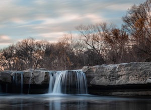
4.0McKinney Falls is separated into the Upper and Lower Falls along Onion Creek just 15 miles outside of Austin. The pin I dropped on the map gets you to the parking lot at the Upper Falls. From there it is a very short walk past the Smith Visitor Center to the falls. The upper falls offers some sha...Read more -
Austin, Texas
Hike the Homestead Trail
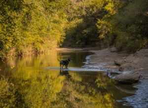
4.03.1 mi / 157 ft gainThe Homestead Loop hike is a 3.1 mile loop featuring the Lower Falls of McKinney Falls State Park. The hike is pretty intermediate and is mostly shaded. There are not many inclines. It is both dog- and kid-friendly. The trail does cross small streams, so be weary to bring water shoes/sandals. Th...Read more -
Austin, Texas
Hike Valburn South Loop
1.02.3 mi / 334 ft gainThe Valburn South Loop is a 2.3 mile loop trail within the Bull Creek Greenbelt in Northwest Austin, Texas. The trail is known for its grand views of the surrounding Hill Country. The trail is shaded for the most part and is pretty rocky, good shoes are highly recommended. The trail is made up of...Read more -
Austin, Texas
University of Texas Walk
2.99 mi / 197 ft gainThe University of Texas Walk is about a 3-mile loop trail around the University of Texas at Austin. Beginning at the LBJ Presidential Library, the trail loops around all of UT's most prominent landmarks, including the LBJ fountain, the Blanton Museum of Art and of course the renowned school tower...Read more -
Austin, Texas
Hike Lost Trail
1.5 mi / 52 ft gainLost Trail is a 1.3 mile loop hike through the Upper Bull Creek Greenbelt in northwest Austin, Texas. The trail features a beautiful waterfall, an abundance of wildlife and wildflowers, several benches, and many beautiful scenes. During the wet season, the creek fills up and flows very nicely. T...Read more -
Burnet, Texas
Hike the Inks Lake State Park Trail
4.04.7 mi / 347 ft gainThe Inks Lake State Park Trail is a 4.7 mile loop trail located within Inks Lake State Park, just outside of Burnet, Texas. Only a small portion of the trail follows the lake, then it veers off through the rocky and hilly terrain of the Texas Hill Country. The trail is only partially shaded at ti...Read more -
Austin, Texas
Hike Mueller Park Trail
4.02.6 mi / 78 ft gainThe Mueller Park Trails total a distance of 5 miles with a 2.6 mile loop hike that takes you by some waterfalls located in Austin, TX. You can wander around Mueller Lake or the pond in Southwest Greenway, where man-made waterfalls can be viewed, or both! In addition to the waterfalls, the Southwe...Read more -
Austin, Texas
Hike the Great Hills Park Trail
2.31 mi / 127 ft gainThe Great Hills Park trail is a 2.3 mile point-to-point nature trail found within the Great Hills neighborhood of Northwest Austin. The trail is perfect for cycling, hiking, or just for taking a regular walk. The hike features a multitude of wildlife and is primarily shaded. There are several bat...Read more -
Llano, Texas
Catch a Sunset at Badu Park
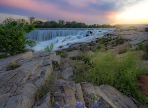
Located in the small but fun town of Llano, Texas, Badu Park is a great location for catching a sunset, fishing, picnicking, or just plain chilling. This location is located about an hour and a half west of Austin, Texas (75 miles) but is well worth the drive for a day trip! The dam is a popular...Read more -
Austin, Texas
Hike Walnut Creek Metro Loop
4.08.8 mi / 534 ft gainWalnut Creek Metro Loop is an 8.8 mile loop hike located within Walnut Creek Metro Park in north Austin, Texas. The trail is moderately hiked and relatively easy. It's great for walking/running/cycling. There are many smaller trails that connect portions of the main loop and it's easy to get conf...Read more -
Leander, Texas
Explore Dinosaur Tracks in Leander
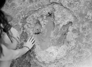
4.11 miAbout a half mile west from the Hwy 183 bridge that crosses the South Fork of the San Gabriel River lies approximately 12 dinosaur footprints embedded in the river bed. Not many people know about the dinosaur tracks just northwest of Austin in Leander, Texas. This is not a marked trail, there ar...Read more

