Soddy-Daisy, Tennessee
Looking for the best photography in Soddy-Daisy? We've got you covered with the top trails, trips, hiking, backpacking, camping and more around Soddy-Daisy. The detailed guides, photos, and reviews are all submitted by the Outbound community.
Top Photography Spots in and near Soddy-Daisy
-
Sewanee, Tennessee
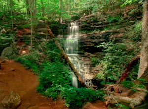
Hike to Bridal Veil Falls in Sewanee, TN
4.01.5 mi / 387 ft gainGreat short hike. Hard to find trail head, it is not marked at the parking area or where you leave the road. Put in your gps the coordinate spot tagged above off Clara Point Rd. To get to the trailhead, you have to cross the road from small parking area and go back 20 - 30 yards, where you will ...Read more -
Chatsworth, Georgia
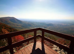
Hike the West Overlook Trail and CCC Stone Tower Trail Loop
4.71 mi / 200 ft gainFort Mountain State Park is filled with horse trails, biking trails, walking trails, camping sites, and a lake. Once you arrive at the park you pay a $5 entrance fee and will receive a park map. While visiting I walked the West Overlook Trail and came back down the CCC Tower Trail. This is a 1 mi...Read more -
Chatsworth, Georgia
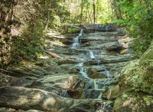
Emery Creek Falls
5.05.9 mi / 833 ft gainThe hike to the five waterfalls on the Emery Creek trail is one of the most spectacular hikes in Georgia. This trail is moderate in climb, yet secluded in the Cohutta Wilderness and challenging enough to keep crowds away. Two things to note about this trail: it is wet (there are 20 creek crossing...Read more -
Chatsworth, Georgia
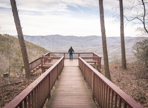
Hike the Gahuti Trail
4.08.1 mi / 1223 ft gainFort Mountain rises prominently from the plateau to the West, serving as the start of the Blue Ridge Mountain range in Georgia. The Gahuti Backcountry Trail circumnavigates the mountain, with several overlooks with views in all directions. At 8.1 miles, this hike is moderately difficult, but can...Read more -
Rockwood, Tennessee
Ozone Falls
4.20.35 mi / 43 ft gainThis beautiful, 110-foot waterfall is an easy 15-minute walk from the parking area. Note that the walk down to the falls, although short, is steep and there isn’t a well-marked trail down. It’s more about choosing the path of least resistance. Also, it can get quite busy in the summer time espec...Read more -
Tellico Plains, Tennessee
Hike to Conasauga Falls
4.51.5 mi / 400 ft gainGetting to the trailhead can be a challenge if there has been any heavy precipitation or icy conditions due to the fact the last two miles are one mile of broken pavement and the last mile a dirt road. You should be fine in good conditions in any car; however, just make sure to take it easy on th...Read more -
Tellico Plains, Tennessee
Drive the Cherohala Skyway National Scenic Byway
5.0The Cherohala Skway is one of the National Scenic byways in America it spans over 43 curvy miles from Tellico Planes, Tennessee to Robbinsville, North Carolina. On the Skyway there are many overlooks ranging elevations from 2000-5200 feet all have beautiful views and different view points. The pa...Read more

