Rock Island, Tennessee
Looking for the best hiking in Rock Island? We've got you covered with the top trails, trips, hiking, backpacking, camping and more around Rock Island. The detailed guides, photos, and reviews are all submitted by the Outbound community.
Top Hiking Spots in and near Rock Island
-
Cookeville, Tennessee
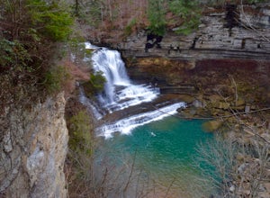
Cummins Falls
4.72.79 mi / 518 ft gainCatch the trailhead down to the falls at the parking lot. The trail quickly approaches the rim of the river gorge to provide hikers with a great bird's eye view of the falls. After snapping a few photos of the falls from above, follow the clearly marked trail down to the river's edge. From there,...Read more -
661-799 Stone Fort Drive, Tennessee
Hike Old Stone Fort Trail
5.02.9 mi / 265 ft gainThe main hiking trail at this small state park follows the wall of Old Stone Fort which was used by the Native Americans as a ceremonial gathering place. The trail threads through dramatic scenery where you can see the original entrance of the fort which was designed to face the exact spot on the...Read more -
Dayton, Tennessee
Hike through the Laurel Snow Pocket Wilderness
5.06 mi / 900 ft gainThe Laurel-Snow Trail was the first National Recreation Trail designated in Tennessee and at just under 35 miles from downtown Chattanooga, it is perfect for a day hike, for a day of climbing, or for setting up basecamp for the weekend. The 2,000 acre area sits along the Walden Ridge of the Cumbe...Read more -
Tracy City, Tennessee
Firey Gizzard, Dog Hole and Ravens Point
5.08.42 mi / 1302 ft gainFirey Gizzard, Dog Hole and Ravens Point is an out-and-back trail that takes you by a waterfall located near Tracy City, Tennessee.Read more -
Tracy City, Tennessee
Sycamore Falls
4.52.18 mi / 236 ft gainSycamore Falls is located in the Fiery Gizzard region of South Cumberland State Park. The trailhead is located just past Tracy City Elementary School on Fiery Gizzard Road. There is a large parking lot with restrooms at the trailhead. Start your hike at the south end of the parking lot. This ...Read more -
Tracy City, Tennessee
Hike the Fiery Gizzard Trail
5.013.5 miStart this journey from the Grundy Forest Trailhead, where you will quickly begin a decent along the Little Fiery Gizzard Creek. At the 0.7-mile split, be sure to turn left and cross the bridge to stay on the Fiery Gizzard Trail. For the next 0.8-mile journey, you'll encounter the gorgeous Black ...Read more -
Spring City, Tennessee
Hike to Stinging Fork Falls
3.53 mi / 400 ft gainThe trail begins on the right side of the parking lot. The first part is flat with no elevation change and easy walking. About half a mile in you will reach a trail split. The right trail will take you to the falls and the left trail will take you to an overlook of the gorge below. I was not able...Read more -
Tullahoma, Tennessee
Hike to Rutledge Falls
4.00.4 mi / 3 ft gainFind the trail parking area by following your GPS to “Rutledge Falls Baptist Church”. You will see a small parking area on the side of the road across the street from the church. The path to the falls is extremely short with a steep section to climb down to the base of the falls. This trail is on...Read more -
Tullahoma, Tennessee
Machine Falls Loop at Short Springs Natural Area
4.84.07 mi / 732 ft gainThe Machine Falls loop at Short Springs Natural Area is a 1.6 mile round trip hike easily followed by white blazes. It is rated moderate difficulty due to the short, steep descent into a gorge where the falls is located. The trail is sparsely trafficked; there are usually quite a few people han...Read more -
Tullahoma, Tennessee
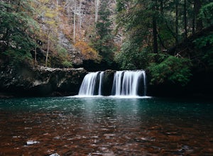
Hike to Lower and Upper Busby Falls
4.82 mi / 275 ft gainShort Springs Natural Area is where these falls are located. There is a decent amount of hiking trails that are a nice getaway for a day to hang out at for waterfalls. Put into your gps "machine falls parking." The gps will take you to the exact parking area. The directions go as follows from Nas...Read more -
Sequatchie, Tennessee
Foster Falls Loop
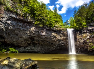
4.62.19 mi / 574 ft gainFoster Falls State Park is part of the South Cumberland State Park system. A short 45 minute drive from Chattanooga, Foster Falls boasts a stunning 60 foot waterfall that is worth visiting during any season of the year. The trailhead for this 2 mile hike starts from the Foster Falls parking lot a...Read more -
Sequatchie, Tennessee
Climb at Foster Falls SP
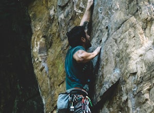
5.04.5 miFoster Falls will suit any climber. A novice climber can find routes here, and an expert can find new and exciting projects. There are a few camping sites near the climbing area. Father Adams which is a primitive spot, and Foster Falls campground which has a shower and toilets (around $16 a night...Read more -
Grandview, Tennessee
Hike to Piney Falls
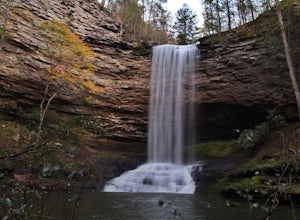
5.01.5 mi / 500 ft gainThe gravel road heading to the trailhead is on the rougher side to take it slow. When you get to the trailhead it’s a small gravel pull off right off the road. There are no maps at the trailhead but there are only a few trails to take and they are marked with a blue marker. To get to the upper fa...Read more -
Soddy-Daisy, Tennessee
Bouldering Stone Fort, TN
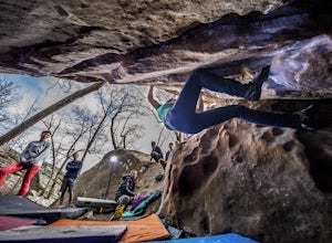
4.50.25 miStone Fort sits atop the Cumberland Plateau just half an hour from downtown Chattanooga, and is one of the premiere bouldering locations in the Southeast. One of the three sites of the annual Triple Crown Bouldering competition, Stone Fort offers a wealth of climbing problems for any climber's a...Read more -
Soddy-Daisy, Tennessee
Hike the Hogskin Upper and Lower Loop
5.01.4 miAfter an easy 25 minute drive from Chattanooga you will reach North Chickamauga Gorge on Montlake Road in Soddy Daisy. Park any where in the gravel loop just make sure other cars can get through. From the Montlake Road Trailhead Kiosk the trail begins on an old mining road. Hogskin Upper Loop Tr...Read more -
Soddy-Daisy, Tennessee
Hike the Hogskin Loop to Stripmine Falls
2.51.3 miStripmine Falls is not the biggest waterfall in the area, but it is both beautiful and accessible with just a short and easy out-and-back (or loop) hike. The additional attraction of cool swimming pools along Chickamauga creek make this an ideal destination for a day full of relaxation and adven...Read more

