Manchester, Tennessee
Looking for the best hiking in Manchester? We've got you covered with the top trails, trips, hiking, backpacking, camping and more around Manchester. The detailed guides, photos, and reviews are all submitted by the Outbound community.
Top Hiking Spots in and near Manchester
-
Sequatchie, Tennessee
Climb at Foster Falls SP
5.04.5 miFoster Falls will suit any climber. A novice climber can find routes here, and an expert can find new and exciting projects. There are a few camping sites near the climbing area. Father Adams which is a primitive spot, and Foster Falls campground which has a shower and toilets (around $16 a night...Read more -
Murfreesboro, Tennessee
Explore Stones River National Battlefield
3.3 mi / 85 ft gainOn the last day of 1862 one of the bloodiest conflicts in the American Civil War started. By the time the Battle of Stones River ended on 2 January 1863 each side had suffered the highest percentage of casualties. For many reasons this was one of the major battles of the Civil War. The Battlefiel...Read more -
Sherwood, Tennessee
Walls of Jericho via Tennessee Trailhead
5.07.74 mi / 1667 ft gainWalls of Jericho via Tennessee Trailhead is an out-and-back trail that takes you by a waterfall located near Belvidere, Tennessee.Read more -
Rock Island, Tennessee
Twin Falls, Rock Island State Park
4.40.3 mi / 125 ft gainUpon entering Rock Island State Park from the east, the parking area for this trail is located right after the old cotton mill (my friend and I actually ended up getting lost because it is tucked away there quite nicely). The trail that leads to Twin Falls actually starts at the westernmost part ...Read more -
Estillfork, Alabama
Walls of Jericho via Alabama Trailhead
4.05.8 mi / 1417 ft gainAround 5pm, we hiked down the only clearly marked trail that departs from the parking lot. The path begins with gentle switchbacks and great views of the forest, occasionally passing by small waterfalls, sinkholes, and caves; and arriving at the Hurricane Creek crossing (log with handrail) after ...Read more -
Pikeville, Tennessee
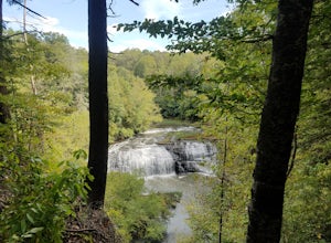
Photograph Buzzard's Roost Overlook
5.00.04 mi / 10 ft gainLocated in the beautiful state park of Fall Creek Falls, you'll find this overlook along with Millikan's Overlook. Both overlooks showcase the views shown in my photos, however, Buzzard's Roost is a short walk down the side trail that gives a more solitude experience that you may be looking for. ...Read more -
Lebanon, Tennessee
Hike the Hidden Springs Trail
3.54.5 miThis trail is a prime spot for anyone who wants to get a simple, but enjoyable walk in the woods. It's very well marked, flat, and can be enjoyed in any weather. Also, it is very dog friendly- Jolene loved it!Starting at the Trailhead across from the parking lot you may go right or left and follo...Read more -
Scenic Loop Road, Tennessee
Hike to the Base of Fall Creek Falls
5.00.86 mi / 299 ft gainFall Creek Falls State Park hosts a variety of large waterfalls which can easily become confusing. The park's main attraction is the 256 foot waterfall dubbed "Fall Creek Falls." Fall Creek Falls is observable from a viewing platform less than a five minute walk from the Scenic Loop Road parking ...Read more -
Pikeville, Tennessee
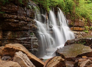
Fall Creek Falls
4.72.76 mi / 781 ft gainFall Creek Falls State Park is sprawled across the eastern top of the rugged Cumberland Plateau. The 20,000-acre park is one of the most scenic parks in the country and is the largest recreation area in the state of Tennessee. It is home to a 256-foot waterfall, cascades, gorges, 5 other waterfal...Read more -
Pikeville, Tennessee
Hike to Rockhouse and Cane Creek Falls
5.01 mi / 500 ft gainFall Creek Falls State Park is home to multiple waterfalls. The main attraction and biggest waterfall, Fall Creek Falls, is often tourists' main destination, but I encourage you to visit the base of Rockhouse Falls and Cane Creek Falls to enjoy some quiet solitude and get away from the usual week...Read more -
Chattanooga, Tennessee
Snoopers Rock Trail
5.05.79 mi / 1339 ft gainSnoopers Rock Trail is an out-and-back trail that takes you by a river located near Chattanooga, Tennessee.Read more -
Pikeville, Tennessee
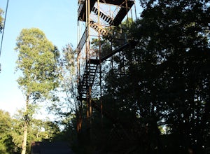
Hike to Fall Creek Falls Fire Tower
4.51 mi / 100 ft gainThe tower is located in the far northeast corner of Fall Creek Falls state park. The road to get there can be rough especially if it has rained recently but any 2 wheel drive vehicle should be able to make it. When you get to the trailhead it is a small gravel pull off with a gate. From the gate ...Read more -
Chattanooga, Tennessee
Hike to Middle Creek Falls
3.50.5 miMiddle Creek Falls, despite its proximity to the Cumberland Trail hikes, has no official designated trail. However, there is a pull-off on Suck Creek Road (informally marked by graffiti and bumper stickers adorning the guard rail) with room on either side of the street to park. The trail begins ...Read more -
Sparta, Tennessee
Burgess Falls
4.51.56 mi / 95 ft gainIf you like waterfalls, this hike is for you. Along the way you'll pass by Falling Water Cascades (20 ft), Little Falls ( 30 ft), Middle Falls (80 ft) and finally the main event, Burgess Falls (136 ft). There are a few spots for swimming so bring your suit if it's a warm day. It's an easy hike s...Read more -
Chattanooga, Tennessee
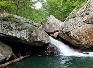
Hike and Swim at the Middle Creek Slide
3.04 mi / 200 ft gainYou park just west of the map waypoint on the wide shoulder (remember to lock your car, thefts have been reported in this area). The trailhead is really just an opening on the side of the road. Follow this to the creek and start making your way along the rocks upstream. The difficulty of the cl...Read more -
Signal Mountain, Tennessee
Hike to Edwards Point
4.75.8 mi / 50 ft gainThe Signal Point to Edwards Points trail serves as the southernmost leg of the Cumberland Trail, winding through part of the Chickamauga and Chattanooga National Military Park. From the initial Signal Point overlook, the path descends into Middle Creek Gorge, passes through the Rainbow Lake Wilde...Read more


