Kodak, Tennessee
Looking for the best hiking in Kodak? We've got you covered with the top trails, trips, hiking, backpacking, camping and more around Kodak. The detailed guides, photos, and reviews are all submitted by the Outbound community.
Top Hiking Spots in and near Kodak
-
Townsend, Tennessee
Backpack to Spence Field
13.8 mi / 3100 ft gainStart your hike at Anthony Creek Trailhead (elevation 1,800 ft), in the Cade’s Cove area. The trailhead is located at the far end of the day-use picnic area near Cade’s Cove campground. There are a few parking spots right at the trailhead, but note that the picnic area closes at dusk (a gate clos...Read more -
35.604955,-83.770373
Hike to Rocky Top
5.012.8 mi / 3500 ft gainRocky Top is known to be the spot that inspired the famous fight song of the University of Tennessee, which is also an official song for the state of Tennessee. The trailhead for this hike begins in the Cade’s Cove picnic area parking lot towards the back side. There are a few parking spots ri...Read more -
Gatlinburg, Tennessee
Appalachian Trail: Charlie's Bunion and Kephart Loop
5.016.84 mi / 4429 ft gainAppalachian Trail: Charlie's Bunion and Kephart Loop is a loop trail that takes you by a waterfall located near Cherokee, North Carolina.Read more -
Gatlinburg, Tennessee
Hike to the Jump-Off
4.36.2 mi / 1079 ft gainThis trail starts at the Newfound Gap parking lot. Newfound Gap is situated on the border of Tennessee and North Carolina. The views from Newfound Gap overlook North Carolina and are worth the trip in their own right. The restroom facilities are clean and have flushing toilets. Follow the crowds ...Read more -
Gatlinburg, Tennessee
Hike to Clingman’s Dome via Newfound Gap
4.516.6 mi / 1600 ft gainThis route to Clingmans Dome is available throughout the year. But during the winter months from December 1 through March 31, the 7-mile Clingman’s Dome Road that branches off Highway 441 at Newfound Gap, stays closed. This means the usual drive to the parking area located just a half mile below ...Read more -
Gatlinburg, Tennessee
Mount LeConte Lodge via the Boulevard Trail
15.95 mi / 3000 ft gainBegin your adventure by arriving at the Newfound Gap parking lot - before first light. Why? Because you won't want to miss the incredible sunrise from the parking lot - even before you step foot on the trail! It is said that a hiker will never get overly warm hiking the Boulevard to Leconte due ...Read more -
Gatlinburg, Tennessee
Charlies Bunion via Appalachian Trail
5.04.32 mi / 1640 ft gainFrom the Sugarlands Visitor Center near Gatlinburg, drive approximately 13 miles south on Newfound Gap Road to reach the Newfound Gap Parking Area (it'll be on your left). The parking area is free and there are bathrooms. Follow the Appalachian Trail towards Katahdin, Maine (1972 miles away, woah...Read more -
35.610235,-83.426410
Myrtle Point via Alum Cave
5.015.43 mi / 3100 ft gainThis hike can be started at the Alum Cave trailhead or the Boulevard Trailhead. For this particular adventure, the starting point is Alum Cave. If you're lucky enough to stay the night at the backcountry shelter on top of Mt. LeConte, (add 0.2 miles if coming from the Lodge), head east on the Bou...Read more -
Cosby, Tennessee
Hike to Hen Wallow Falls in Great Smoky Mountains NP
5.04.57 miStart your adventure by parking in the Cosby Picnic Area Parking Lot near the entrance of the Cosby Campground. (127 Cosby Picnic Area Rd, Cosby, TN 37722.) Then backtrack through the parking lot about 100 yards until you see the sign marking the start of Gabes Mountain Trail. The trek to Hen W...Read more -
Cosby, Tennessee
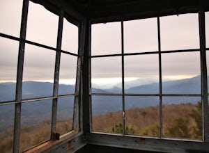
Hike to the Mount Cammerer Lookout Tower
4.510.99 mi / 3040 ft gainMost visitors have a vision of how they'd like to see Great Smoky Mountains National Park, and it typically involves climbing to the top of a mountain like 4,928-foot Mount Cammerer. This is a very strenuous hike involving a breathtaking amount of elevation gain along the rugged Low Gap and Appal...Read more -
Newport, Tennessee
Explore Halls Top Fire Tower
4.01 mi / 200 ft gainHalls Top Fire Tower is a special untouched spot in the Cherokee National Forest. The road that leads you into the CNF is known as Halls Top Road just a few miles off of Interstate I-40. This road will take you 4.4 miles to the next turn onto Stone Mountain Road this road is 2.1 miles to the gat...Read more -
Tallassee, Tennessee
Abrams Falls Trail
4.84.96 mi / 625 ft gainOne of the biggest perks of hiking Abrams Falls is the drive to get there. The trailhead is located approximately 5 miles into the scenic Cades Cove Loop. Cades Cove is an adventure in itself. Keep your eye out for black bears, deer and wild turkey. If you are taking the self guided auto tour, Ab...Read more -
Tallassee, Tennessee
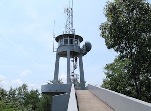
Hike to Look Rock Tower
5.01 mi / 300 ft gainLook Rock tower has spectacular views and is a great hike to enjoy year round. The tower is an old fire tower used for spotting smoke in the valley. Because of this the tower is placed on the highest ridge around making for some amazing views. The only way to get to the tower is along the Foothil...Read more -
Bryson City, North Carolina
Clingmans Dome
4.41.23 miThe drive to Clingmans Dome is miles of scenic overlooks that provide endless views of ridges and valleys. Clingmans Dome Road comes to a parking lot from which you follow a .5 mile paved trail to the summit. There are also several trails that start on Clingmans Dome Road. Most notably The Appal...Read more -
Bryson City, North Carolina
Andrews Bald
5.03.55 mi / 1200 ft gainThe trail begins at the Clingmans Dome parking lot, just to the left of the paved walkway up to Clingmans Dome. You will start the hike at an elevation of 6130 feet which is only 334 feet less than Clingmans Dome which is the highest point in The Great Smoky Mountain National Park, and the second...Read more -
Bryson City, North Carolina
Clingmans Dome Loop
25.75 mi / 4000 ft gainThe first day of the hike is either 12.3 miles or 10.5 miles (depending on the campsite) almost all downhill, and the second half of the loop is 13.3 miles or 11.5 miles, again depending on the campsite, almost exclusively uphill. Just as a reference the first day took us about 6 and a half hours...Read more


