Greeneville, Tennessee
Top Spots in and near Greeneville
-
Kingsport, Tennessee
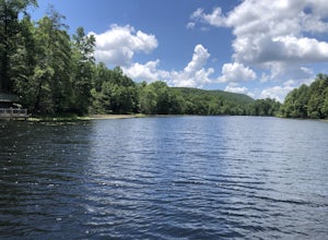
Bays Mountain Reservoir Trail
5.02.8 mi / 469 ft gainBays Mountain Reservoir Trail is a loop trail that takes you by a lake located near Kingsport, Tennessee.Read more -
Kingsport, Tennessee
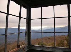
Bay's Mountain Firetower
4.83.67 mi / 768 ft gainBay's Mountain Firetower overlooks the city of Kingsport, the South Fork Holston River, and the surrounding Tennessee mountains. Part of Bay's Mountain State Park, this is the most popular hike of the 25 miles of trails. The hike to the fire tower passes the Kingsport Reservoir which is essential...Read more -
Kingsport, Tennessee
Bays Mountain Trail Loop
5.06.01 mi / 728 ft gainBays Mountain Trail Loop is a loop trail that takes you by a lake located near Kingsport, Tennessee.Read more -
Newport, Tennessee
Explore Halls Top Fire Tower
4.01 mi / 200 ft gainHalls Top Fire Tower is a special untouched spot in the Cherokee National Forest. The road that leads you into the CNF is known as Halls Top Road just a few miles off of Interstate I-40. This road will take you 4.4 miles to the next turn onto Stone Mountain Road this road is 2.1 miles to the gat...Read more -
Unicoi, Tennessee
Appalachian Trail: Beauty Spot to Unaka Mountain
5.06.35 mi / 1654 ft gainAppalachian Trail: Beauty Spot to Unaka Mountain is an out-and-back trail that provides a good opportunity to view wildlife located near Green Mountain, North Carolina.Read more -
Johnson City, Tennessee
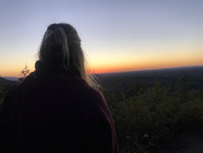
Sunset Point
5.00.65 mi / 223 ft gainSunset Point is an overlook located in Buffalo Mountain State Park. The trail is a short hike up along the White Rock loop trail then a short walk off the trail to get to the overlook. There is a clearing with a few benches that has wide open views to the west. The short hike up to the point shou...Read more -
Johnson City, Tennessee
Fork Knob, White Rock and The Noggin Loop
5.03.12 mi / 1220 ft gainThe Fork Knob and White Rock Loop in Johnson City, Tennessee, is a moderately challenging hiking trail that spans approximately 3.12 miles. The trail is marked by a variety of natural features, including a prominent rock formation known as White Rock, which offers panoramic views of the surroundi...Read more -
Johnson City, Tennessee
Hike to Tip Top on Buffalo Mountain
4.05.4 mi / 1388 ft gainTip Top rests on one of the highest points of Buffalo Mountain. The overlook features tree coverage perfect for hammocking and benches while providing views of Downtown Johnson City as well as the other side of the mountain range. The hike from the trailhead to Tip Top is moderately steep. The tr...Read more -
Johnson City, Tennessee
White Rock Overlook
5.02.85 mi / 876 ft gainThe White Rock trailhead is less than a 10 minute drive from downtown Johnson City. When pulling up Highbridge Road, take a left at the fork. You will shortly encounter a vehicle gate where you will park to the side of the road (do not block the yellow vehicle gate). You have the option to walk ...Read more -
Johnson City, Tennessee
White Rock Loop
5.04.94 mi / 1457 ft gainWhite Rock Loop is a loop trail where you may see beautiful wildflowers located near Johnson City, Tennessee.Read more -
Unicoi, Tennessee
Camp at Unaka Mountain Overlook
4.00.1 miUnaka Mountain Overlook is one of the highest locations in the Cherokee National Forest. Easily accessibly by vehicle, the overlook towers over the surrounding mountains, including Beauty Spot Gap, and is an ideal spot to camp overnight. Take Rock Creek Road until you meet the border of North Car...Read more -
Clyde, North Carolina
Hike to Little Fall Branch falls
0.3 mi / 300 ft gainThe trailhead to this hike is easy to find but the gps is hard to match so it might try to take you through the middle of the trees but its easy to follow the road. The best way to get here is to go off of I-40 at the Harmon Den exit and then go up the road towards Max Patch. To get to the trailh...Read more -
Johnson City, Tennessee
Bike the Tweetsie Trail
3.320 miThe course gravel trail begins just east of downtown Johnson City. The trail maintains a flat grade throughout the 10 miles towards the city of Elizabethton. There are restrooms 3 miles in from the Johnson City trailhead. You can also park at Lions Field in Elizabethton and head west towards John...Read more -
Hartford, Tennessee
Whitewater Rafting the Pigeon River
5.0The Pigeon River is a dam controlled river that winds its way through North Carolina and Eastern Tennessee just outside Great Smoky Mountains National Park. The river provides beautiful views as one paddles along via raft or kayak. Cutting through portions of the Pisgah and Cherokee National For...Read more -
Thorn Hill, Tennessee
Photograph and Swim at Elrod Falls
5.0Elrod Falls is a great place to cool off in a cool clear river stream. It is located near a very small town in East Tennessee and is a great secluded place if you want to get away from people. When you get to the area you will see signs for it on the side of the road. When you get to the field an...Read more -
Colonial Heights, Tennessee
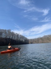
Kayak Patrick Henry Reservoir
5.0Patrick Henry Reservoir in Warriors Path State Park is a great location for kayaking, canoeing and stand up paddling. The reservoir is not always very clean, but it can still be very beautiful when you're on the water. In the Summer and Fall, the trees are beautiful to view. There is also a small...Read more

