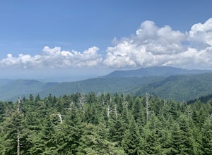
Great Smoky Mountains, Tennessee
Top Spots in and near Great Smoky Mountains
-
Gatlinburg, Tennessee
This loop offers a scenic 2.5 mile hike next to the river before looping back around via the Cucumber Gap Trail. At the tail end, you'll connect with the Jakes Creek Trail for about 0.7 miles to return you back to the parking lot.
Many people hike this trial clockwise, but if it's a hot day, it...
Read more
-
Gatlinburg, Tennessee
4.5
13.37 mi
/ 3993 ft gain
Begin at the Rainbow Falls trail parking lot. This is very popular area especially in the summer. If the parking area at the trail head is full there is additional parking located just past the main lot. From here the Rainbow Falls trail is just under 14 miles to the summit of Mount Leconte. Elev...
Read more
-
35.675929,-83.485764
This 6 mile drive is a great way to spend a scenic day in the Smokies. The road is open to cars only (no trucks or RVs) and runs one-way. There are no visitors centers after you head out, so be sure to bring everything you need along.
The drive begins at the historic Ogle farmstead, which is als...
Read more
-
Sevier County, Tennessee
5.0
12.34 mi
/ 412 ft gain
The trailhead parking area is large but if no spaces are available additional parking can be had at the Jake's Creek trailhead at the top of the hill and to the right of the Little River trail parking lot. After parking, the trailhead itself will be to the left of the parking area. Parking Lot Co...
Read more
-
Gatlinburg, Tennessee
You will find the trailhead to this gravel path just to the left of the Sugarlands Visitor Center. The easy walk along Fighting Creek is scenic and tends not to be crowded, either.
At the end of the hike you will find a beautiful 25-foot waterfall. Please refrain from climbing on or around the f...
Read more
-
-
Gatlinburg, Tennessee
5.0
1.83 mi
/ 585 ft gain
This is an intermediate hike along Trillium Gap Trail. There are four stream crossings on your way to the falls as you hike through an idyll, often wildflower-sprinkled landscape. Late spring is best for catching blooms. Once at the waterfall, you can walk behind the cascade of water.
This is a ...
Read more
-
Sevierville, Tennessee
4.3
2.45 mi
/ 314 ft gain
This straightforward, yet scenic hike follows a paved trail to the falls, which is among the most popular in the park.
This trail can be especially crowded during the summer, so be sure to arrive early. Keep an eye out for a few steep drop-offs on either side of the trail along the way. There ha...
Read more
-
Gatlinburg, Tennessee
4.0
4.54 mi
/ 879 ft gain
Twin Creeks Trail is an out-and-back trail that takes you by a river located near Gatlinburg, Tennessee.
Read more
-
Bryson City, North Carolina
5.0
3.92 mi
/ 850 ft gain
Kephart Prong is a pretty easy hike in close proximity to the Visitor Center on the North Carolina Side of GSMNP. 2 miles up the trail, you'll arrive at Kephart Shelter, where you can rest and enjoy vies of the Kephart Prong. Once you've had your fill, head back down the way you came.
During th...
Read more
-
Bryson City, North Carolina
Charlies Bunion via Kephart Loop is a loop trail located near Cherokee, North Carolina. This is a longer version of the Charlies Bunion hike starting from the Newfound Gap parking lot. The added benefit of this longer loop is the opportunity to see more of the Great Smokey Mountains! You'll pass ...
Read more
-
Upper Tremont Road, Tennessee
4.5
7.21 mi
/ 1140 ft gain
One of the best trails in the Smokies is the Middle Prong Trail. The trail passes three major waterfalls, in addition to numerous smaller falls, cataracts and cascades.
Once you've parked, you'll start at the trail head and immediately see your first cascade. From the trailhead hikers will cro...
Read more
-
Gatlinburg, Tennessee
Take Porters Creek Trail, a gravel road alongside Porters Creek. You will pass by an old farmstead and cemetery, as well as lots of wildflowers if you're out during the spring.
In a mile, keep left, then in another half mile or so you should cross over a small (and somewhat harrowing) footbridge...
Read more
-
Gatlinburg, Tennessee
5.0
3.55 mi
/ 1000 ft gain
Parking available off of Little River Gorge Road (State Hwy. 73) at The Sinks/Meigs Creek Trailhead.
The trail starts with winding elevation gain until it crests around 1 mile into the hike (notice pine trees at higher elevation). After the crest it starts descending towards Meigs Creek. While f...
Read more
-
Bryson City, North Carolina
4.5
20.39 mi
/ 5750 ft gain
This is a strenuous (though not technical) hike that really showcases the forests, creeks, and (eventually) the highest point of Great Smoky Mountains National Park. As this is a point-to-point route, you will want to have two vehicles - one that you can leave at Clingman's Dome and one that you ...
Read more
-
Bryson City, North Carolina
This is a ~36 mile loop that goes up Clingman's Dome (the tallest point in Tennessee). Pretty challenging, not for the novice backpacker. Park at Deep Creek campground in Bryson City, NC. We did it as a 3-day, 2-night camping at sites 53 and 61. As it is a loop it could easily be done in reverse....
Read more

