Lead, South Dakota
Looking for the best hiking in Lead? We've got you covered with the top trails, trips, hiking, backpacking, camping and more around Lead. The detailed guides, photos, and reviews are all submitted by the Outbound community.
Top Hiking Spots in and near Lead
-
Deadwood, South Dakota
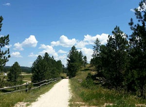
Bike the George S. Mickelson Trail
5.0108.8 mi / 2300 ft gainBiking the George S. Mickelson Trail is a very popular activity for many people in the Black Hills, locals, visitors, and tourists all enjoy the Mickelson Trail. Not only can you bike, but you can run, walk, or even ride horses, and you most definitely do not have to do the entire length of the ...Read more -
Lead, South Dakota
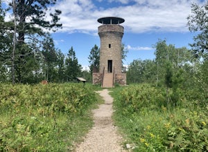
Hike to Mt. Roosevelt Tower
0.8 mi / 160 ft gainTo get to the trailhead for Mt. Roosevelt, you will need to travel about a mile north of Deadwood, on HWY 85, then you will see signs for it near the Lodge of Deadwood, from there you will eventually hit a gravel road and it is about 2.5 miles from the highway. The trailhead has picnic tables, an...Read more -
Lead, South Dakota
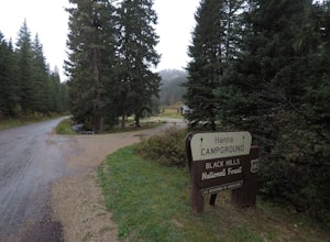
Camp at Hanna Campground
0.25 mi / 0 ft gainThe campground is located 7.5 miles south of Lead on Highway 85, then turn left on road 196, there will be a sign for Hanna CG, from there it is just over 2 miles to the campground. The campground has 13 total sites, the main area of the CG is closed during the fall winter and spring, but there a...Read more -
Lead, South Dakota
Hike to Devil's Bathtub, Black Hills National Forest
5.01 miBefore you start this adventure, make sure you're wearing shoes that will not be ruined by crossing creeks. There are several stream crossings so wear waterproof boots or sturdy hiking sandals (I prefer my Original Universal Tevas or my KEEN Whisper Sandal). The pull off to start the hike is abo...Read more -
North Lawrence, South Dakota
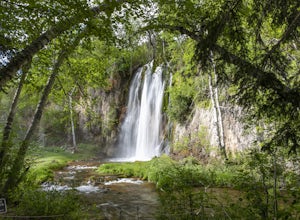
Spearfish Falls
1.6 mi / 60 ft gainThis is a super short and very easy hike that has an incredible payoff. It is an out-and-back trail that is accessible for all skill levels. The trail slowly descends along a path that varies between paved sections and very well-groomed gravel leading to an observation deck of a super scenic wate...Read more -
Lead, South Dakota
76 Trail
1.24 mi / 499 ft gainThe '76 Trail is only 3/4 of a mile long but elevates 1,000 feet, making this hike difficult for many. Plan to take a couple breaks but admire the gorgeous surroundings! The hike is not a leisurely one but the views at the top are well worth the effort.Read more -
Lead, South Dakota
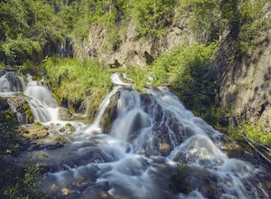
Hike the Roughlock Falls Trail
4.04.2 mi / 50 ft gainThe trailhead to Roughlock Falls is in the town of Savoy, SD in the Black Hills. From Spearfish on I-90, head south on Route 14 for 15 miles into Savoy. There is only one road to make a right onto in town, Roughlock Falls Road. You can cheat and drive this all the way up to the falls for a quick ...Read more -
Spearfish Community Caves, South Dakota
Hike to the Community Caves
4.51 mi / 300 ft gainCommunity Caves is located in the scenic Spearfish Canyon, on Highway 14A, about 2.7 miles from Spearfish (once you turn off of Colorado Blvd). There is a large pull-off area on the right (west) side of the road and then the trail, which is not marked at all, is on the opposite side of the pull-...Read more -
Spearfish, South Dakota
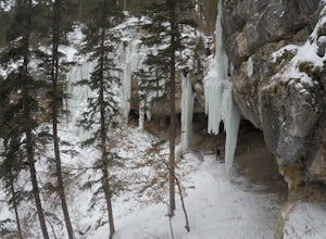
Explore the Frozen Waterfalls of Spearfish Canyon
5.0There are a multitude of frozen waterfalls throughout Spearfish Canyon. Some require a short hike and others can be seen from the road. This adventure will describe how to access the three largest frozen falls.Take Spearfish Canyon Highway south out of the town of Spearfish SD. After roughly 6 mi...Read more -
Spearfish, South Dakota
Hike around Lookout Mountain
4.52.4 mi / 860 ft gainTo get to the trail for Lookout Mountain there are 2 trailheads. One trailhead is just a few blocks from downtown on Nevada St., the other trailhead is on the East side of town. This post is using the Nevada St. Trailhead as the starting point. From this trailhead to the top of Lookout Mountain i...Read more -
Hill City, South Dakota
Camp at Black Fox Campground
Black Fox is 9 miles west of Rochford has nine campsites along the Rhoads Fork Creek where it meets up with the South Fork of Rapid Creek. Campsites are nicely arranged for the most part with a fire pit and picnic table at each site. From the campground there are many things to do, many people en...Read more -
Hill City, South Dakota
Camp at Castle Creek Campground
5.00.25 mi / 0 ft gainCastle Creek is a challenging place to get to, the road in the off seasons can be even more difficult. In the spring/early summer when the road is wet it can become rutted. There is one road to get to the campground from the East from Mystic it is about 8 rough narrow miles, but you could arrive ...Read more -
Vale, South Dakota
Hike the Sacred Steps of Bear Mountain
4.23.5 mi / 1200 ft gainBear Mountain or Mathó Pahá as it's called by the Lakota peoples, is the leftover remnants of an ancient volcanic plug. The mountain weathered away, to leave the harder igneous formation, for which plains tribes have been coming to for sacred communication with their Creator for 10,000 years. Thi...Read more -
Rapid City, South Dakota
Hike the Deerfield Lake Trail to Slate Creek Convergence
5 mi / 60 ft gainThe Deerfield Lake trail is overall 23 miles long, but this post is just about the section of the trail that starts at Silver City where Rapid Creek flows into Pactola Reservoir, and follows the creek upstream to where Slate Creek converges, about 2.5 miles from the trailhead. You could follow th...Read more -
Black Hawk, South Dakota
Hike Botany Canyon
5 mi / 807 ft gainAfter reaching the trailhead, the first couple miles are forest service road. You'll want to follow the main FSR, do not branch off onto any of the smaller dirt roads. The turn off to go down into the canyon is very easy to miss. It will be on your right hand side after a small patch of trees, th...Read more -
Rapid City, South Dakota
Fly Fish from the Rapid Creek Trailhead
2 miTo get the the trailhead for Rapid Creek you must turn to the east onto Pactola Basin Road or FS road 164 when on Highway 385 crossing the Pactola Reservoir. The road down to the trailhead is steep and can be rough depending on the time of the year. Once at the trailhead there is a parking area, ...Read more
Top Activities
Go Great Places in South Dakota
In the Mount Rushmore state, travels to South Dakota are full of one-of-a-kind adventure with wide-open spaces as endless as the horizons. Between legendary landscapes and scenic drives, you can always find space that shifts life into park. When you’re ready, go great places.
Learn More

