Walhalla, South Carolina
Looking for the best hiking in Walhalla? We've got you covered with the top trails, trips, hiking, backpacking, camping and more around Walhalla. The detailed guides, photos, and reviews are all submitted by the Outbound community.
Top Hiking Spots in and near Walhalla
-
Pelzer, South Carolina
Interpretive Jo Peeler Nature Trail
3.70.74 mi / 151 ft gainThere are three loop trail options at this 65-acre park, all beginning at the kiosk. The interpretive Jo Peeler Nature Trail is an easy 0.6 mile tour of the park, while the white trail is rated as a medium length hike, and the blue trail as long. Leashed dogs are permitted at the park.Read more -
Pelzer, South Carolina
Cedar Falls Park Trail
2 mi / 190 ft gainCedar Falls Park Trail is a loop trail that takes you by a waterfall located near Pelzer, South Carolina. The loop is both family friendly and dog friendly (please keep your pup on-leash). There's also a park at the entrance for the kiddos before or after walking/hiking the trail.Read more -
Franklin, North Carolina
Wesser Bald Fire Tower
4.72.36 mi / 807 ft gainThe road leading to the trailhead is rough the last mile, but doable in any car. Just make sure to take it easy going up and be careful, especially if there has been any rain or snow. You will have reached the parking area for the hike once you see a large green Appalachian trail sign and a few...Read more -
Young Harris, Georgia
Hike the Miller Trek
5.06.3 mi / 1325 ft gainThis is an awesome trek with views of both Young Harris and Hiawassee, GA! The trail starts from the parking area where there is the Miller Trek A-Frame (see photo for reference)! There are several different trails within the trail system on the mountain, but if you take 5 minutes to read the map...Read more -
Sylva, North Carolina
Pinnacle in Pinnacle Park
5.05.98 mi / 2142 ft gainHeading out from the parking area, head north on this challenging hike. For the majority of the hike, you'll have a pretty steady uphill charge. There are some flat parts between climbs, so be sure to catch your breath and get some water in during these times. Once you reach the fork, where you'...Read more -
Canton, North Carolina
Climb Fryingpan Mountain Lookout Tower
4.51.5 miThis is an extremely easy trail with a minimal incline. The tower, built in 1941, standing 70 feet above the summit, can be nerve wracking, even for those who aren't scared of heights. However, most feel it's worth the view. Expect to see fellow hikers. On pretty days there can be a few people w...Read more -
Blairsville, Georgia
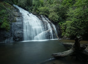
Hike to Helton Creek Falls
4.50.6 mi / 22 ft gainGetting to Helton Creek Falls can be a little bit tricky. You can either access the trailhead from 348 (the less popular, more adventurous route), or you can access the trailhead easily off of highway 19. The reason why access from 348 is a bit tricky is that the road actually has two creek cros...Read more -
Arkaquah Trail, Georgia
Hike the Arkaquah Trail to Brasstown Bald
11 mi / 3756 ft gainThe Arkaquah Trail is unique as far as North Georgia trails go for any reasons. Its elevation gain and distance puts it near the top for most challenging day hikes in the Blue Ridge Mountains. If the 11 miles round-trip sounds a bit daunting, this hike can also be done as a 5.5 mile point-to-po...Read more -
Canton, North Carolina
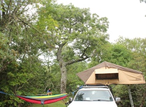
Camp at Mt. Pisgah
5.0The Mt. Pisgah campground is nestled right off of the Blue Ridge Parkway near Canton, NC. Since it is at an elevation of 4,980 feet the campground is a perfect destination to beat the heat and humidity that the region can be known for in the summer months. Reservations and information can be fo...Read more -
Sylva, North Carolina
Waterrock Knob Trail
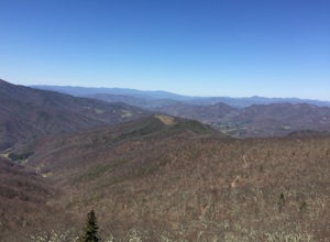
5.01 mi / 407 ft gainThe trail begins paved and quickly climbs up into a heavily forested area. Once at a 1/4 of a mile in, you will come to a nice overlook that will give you your first real good view of the surrounding mountains. The trail then continues on, though now unpaved, with great views off to your left as ...Read more -
Sylva, North Carolina
Abandoned Cessna 414A at Waterrock Knob (Removed)
3.71.72 mi / 430 ft gainNOTE: The wreckage has now been removed. Please see the press release on NPS.gov for more details. Ever hiked to an abandoned plane in the middle of the woods? Yeah me neither until I heard of this gem. This is an AWESOME day hike for anyone looking to get outside for a few hours and see some ...Read more -
Cleveland, Georgia
Hike to Desoto Falls, Georgia
3.72 miThe Chattahoochee National Forest is another kind of jungle. On hot summer days well over 95 degrees, the forest canopy provides a shelter for human and wildlife alike. Here adventurers can enjoy hiking the Desoto Falls trail(s), try their luck at fishing, or take in the solitude of the North Ge...Read more -
Blairsville, Georgia
Blood Mountain via Byron Reece Trailhead
4.74.34 mi / 1447 ft gainThe Chattahoochee National Forest and Cohutta Wilderness make up the wild and scenic southern tip of the Blue Ridge Mountains. The Blood Mountain trail offers the day hiker a taste of the Appalachian Trail that does not disappoint. The hike starts at the Byron Reece trailhead at Neels Gap where ...Read more -
Blairsville, Georgia
Appalachian Trail from Blood Mountain to Cowrock Mountain
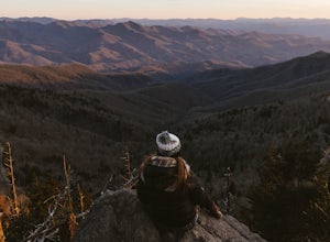
4.014 mi / 2907 ft gainNorth Georgia is packed with awesome mountain trails, but few boast the beauty and magnitude of the Appalachian Trail. The hike from Blood Mountain to Cowrock Mountain is one of the more scenic sections of the AT in Georgia, in terms of mountain views. Do this hike as a full day hike, or spread ...Read more -
Blairsville, Georgia
Hike the Trahlyta Lake Trail to Trahlyta Falls
1 mi / 30 ft gainLake Trahlyta in Vogel State Park offers a truly unique combination of natural beauty and opportunity for recreation. The easy one-mile Lake Trahlyta trail circles the emerald colored lake and has a short deviation that leads to a calming, yet impressive waterfall. The trail starts on the edge...Read more -
Blairsville, Georgia
Hike the Bear Hair Gap Trail
4.55.5 mi / 675 ft gainVogel State Park is one of the many beautifully preserved wilderness parks of Northern Georgia. With a stunning alpine lake and 17 miles of trails, you cannot go wrong. The Bear Hair Trail is the perfect mid-distance option that will reward you with both great views of the lake from a high vant...Read more

