Salem, South Carolina
Looking for the best hiking in Salem? We've got you covered with the top trails, trips, hiking, backpacking, camping and more around Salem. The detailed guides, photos, and reviews are all submitted by the Outbound community.
Top Hiking Spots in and near Salem
-
Sautee Nacoochee, Georgia
Unicoi Gap and Indian Grave Gap Loop
5.05.04 mi / 1765 ft gainThe Unicoi Gap and Indian Grave Gap Loop in Sautee Nacoochee, Georgia, is a moderately challenging hiking trail. Spanning approximately 5.04 miles, the loop offers a variety of terrain, including forested areas, open fields, and rocky paths. The trail is known for its two significant landmarks: U...Read more -
Helen, Georgia
Hike the Unicoi Lake Trail
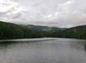
1.9 miUnicoi State Park is a pleasant, refreshing park just outside of Helen, GA. There is a hiking trail, kayaking/canoeing launch, paddle boat rentals, camping area, and even a 3 segment zipline course (all three were fantastic)! Fishing is allowed, and when we went last there were a few kayakers fis...Read more -
Flat Rock, North Carolina
Watch the Green Race
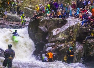
5.01.8 mi / 500 ft gainOn the first Saturday of November the best creek boaters in the world gather at the Green River in North Carolina to see who can storm the Narrows and claim the top title (at least for the next year!). For paddlers, creek boating is a pursuit along tight and narrow steeps that most of us have ne...Read more -
Asheville, North Carolina
Explore Lake Powhatan
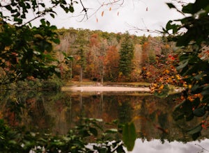
Lake Powhatan is located just minutes away from Asheville, NC and offers a number of fun activities for you, your friends, and your family. In the warm summer months, the Lake is a popular spot for swimming. The small stretch of beach along the lake is a nice place to lay out and soak in the sun....Read more -
Cleveland, Georgia
Mount Yonah Trail
4.17 mi / 1430 ft gainMount Yonah Trail is an out-and-back trail where you may see beautiful wildflowers located near Cleveland, Georgia.Read more -
Cleveland, Georgia
Hike and Climb to Yonah Mountain
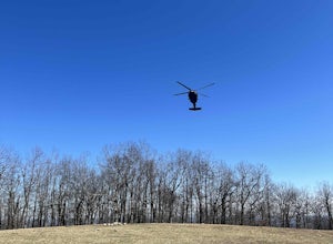
4.94.53 mi / 1417 ft gainThe trail starts at "Mt. Yonah Trailhead" and is 4.4 mile round-trip with elevation of 1,500' to 3,166'. The trail stays below moderate tree coverage until around the halfway point where you will come upon a clearing known as the first LZ (landing zone). The mountain is shared with hikers by Army...Read more -
Bureau of Indian Affairs Highway 506, North Carolina
Barrett Knob Fire Tower
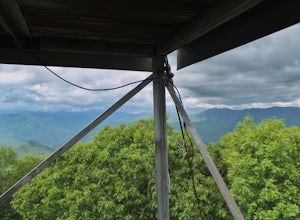
5.01.21 mi / 400 ft gainYour hike will start at the base of the Blue Ridge Parkway just a few miles from the start in Cherokee. The trail starts right off of the parkway in a very small easy to miss dirt road. There is a small area to park that then you start your hike up the dirt road right after the gate. The hike to ...Read more -
Blairsville, Georgia
Hike to Horsetrough Falls
5.00.4 mi / 10 ft gainTo get to the trail head you will follow Wilks road five miles to Upper Chattahoochee River Campground. The five miles down the gravel road should be doable for a majority of cars as the gravel road is in good condition. Pretty much if you feel comfortable driving your car on a regular gravel roa...Read more -
Arden, North Carolina
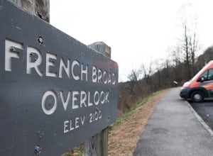
Photograph the French Broad Overlook
5.0The French Broad Overlook is one of several overlook spots along the Blue Ridge Parkway. It's not known to be the most breathtakingly scenic spot of the batch, but it's still a nice viewpoint that will offer you sights of the French Broad River, one of the few north flowing rivers in the US. Yo...Read more -
Saluda, North Carolina
Hike Bradley Falls
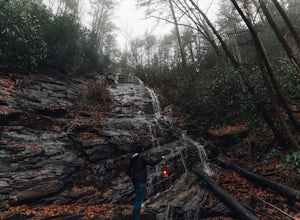
4.82.3 mi / 312 ft gainThis is a really nice hike along Cove Creek that leads to a beautiful, 100 foot waterfall. While most of the trail is a relaxing stroll, the end of the hike provides a little adventure for those who feel up for it. Starting from the parking lot, follow the main trail into the woods. Early in the ...Read more -
Bryson City, North Carolina
Explore Old 288 and the Lands Creek Bridge
2.51 miNC 288 was constructed in the 1920's, but did not last long with the construction of the Fontana Dam as the resulting lake covered the highway. The U.S. government entered an agreement in which they would provide a replacement road, but to this day it has not been completed and is know by locals ...Read more -
Bryson City, North Carolina
Hike to Lonesome Pine Overlook
5.07 mi / 2300 ft gainTo start the hike to Lonesome Pine Overlook begin from the Noland Divide Trailhead in Deep Creek. The trail is a steady climb with an average gain of 700 ft. every mile. Approaching the top you'll walk along a rocky ridge line where you are able to see the overlook. As you continue, be sure to lo...Read more -
Blairsville, Georgia
Hike to the Brasstown Bald Peak
4.31.42 mi / 430 ft gainOnce you make it to the parking area (parking fee required) to Brasstown Bald you will be at about 4284 feet elevation. From there you will have a short (0.6 mile) but steep hike to the tower that sits atop Brasstown Bald. Along the path you will see Rhododendron and various other blooms dependi...Read more -
Bryson City, North Carolina
Hike Three Waterfalls Loop
5.02.4 mi / 450 ft gainStart the loop by hiking the Juney Whank Falls Trail to Juney Whank Falls. The footbridge across the creek makes an excellent place to rest and take in the falls. Follow the trail across the bridge and up the bank. After about 300 feet take a right and follow Deep Creek Horse Trail towards Deep C...Read more -
Bryson City, North Carolina
Deep Creek to Clingmans Dome Loop
32.82 mi / 7400 ft gainThis is a ~36 mile loop that goes up Clingman's Dome (the tallest point in Tennessee). Pretty challenging, not for the novice backpacker. Park at Deep Creek campground in Bryson City, NC. We did it as a 3-day, 2-night camping at sites 53 and 61. As it is a loop it could easily be done in reverse....Read more -
Bryson City, North Carolina
Tom Branch and Indian Creek Falls
4.51.76 miFrom the Deep Creek Trailhead, you can hike to both waterfalls heading up the Deep Creek Trail. You will come across Tom Branch Falls quickly, after 0.2 miles. Once you've had your fill of Tom Branch, head further along the Deep Creek Trail for another 0.5 miles. Turn right on the Indian Creek Tr...Read more

