Cleveland, South Carolina
Looking for the best photography in Cleveland? We've got you covered with the top trails, trips, hiking, backpacking, camping and more around Cleveland. The detailed guides, photos, and reviews are all submitted by the Outbound community.
Top Photography Spots in and near Cleveland
-
Glenville, North Carolina
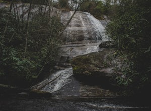
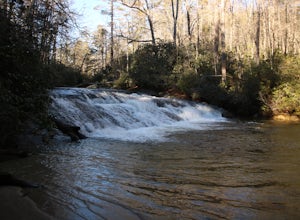
Hike to Wilderness Falls
1.4 mi / 300 ft gainWilderness Falls offers a beautiful hike with a simple yet captivating falls. All of the maintained trails in Pantertown Valley are marked by a number system (there is an information hut in the parking lot with information about other local trails, distance of different trails, and emergency cont...Read more -
Glenville, North Carolina
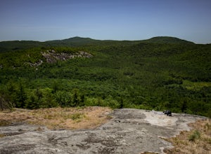
Hike to Blackrock Overlook
3 mi / 700 ft gainThis is probably one of my favorite hikes I've done in Panthertown Valley. Its also one of the easier views to access. You start from the Salt Rock Gap Parking lot, taking the Blackrock Trail (447) up Blackrock Mountain. This trail is located about 100 yards to the left if you are standing lookin...Read more -
Cashiers, North Carolina
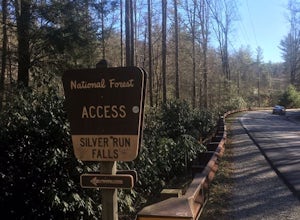
Hike to Silver Run Falls
0.25 mi / 100 ft gainThe hike to this waterfall is very short and well worth it. The waterfall is about 40 feet tall and has a large volume of water. This makes for a great place to swim. The bottom of the pool is about 15 feet deep and offers cool mountain water. To get there it is just outside of Cashiers, North C...Read more -
Cashiers, North Carolina
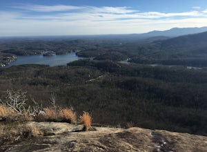
Hike to Chimney Top
3.31.7 mi / 1000 ft gainUpon entering High Hampton Inn, follow the entrance road past the registration building, cart shed and parking lot. Take a right down a gravel road that follows alongside Hampton Lake. This gravel road continues for half a mile, even winding through part of the golf course and crossing over the c...Read more -
Lake Lure, North Carolina
Hike to Party Rock
4.52.4 mi / 1549 ft gainThis hike is a strenuous 2.4 miles that takes about 1.5 hours to complete. The trail is not maintained--it is an old logging road--so there are lots of loose rocks and you frequently have to hop over the washout/creek. However, the difficulty on the way up is extremely rewarding at the top!The tr...Read more -
Highlands, North Carolina
Explore Cashiers Sliding Rock
0.2 mi / 70 ft gainThis waterfall is located just outside of Cashiers, NC. The trailhead to the waterfall is right off of the road and has a good amount of parking. The trial itself is very nice and has new steps at the beginning of the trail. The trail is very wide and is mostly flat the entire way there. Once you...Read more -
Tuckasegee, North Carolina
Hike to Cedar Cliff Rock
2.4 mi / 830 ft gainCedar Cliff Rock is one of those local places that exemplifies the Blue Ridge mountains oh-so-well. From the top you can see the Tuckaseegee River along with both Cedar Cliff and Bear Creek Reservoirs. While there are a few homes in between, much of the view is untouched, allowing a big mountain ...Read more -
Tamassee, South Carolina
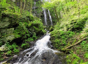
Hike to Lee Falls
4.01.6 miThe Hike: Head out through the middle of the first of three fields, crossing creeks two times as you come to them. At the end of the last field, the trail enters the woods. Hike through the woods for 0.3 mile and take the left fork, crossing a creek , and head toward the larger branch of Tamassee...Read more -
Mountain Rest, South Carolina
Hike along the Chattooga River to Spoonauger Falls
1 mi / 100 ft gainSpoonauger falls housed in Sumter National Forest, received its name after the Spoonauger family which historically lived above the falls. From Walhalla SC, drive north on Highway 28 until it meets SC 107 (right under 10 miles). Take a slight right onto SC 107 and drive another 10 miles until yo...Read more -
Mountain Rest, South Carolina
Hike to Kings Creek Falls
4.80.5 miThe trail to Kings Creek begins behind the bulletin board in the Burrells Ford primitive campground parking lot. It is an easy .5 mile trail to the falls. The falls are only 70ft high but they are beautiful, there is an area to the side of the falls with some nice sitting rocks and the area under...Read more -
Pendleton, South Carolina
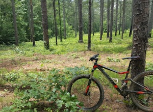
Bike the Fant's Grove Trails in the Clemson Experimental Forest
20 mi / 1985 ft gainFant's Grove is part of Clemson University property and is housed inside of the southern end of the Clemson Experimental Forest. The property is managed by Clemson University, and the trail weaves through prescribed burned areas, loblolly pine stands, agriculture fields, wildlife openings and fee...Read more -
Highlands, North Carolina
Bouldering Granite City
5.00.3 mi / 96 ft gainAt the foot of Blackrock Mountain just outside of Highlands, North Carolina, lies one of the most unique and secluded natural playgrounds around. Granite City is composed of several massive granite boulders, ranging between 10-40 feet tall. This spot is most popular for bouldering (mostly V0-V2...Read more -
Highlands, North Carolina
Hike the Whiteside Mountain Loop
5.02 mi / 595 ft gainWhiteside Mountain is simply breathtaking, there is no way around it. Views of the mountain from the South expose its sheer granite face, which runs almost its entire length East-to-West. However, the views of the mountain are just the beginning, as this hike climbs to higher heights than just ...Read more -
Cullowhee, North Carolina
Exploring two legendary Cherokee sites: Judaculla Rock and Devil's Courthouse, North Carolina
5.00.9 mi / 258 ft gainJudaculla was an ancient Cherokee spirit being and giant. He ruled in western North Carolina in the traditional Cherokee homeland. Once while chasing some hunters, when he jumped to the ground, his hand hit a rock. You can still see the print on Judaculla Rock. It is the most elaborate piece of r...Read more -
Cullowhee, North Carolina
Hike to High Falls
3.51.5 mi / 600 ft gainThis is an awesome hike if you're up for a challenge! The hike in isn't bad at all and the trail itself isn't super long but the climb back out will be a little more difficult due to the rock steps and lengthy uphill. This hike starts from a parking lot, just across the road from Lake Glenville a...Read more -
Asheville, North Carolina
Photograph Haw Creek Valley Overlook
The Haw Creek Valley Overlook is only 8 miles from downtown Asheville. If you're in the downtown area, it's a rather easy place to zip on over to if you're in need of some time away from urban life. This overlook is a hot spot for sunset watching and picture taking. If you plan on seeing what th...Read more

