Smithfield, Rhode Island
Looking for the best hiking in Smithfield? We've got you covered with the top trails, trips, hiking, backpacking, camping and more around Smithfield. The detailed guides, photos, and reviews are all submitted by the Outbound community.
Top Hiking Spots in and near Smithfield
-
Boston, Massachusetts
Run the Arnold Arboretum Trail
5.02.6 mi / 150 ft gainPark in the lot off of Arborway to access the trail. This place is gorgeous year round. The winter offers a quiet solitude, fall boasts bright colors, spring is the most beautiful as the flowers start to burst and cherry blossoms take over, and summer is overwhelmingly green. There are dozens of ...Read more -
North Stonington, Connecticut
Hike Wyassup Lake
5.02.4 mi / 278 ft gainWyassup Lake is a 2.4 mile out and back hike that takes you past great forest setting located near North Stonington, Connecticut.Read more -
Quincy, Massachusetts
Hike The Skyline Trail at Blue Hills
4.012.7 mi / 2542 ft gainPark in the lot across from Batterymarch Rd off of Willard St. Access the Skyline trail from here, it is marked blue. Follow the signs. The trails in Blue Hills are perfect for training for backpacking because they are so steep and rocky. I would fill up a big pack and take the skyline trail up t...Read more -
Middletown, Rhode Island
Birdwatch at Sachuest Point
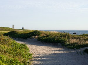
1.5 miA trip to Aquidneck Island would not be complete without a quick walk around Sachuest Point. I highly recommend this hike at sunrise, but any time of the day (or year) is great! This nature preserve is home to a large population of tourist-friendly deer, and is visited every winter by at least tw...Read more -
Mansfield, Connecticut
Hike Nipmuck Trail
5.08.3 mi / 748 ft gainNipmuck Trail is a 8.3 mile out and back hike that takes you past wildlife located near Mansfield Center, Connecticut.Read more -
Hanson, Massachusetts
Burrage Pond Indian Trail
5.03.39 mi / 194 ft gainBurrage Pond Indian Trail is an out-and-back trail where you may see beautiful wildflowers located near Hanson, Massachusetts.Read more -
Franklin, Connecticut
Hike Baileys Ravine at Ayer's Gap Preserve
1.6 mi / 314 ft gainIt's steep and rocky in the beginning but it levels out after a while! When standing in the parking lot, the trailhead is hidden! Look to the right. The trail ends on Ayer's Road so you have to walk back a little ways on the road.Read more -
Acton, Massachusetts
Hike the Pratt's Brook Conservation Area Loop
4.01.5 mi / 85 ft gainPark in the small parking area right before the trailhead. *Notice this parking area is small and only fits about 3-4 cars so prepare to find street parking on a busy day. You can punch in the coordinates to a GPS if you need help finding it: 42.4545482, -71.4358192. The loop is very diverse wit...Read more -
South Kingstown, Rhode Island
Hike the Osprey Point Loop on Trustom Pond
2 miCareful on the drive in for deer! From the parking lot head right around the Farm Field Loop Trail then continue to your right down Osprey Point Trail (0.8 miles). This is where you will most likely see the deer up close. Continue to your right to the Osprey Point Overlook, which will (on a clear...Read more -
Concord, Massachusetts
Hike around Walden Pond
4.51.69 mi / 45 ft gainPark in the lot ($8 for MA residents) by Walden Pond to access the trail, and head out either direction on the loop around the pond. Trail is accessible from April-October.Read more -
North Stonington, Connecticut
Hike Narragansett Trail
4.010.7 mi / 1 ft gainNarragansett Trail is a 10.7 mile point-to-point hike that takes you by a lake located near North Stonington, Connecticut.Read more -
Westerly, Rhode Island
Grills Preserve
4.04.27 mi / 351 ft gainGrills Preserve is a loop trail that takes you by a lake located near Bradford, Rhode Island.Read more -
Norwich, Connecticut
Explore Yantic Falls Historic District
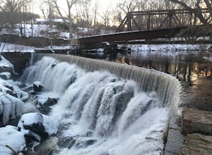
0.3 mi / 26 ft gainThe Yantic Falls Historic District encompasses a historic mill and associated worker housing on Yantic Street in Norwich, Connecticut. The 10 acre area includes a complex of mill buildings arrayed along the Yantic River, and a group of three brick mill worker houses. Today, Yantic Falls is part d...Read more -
Dartmouth, Massachusetts
Hike Frank Knowles–Little River Reserve Trail
4.64 mi / 295 ft gainFrank Knowles-Little River Reserve contains nearly 9 miles of hiking trails to explore. Start off by parking in the white sea shell parking lot. From there you will find the trail marked by a DNRT sign . My group and I walked along the red/boardwalk trail which features a number of boardwalks lea...Read more -
Boston, Massachusetts
Freedom Trail
4.72.9 mi / 121 ft gainPark along the trail and then hop on. The Freedom Trail allows you to not only see the most beautiful parts of Boston (which is an absolutely gorgeous city) but you can learn some history too! Head off the trail a bit to explore the Charles River, the waterfront near the aquarium and picturesque ...Read more -
Westport, Massachusetts
Hike Gooseberry Island
1.5 mi / 36 ft gainBegin an hour before sunset at the intersection between West Beach and East Beach Road. The intersecting roads will lead you to a paved causeway over the ocean. Waves typically clash on either side of you as you drive over the ocean. There is a free parking lot once you reach the opening. To reac...Read more


