Providence, Rhode Island
Top Spots in and near Providence
-
Bolton, Massachusetts
Take a Stroll at Fyfeshire Conservation Area
1.0Fyfeshire is located in Bolton Massachusetts off "Wattaquadock Hill Road", near the "Fotini's Restaurant and Bar". The trailhead begins at a small parking area with a stone gate that says Fyfeshire Conservation area on a wood plank. Once you are in the conservation area you will see an opening in...Read more -
Acton, Massachusetts
Hike the Pratt's Brook Conservation Area Loop
4.01.5 mi / 85 ft gainPark in the small parking area right before the trailhead. *Notice this parking area is small and only fits about 3-4 cars so prepare to find street parking on a busy day. You can punch in the coordinates to a GPS if you need help finding it: 42.4545482, -71.4358192. The loop is very diverse wit...Read more -
Groton, Connecticut
Hike Sheep Farm
3.01 mi / 91 ft gainSheep Farm is a 1 mile loop hike that takes you by a waterfall located near Groton, Connecticut.Read more -
Medford, Massachusetts
Hike Southern Middlesex Fells Loop
4.73.5 mi / 756 ft gainPark in the parking area near Bellevue Pond. There are multiple entrances to the reservation (some closer to the reservoir itself than others). I have spent days in there hiking around and never seeing the water and there are days when I just hiked right in to the water and sat and enjoyed it. Th...Read more -
New Shoreham, Rhode Island
Explore Block Island
5.0Block Island, a small island off the coast of the Rhode Island mainland, is well-known as a local summer playland. Tourists typically go to the quaint New England island in the summer months for the biking, hiking, sailing, kayaking, fishing and 17 miles of beaches.Although you can bring a car o...Read more -
New Shoreham, Rhode Island
Explore Block Island on Mopeds
Block Island offers beautiful beaches, lighthouses, cliffs, and harbors - but what's the best way to see them all? Mopeds of course! We went through Island Moped & Bike but there are other options if you want to shop around. We chose them because they had a special rate for an afternoon/eveni...Read more -
Groton, Connecticut
Hike Haley Farm Loop
5.02.7 mi / 193 ft gainHaley Farm Loop is a 2.7 mile loop hike that takes you past wildlife located near Groton, Connecticut.Read more -
Groton, Connecticut
Hike Bluff Point State Park Eastern Loop
4.54.3 mi / 344 ft gainBluff Point State Park Eastern Loop is a 4.3 mile loop hike where you may see beautiful wild flowers located near Groton, Connecticut.Read more -
West Tisbury, Massachusetts
Photograph Lambert's Cove
While there are a number of beaches on Martha's Vineyard, many of the more well known and popular ones can easily get over crowded. The less widely known Lambert's Cove, however, is a gem that will not disappoint. To access Lambert's Cove in the summer season, you'll need to get or borrow a pas...Read more -
New Shoreham, Rhode Island
Explore the South East Lighthouse
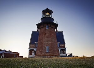
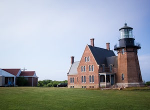
If you're visiting the Mohegan Bluffs, you should take the extra time to see the Lighthouse next to them. There's a beautiful overlook looking out onto the Atlantic and a bench to relax in the grassy hill. It's free to walk around the grounds and it's only about 2 miles from the town the ferry po...Read more -
New Shoreham, Rhode Island
Explore the Mohegan Bluffs
If you make the ferry ride to Block Island the bluffs are a must-see. From the town where the ferry ports, it's about two miles to get there. If you don't travel with your car you can always walk there via the road, bike ride, or rent a moped! There is no fee to use the beach and it can be access...Read more -
Chilmark, Massachusetts
Menemsha Hills Reservation Loop
5.02.98 mi / 344 ft gainGPS service in densely wooded areas on the Vineyard is hard to come by, so plugging in Menemsha Hills Reservation before getting on the road is advised. Traveling down N Road, you'll find an unmarked gravel road located between Turtle Cove and Trustees Lane. A short 400 meter drive will take you ...Read more -
Harvard, Massachusetts
Hike along the Nashua River and the Oxbow National Wildlife Refuge
9.5 mi / 0 ft gainPark in the lot on Tank Road to access the Nashua River Trail. Keep your eyes peeled for turtles, chipmunks, birds, and other wildlife! This trail is open from April to October. The trail can become flooded and muddy after a rain/ snow, so for a shorter alternative to the 9.5 miles, you can take...Read more -
Groton, Connecticut
Visit Avery Point Lighthouse
3.0Owned by the University of Connecticut this lighthouse is a short walk from the parking area. Though the grounds are open the tower is not. Avery Point offers panoramic ocean views. From this location you can also see New London Harbor Lighthouse & New London Ledge Light. You can also see t...Read more

