New Tripoli, Pennsylvania
Top Spots in and near New Tripoli
-
Douglassville, Pennsylvania
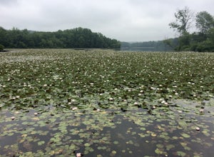
French Creek State Park offers a web of trails for hiking and mountain biking with two lakes, picnic areas, and more. Hike the Lenape and Boone Trail Loop, a moderate 4.5 mile hike that winds through the forest and offers views of both of the park's lakes - Scott's Run Lake and Hopewell Lake. Dog...
Read more
-
Bloomsbury, New Jersey
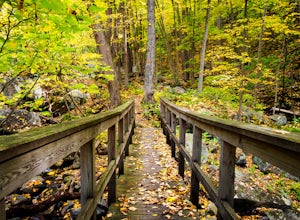
Start out on Ridge Trail (yellow blazes), found at the rear of the parking lot. Shortly, you will come to a stream crossing, followed by a set of wooden steps. Just before the next stream, turn left following the white blazes. This section of the trail makes a moderately rocky descent, as it foll...
Read more
-
Washington, New Jersey
4.0
5.33 mi
/ 371 ft gain
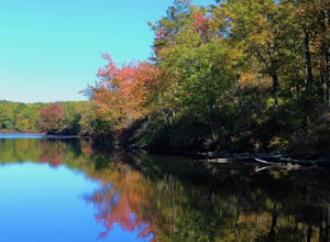
Merrill Creek Reservoir Perimeter Trail is a loop trail that takes you by a lake located near Stewartsville, New Jersey.
Read more
-
White Haven, Pennsylvania
5.0
1.45 mi
/ 128 ft gain
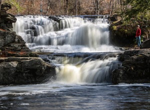
Hiking to Choke Creek Falls is easy! The hike down to the waterfall is less than a mile and the payoff is a scenic two story waterfall.
From the curve in Phelps Road, take the gated forest road downhill about 1/3 of a mile to a clearing. From here, the trails splits. Take the trail to the right,...
Read more
-
Wilkes-Barre, Pennsylvania
The Pinchot Trail, built by the Sierra Club's Northeast Pennsylvania Group and located in the southern corner of Lackawanna County, is an excellent warmup or beginner backpacking trail. The trail systems totals 22 miles but can be broken up by the North or South Loops. The North loop is mostly f...
Read more
-
Tinicum Township, Pennsylvania
High Rocks State Park, a section of Ralph Stover State Park, offers visitors some of the best views in Eastern Pennsylvania. Across from the parking lot on Tory Road, you will find the main trailhead. This will lead you to several different trail options, all varying in length, and all bringing y...
Read more
-
Bangor, Pennsylvania
This is a great 5.5 mile hike at the Delaware Water Gap. You follow the Appalachian Trail the entire time (white marked trail) as it climbs to the top on Mt Minsi. There are multiple viewpoints on your way up that provide a great view of the water gap as well as some very picturesque trail points...
Read more
-
Collegeville, Pennsylvania
4.0
7.25 mi
/ 377 ft gain
The Skippack Creek Trail in Evansburg State Park was one of my favorites on this most recent trip. Any chance I can hike a trail alongside a river, I take advantage of it. The trail starts on the south side of Skippack Creek at a parking area on Kratz Road. It was early in the morning and the wea...
Read more
-
Doylestown, Pennsylvania
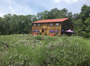
Capture the beautiful barn house shop on a farm while taking in the wonderful scent of lavender. Peace Valley Lavender Farm is open during the day and sells a plethora of lavender products from soaps to eats. Pull into the driveway and park behind the barn house for free.
It's a wonderful spot f...
Read more
-
Columbia, New Jersey
4.5
7.9 mi
/ 1150 ft gain
At the end of the parking lot, cross over the bridge and follow the Appalachian Trail (AT, white blazes) to a V-intersection. Turn right onto Dunnfield Creek Trail (green blazes), which will take you past a few cascades and up to Sunfish Pond.
Relax and eat lunch at the pond. When you're ready, t...
Read more
-
Hardwick Township, New Jersey
5.0
10.54 mi
/ 1434 ft gain
Sunfish Pond via Red Dot, Tammany Fire Road, Turquoise and Dunnfield Creek Trail is a loop trail that takes you by a lake located near Pahaquarry, New Jersey.
Read more
-
Columbia, New Jersey
4.6
2.3 mi
/ 1115 ft gain
This is a short but strenuous hike to a bluff overlooking the Delaware River and surrounding mountains and hills. The summit makes a good spot for a picnic or just for relaxing and watching the sunset. The entire hike also has plenty of beautiful photo ops, especially in the Fall.
Find the trailh...
Read more
-
Columbia, New Jersey
4.5
3.3 mi
/ 1197 ft gain
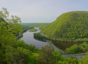
Mount Tammany located in the Delaware Water Gap is a very exciting hike. Short in length but with steep, rocky uphill portions this becomes more of a challenging trek. This hike allows for amazing views of the Delaware River, Route 80, and Mount Minsi on the other side. The summit makes for an aw...
Read more
-
Doylestown, Pennsylvania
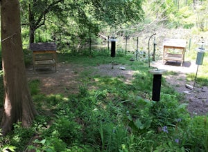
The feeder area is located in Peace Valley Park, tucked right behind the Peace Valley Nature Center. Here is where you'll find many unique smaller species. The shelter is covered and has several benches to relax on as you watch and photograph many varieties of birds. I've seen many blue jays and ...
Read more
-
Frenchtown, New Jersey
Apart from the rock, there's more trail to follow for a stunning overview and a great spot to hang out and relax. The view is a must-see, it is so much better in person. The hike is not challenging at all, it is basically a straight trail. Climbing some medium sized rocks might be required, but i...
Read more
-
Stockton, New Jersey
Drive 5.2 miles north on Route 29 from the center of Stockton, NJ and you will come across a very small parking lot on the left side of the road. If you park your car there, walk back south on Route 29 about 50 feet, and cross over to the woods-side of the road. There you will find the trailhea...
Read more

