Mifflinburg, Pennsylvania
Looking for the best hiking in Mifflinburg? We've got you covered with the top trails, trips, hiking, backpacking, camping and more around Mifflinburg. The detailed guides, photos, and reviews are all submitted by the Outbound community.
Top Hiking Spots in and near Mifflinburg
-
Cammal, Pennsylvania
Bob Webber Trail
4.03.63 mi / 1424 ft gainTo get to the Bob Webber Trail, start by heading up one of the most beautiful valleys in Pennsylvania: Pine Creek. Shortly after Waterville jump onto 414 and enjoy the drive past Cammal. About one mile after Cammal you will come to the Ross Run parking area on the left and you are there. The Bob ...Read more -
Marysville, Pennsylvania
Hike Trout Run
1.01 miHike along the creek for about a half mile, we stop where the trail meets the stream and let the kids play in the water for a bit and then head back. There are 2 large pull-off parking areas alongside of the road. The spot is exactly 3.7 miles from Adventure Park in Mechanicsburg. If you are unfa...Read more -
Williamsport, Pennsylvania
Backpack the Old Logger's Path
5.027 miThe Old Logger's Path follows abandoned logging roads in a loop through the Loyalsock State Forest. There are multiple places to join the trail, but most people start in the ghost town of Masten, PA.Highlights include Rock Run, noted by many as the most beautiful steam in Pennsylvania. Vistas alo...Read more -
Trout Run, Pennsylvania
Old Loggers Path
4.027.24 mi / 3698 ft gainOld Loggers Path is a loop trail that takes you by a waterfall located near Ralston, Pennsylvania.Read more -
Cammal, Pennsylvania
Hike the Golden Eagle Trail
5.09.2 mi / 4382 ft gainThe Golden Eagle Trail, otherwise known as the GET, is a challenging day hike north of Cammal, Pennsylvania. Hikers have the option of taking the loop clockwise although most would say counter-clockwise is the best. The climb to the first summit, which is the most challenging, brings hikers throu...Read more -
Muncy Valley, Pennsylvania
Mineral Springs Falls
0.25 miMineral Springs is a roadside waterfall near Worlds End State Park. It is worth the stop to photograph and fairly easy to move around on either side of the run to get different angles. This is a run not far from Canyon Vista which is another popular spot. The waterfall sits just off Mineral Sp...Read more -
Brown Township, Pennsylvania
Hike the Hemlock Mountain Loop
5.06.48 mi / 1200 ft gainThe trail starts where Naval Run Road ends. Follow the the blue blazes into Naval Run. After crossing Naval Run continue right up an old logging skid trail along the run. The trail will intersect with the Black Forest Trail at Naval Run Falls.The trail will follow the orange blazes of Black Fo...Read more -
Carlisle, Pennsylvania
Hike to the Cumberland Valley Overlook
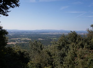
4.06 miThis hike is steep at points but the climb up the mountain has lots of switchbacks so it isn't just straight up. The hike is beautiful and during the summer there are lots of blackberry and raspberry bushes along the trail that we stopped to snack on. The Overlook is just before you crest the top...Read more -
Brown Township, Pennsylvania
Hike the Gas Line Ridge Loop
3.8 mi / 900 ft gainPark at the end of Naval Run Road, at the end of the road to the right, follow the sign for Lance Raisch Trail marked with yellow blazes. This is the first of three trails that this loop will use. The Lance Raisch Trail climbs in elevation along Naval Run and after about a quarter mile will ins...Read more -
Forksville, Pennsylvania
Double Run Nature Trail
4.01.3 mi / 335 ft gainDouble Run Nature Trail is a loop trail that takes you by a waterfall located near Forksville, Pennsylvania.Read more -
Slate Run, Pennsylvania
Backpack the Black Forest Trail
5.042 mi / 8550 ft gainThe Black Forest Trail is an orange blazed horseshoe loop with many options for a starting point which over the years due to reroutes may make the trail a little longer than 42 miles . I started at the traditional trailhead on Slate Run Road and hiked counter clockwise. Many consider this trail t...Read more -
Wilmington, Delaware
Worlds End Link Trail
1.38 mi / 285 ft gainWorlds End Link Trail is an out-and-back trail that takes you by a river located near Forksville, Pennsylvania.Read more -
Forksville, Pennsylvania
High Rock Trail
4.01.31 mi / 427 ft gainWorld's End offers a ton of trails, some for the family, and some for the more adventurous. The High Rock Trail is one of the more difficult trails in the State Park and one of the shortest. Start by parking at the main parking lot just near the Visitor Center. Take a quick walk over the bridge t...Read more -
Lock Haven, Pennsylvania
Hike the Ruth Will Trail
3 miTheir is a large gravel parking area about 12 miles north of Haneyville on route 44. Parking is on the east side of route 44.The trailhead is on the opposite side of the road, follow the trails blue blazes right to hike the loop counter clockwise. The trail initially parallels route 44.The trai...Read more -
Benton, Pennsylvania
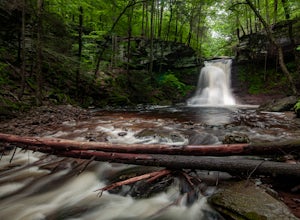
Sullivan Falls
0.1 miSullivan Falls is a beautiful roughly 30 foot waterfall near Ricketts Glen State Park, but in State Game Lands Number 13. There is a large parking area with a huge stone labeled 'Sullivan Falls' and from the lot it is more of a short walk vs a hike back a trail to the top of the falls. However, t...Read more -
Morris, Pennsylvania
Hike the Gillespie Point Loop
5.3 mi / 1166 ft gainFrom the Blackwell parking access at the route 414 bridge that crosses Pine Creek, walk on 414 east towards Babb's Creek. Shortly after crossing the single lane bridge over Babb's Creek, you will turn right onto Big Run Road.Follow Big Run Road for about 2 miles and when the road makes a sharp t...Read more

